3,000
So many things to write about. I blog in my head often but I never get around to writing it, being at a computer once every two weeks!
A few days ago we hit 3,000 miles of hiking this year. We’ll wrap up the trail in about 11 days, or 220 miles left for the year. Shortly after it will be a year since we started this crazy hiking adventure on Springer Mountain. How can it be a year already?
Since White Springs we have had beautiful weather. It’s supposed to stay nice until the end of the week and then it looks like a few rain days may be around—crossing fingers for night rain! There’s nothing better to getting out of the tent to clear skies and the sun coming up. That said, it has been warming up to the 70’s during the day, which is nice, but it has been more sweat inducing.
We had a plesant three nights along the Suwanee River. Then we walked through some pretty unpleasant logging roads, but I was glad to be on them since the rest of the area was quite flooded. Then we took a good jaunt down the Aucilla River which goes under ground for a bit and is visible through sinkholes along the rest of the way it follows the trail. In St. Marks NWR we got wet in the first mile trying to enter the area, and it was cold water! Brrrrr! Numb toes are not nice. But it was really nice to walk along the levees out there and get within a mile or two from the Gulf of Mexico. You could see the waves *farrrrrr* out there. That morning we detoured to the Visitor Center to get our backcountry permits and then hitchiked across the St. Marks River. Yes, we had to hail a boat to cross the river! Luckily it didn’t take too long and we resupplied at the tiny grocery store and had lunch in the town that reminded me of Everglades City a bit. We had one more night in St. Marks before hitting Appalachicola National Forest. After dealing with some of the colder water crossing we’d decided that wading through 2-3′ of cold water in Bradwell Bay was not going to be fun so initially Chris and I were going to take the trail up to Monkey Creek and ditch. We called the USFS to find out the current water levels in that section and then were told they’d just did a controlled burn in the area and we were to stay out. So, we managed to bypass Bradwell Bay by necessity! WOO! I wouldn’t mind doing a swamp tromp under normal circumstances—warmer water, no pack on my back—but it just seems so ridiculous that there are all these other opportunities to avoid water and then they just send you right through it. It’s almost like the FTA needed a hard section and this was it. So, perhaps one day we will come back and hit this section up and actually take our time and enjoy it.
The rest of Appalachicola was pretty nice after Porter Lake. We had some water crossings, these ti-ti strands (tie-tie is the pronunciation) that would be every 1/2 mile between nice dry pine areas and eventually Chris and I gave up taking our boots on an off and wading across and just put our water shoes on for the rest of the day.
Right now we are coming up on a roadwalk. A nasty one. It’s worse than the 30+ one we did a few weeks ago. We’ve done 10 this morning and will do 44 in total by tomorrow. We’re planning about 30 tomorrow, which will now be our longest day ever. Do-able but probably not enjoyable. We actually have very little natural areas left to hike in, Econfina Creek WMA and Eglin Airforce Base being the two more prominent ones, a few small pieces including the beach at the end. But other than that it will be roadwalks and private land.
Here are a few photos:
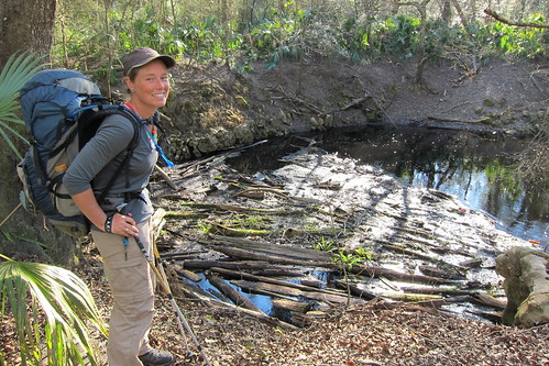
Where the Aucilla River goes underwater. A pile of logs and other debris on the surface.
Sinkhole on the Aucilla River
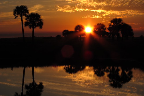
Sunset on the Ring Levee campsite at St. Marks
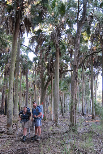
“The Cathedral” in St. Marks, a lot of old cabbage palms. Pretty cool!
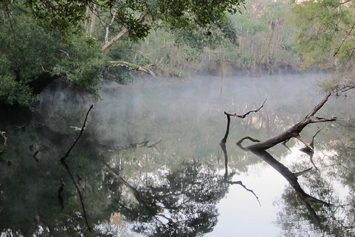
Shephard Spring before the Wakulla Field Campsite in St. Marks. Small gator in here.
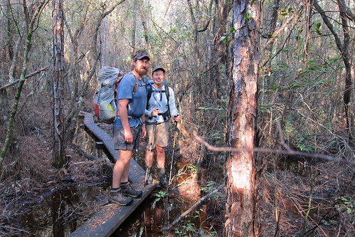
Walking the forest roads around Bradwell Bay Wilderness to avoid the burn area.
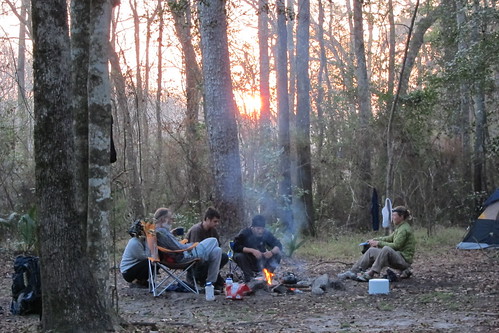
At Porter Lake in Appalachicola we met three people who were just kinda living in the woods. More on them later when I do my big write ups.

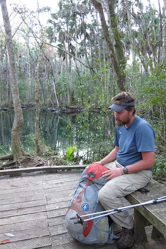
Speaker and his pancake experiment
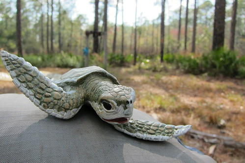
“Ridley” relaxing at the Vilas Campsite in Appalachicola
Through Shuler Bay in Appalachicola. One of the few areas with bog boards. Bog boards are needed in many more areas!!!!
Not sure if I will update again or not before we finish. We hit a few more towns but I don’t think we are planning to stay in any of them unless we are caught in a roadwalk again and have to.
Looking forward to a haircut, a pedicure (lost two toenails this trip) and food. My hiker appetite has just kicked in—of course, 11 days before we finish! Gah!
8 Comments
Patrice
Wow! These photos are fantastic! Really unique and pretty! Can’t wait to hear more!
dad
ready for y’all to be home for awhile
Gayle
We are too! Anxious to see you! Miss y’all lots.
marge
sounds like a rough trip, but you and your husband look GREAT! proud of you. marge
Stephanie H
Looks like y’all are having fun out there! Be safe and can’t wait to visit with you and hear about your adventures sometime soon..:)
Mom
Well stay dry as you can out there. May God take care of you. Love and kisses. Moosie
Suwannee Refugee
Ya’ll are completing one of my dreams. Maybe one day. I think ya’ll picked a pretty good year to do the FT. Best of luck!
marge
Misti – I alerted Swannee Refugee (above) to your adventure, so he has mentioned it in his blog. http://www.suwanneerefugee.com/
Hope all is well. We’re having lovely weather here – hope it is equally nice where you are.
marge