Texas
-
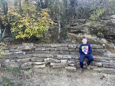
Swooning Over Plants at Gus Engeling WMA – June 2023
I don’t know if I can express how much I love Gus Engeling WMA. I wish I lived closer to it, though perhaps it wouldn’t be as special? Nah, I think it would and I would probably know its ins and outs a little better. I’m constantly drawn back to thinking about south Florida and how “close” everything was, how driveable within a 1-3 hours a place could be, most places in the 1-2 hr range and many within the 1 hr or less range. Feel like going to the Keys for a long day? Done. More in the mood for interior slow moving creeks and rivers? Done. Dwarf cypress…
-
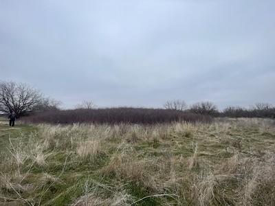
Cemetery Botanizing – Old Sanders Cemetery | 5
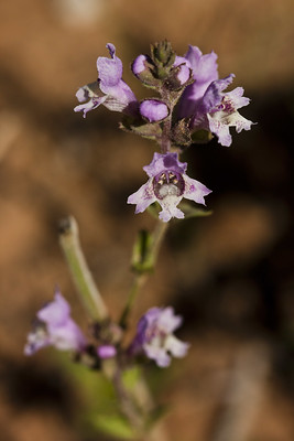
This is probably my favorite cemetery botanizing from last year. Write up at the end! Nuttall’s Deathcamas, Toxicoscordion nuttallii Yellow star grass, Hypoxis hirsuta Tenpetal anemone, Anemone berlandieri Ozark milkvetch, Astragalus distortus Fraser’s wild onion, Allium fraseri Texas toadflax, Nuttallanthus texanus Prairie nymph, Herbertia lahue Right before I went to this cemetery I had seen people in central Texas posting photos of Nuttall’s death camas and had checked iNaturalist to see what its range was. There were some stragglers into the Brazos Valley and knowing where this cemetery was located and how it was on the transition zone between ecological regions, I had a hope that I could possibly find…
-
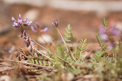
September Wildflower Walk at Watson Rare Native Plant Preserve
In September we drove over to the Watson Rare Native Plant Preserve to help with the scheduled wildflower walk. The preserve typically holds monthly guided wildflower walks for visitors, with a break in July and sometimes August as well as some of the quieter times such as December-February at the preserve. I had primarily been volunteering on work days and wanted to come out for a bit of a lighter load than a work day—really I just wanted to take some photos and enjoy the blooms instead of doing the never ending task of trimming back ti-ti! It coincided with Chris’ birthday and I didn’t have to twist his arm…
-
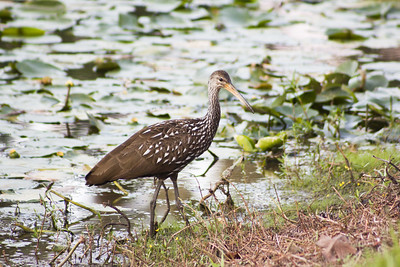
Limpkin Invasion!
It was Saturday late afternoon in September before dinnertime, and Chris decided he needed to run to Dollar General to get a Monster energy drink to cure his lingering headache. Off he went and minutes later I get a phone call from him telling me about a Bird Alert. A Bird Alert is usually when we see a rare or uncommon bird in the area, something to get worked up about! We’re not birders per se, though my Chris is much more in tune with birds than I am. I gravitate towards the more gregarious species and generally ignore the little brown jobbers. Yes, I know this makes me a…
-
Thanksgiving at Lake Brownwood State Park
The lake was very low, still feeling the effects of the drought. Don’t cut hearts into the prickly pears, y’all. We made Thanksgiving camping reservations a little later this year and paired with only having the four days off instead of taking the entire week, we needed to go somewhere mid-range, not making the trek to South Llano River SP or the Davis Mountains as per what we’ve done frequently in the last several years. Plus, we’d already hit the Davis Mtns back during Spring Break in 2023, though I could easily go there twice a year or more if time was available. Lake Brownwood is “out there” in that…
-
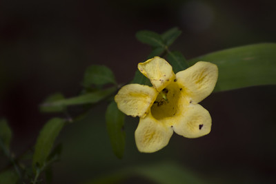
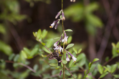
Large-flowered False Foxglove, Aureolaria grandiflora | Wildflower Wednesday
Bumblebee on large-flowered false foxglove BONAP range iNat Observations Aureolaria grandiflora and it’s Aureolaria cousins have been on my to-see list for quite a while now. Imagine my surprise when Chris found them growing at Watson Rare Native Plant Preserve last July. I wasn’t expecting them to be there but I should have checked iNaturalist and paid more attention. The bumblebee video is from July at Watson. The other photos are from stumbling across the plant alongside the road in the Turkey Creek Unit of the Big Thicket last September. We’d just come off the Turkey Creek Trail and were walking back to the truck when Chris saw them growing…
-
Meeting Nabalus barbatus, barbed rattlesnake root | Wildflower Wednesday
We went camping at Martin Dies Jr State Park in October, and while I had some usual suspects to check out on the trails there, I had a plant in mind I wanted to attempt to scout out in Jasper County—between Jasper and Kirbyville. Nabalus barbatus, aka barbed rattlesnake root, came on my radar a few years ago. It is relatively scattered and uncommon in east Texas as you can see in the map from iNaturalist above. Being uncommon and also trying to make sure I’m in the area at the right time for a bloom, well, it hadn’t worked out for a while to visit. I asked Chris to…
-
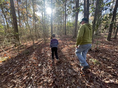
Exploring the Big Woods Nature Trail
In December, after the three of us went to a volunteer workday at Watson, we stopped by the Big Woods Trail in Woodville at Heritage Village. I only found out this trail existed back in October when I did a different volunteer event at the Village with a couple of other Watson folks but at the time I didn’t have time to explore the trails. This time I had an agenda (hopefully more on that soon!) and I was also just curious about the trails, too. Here’s what we saw: There are less than a mile of trails but all of the little side trails make it feel as if…
-
First Day Hike at Lake Arrowhead State Park
It was January 2022 the last time we did a First Day Hike, that time we tromped around Tandy Hills and the newly opened Broadcast Hill trail system. Last year my parents were at our house for New Year’s so we didn’t get out for a hike. This year we spent the week after Christmas in DFW before Chris and I drove to Wichita Falls on New Years Eve to stay at our favorite B&B, the Harrison House in Wichita Falls. We first stayed there in late 2021 after our Charon’s Garden Wilderness Hike in the Wichita mountains and stayed there again on our drive back from New Mexico in…
-
Down but Not Out
*TLDR: Short backstory for what I’m talking about. Energy company created Fairfield Lake for cooling water for its power plant back in late 1960s. Early 1970s, they asked the state to put a state park in on part of the land. State leased the land for ‘free’ (re: yes, monetarily free to landowner but also consider the millions in infrastructure and staff put in by the state, but also the repercussions for the plant to pollute, tax incentives, etc, etc…so very much tit for tat here…) for 50 years. Energy company went bankrupt in mid 2010s, closed plant in 2018, decided to sell off portion of their property, 5000 acres…