AT Best of: Springer Mountain Mile 0 to Pine Mtn Mile 500
Reviewing the ATC book for all of the “best of’s” was a good review to remember what we’d done for those first few weeks. Time seems to creep by and go so fast at the same time. Items are in no particular order unless I otherwise specify.
Best Views:
- Tray Mountain 4,430 elev MM 56.1
- Albert Mtn 5,250 MM98.0
- Siler Bald 4,600 MM 112.0
- Rocky Top 5,440 MM 181.6
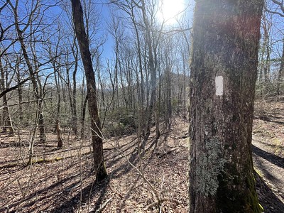
- Charlies Bunion 5,905 MM 208.5
- Bradley’s View 5,200 MM 213.8
- Max Patch Bald 4,629 MM 252
- Lovers Leap Rock 1,820 MM 273.2
- Big Firescale Knob 4360 MM 295.7
- Overmountain Shelter 4550 MM 379.2
- Little/Hump Mtns 5439/5587 MM 380.8/383.0
Best Section:
- Newfound Gap to Davenport Gap (Smokies): MM 204.7-235.1
This section was and has been significantly different from the rest. So many fir trees and the terrain reminds me of the Rockies. A beautiful, awesome section.
- Standing Indian Mtn to Rock Gap (NC): MM 85.7-104
We walked in the snow for most of this section, but the trail was smooth and the snow on the rhododendrons was magnificent.
- Blackstack Cliffs to Little Bald (NC/TN border): MM 294.7-324.4
At the cliffs you start seeing some crazy rock formations and then you get to walk on a very rocky ledge on a knob shortly after the cliffs. The terrain is just a nice change in scenery. Then you start getting into the balds. I just loved this section for how beautiful it was and for the decent terrain.
- US 19E to Upper Laurel Fork (TN): MM 388.4-401.0
Before you start this area, stop at the Mountain Harbor B&B/Hostel on 19E for the best breakfast ever. We didn’t stay at the hostel, but it was pretty nice. This section is very smooth, has some creek/stream walks and was just very pleasant. The six miles following are a beat down, though.
- Vandeventer Shelter (TN) to Damascus, Va: 430.6-463.5: This is where the trail ‘flatten’s out’. Actually, it is just a really nice ridge walk for most of the way and there isn’t a lot of ups and downs. You can pull big miles here if you wanted. We knew people doing 23-33 into Damascus, and some insane people doing 40 from Watauga Lake into Damascus. An enjoyable section.
Best Food:
- Monte Alban: Hiawassee, GA One of the first towns to stop in during the first week and of course Mexican is right up there for something good to eat!
- Fontana Village restaurant, Fontana Dam, NC: Take the $3 shuttle from the Fontana Hilton shelter up to the village for a really awesome burger and fries. We both agree that it has been the best burger on the trail so far. The restaurant is kinda nice, but they don’t mind the smelly hikers.
- Smokey Mountain Diner: Hot Springs, NC Stay up the trail about a mile, hike in by 8am and get a truly awesome breakfast. Some people said they ate there for all their meals, but we only ate for breakfast.
- MoJoes: Damascus, Va A local coffee shop that serves up a good breakfast and some lunch type foods. They also have a computer for guests (you can also use the public library).
- Dairy King: Damascus, Va Cheap, home cooking grub. We both got the chicken fried steak with potatoes and green beans. I hear they have a good breakfast and shakes.
- Quincey’s: Damascus, Va Pizza, grill items, burgers….oh my! The portabello burger was really, really good. We ate there several times during our stay in Damascus.
Best Hostel:
- Blueberry Patch: Hiawassee, GA Absolutely the best hostel in the first 500 miles. Gary and Lennie are the nicest couple and do a lot for hikers during the March-May season. There is a nice bunkhouse, good shower/toilet area, and a kitchen to cook food if you want. Donations are the means for making their money on this and they even serve you breakfast in the morning in their home.
- Standing Bear Farm: near Davenport Gap, TN We pulled an 18 miler to get into the hostel after deciding we wanted pizza for dinner instead of making camp food. We got there and could only tent, not bunk and we were peeved to have them charge us the same $15 a person for tenting even though they were out of bunk space. Aside from the insane fee for tenting, the set up is nice. It is very laid back and there are two showers, a resupply section complete with pizzas and then bacon and eggs for breakfast, a computer that charges $1 per 15 minutes, and a kitchen area for cooking your food. Aside from the dumb fee, this was a nice place right outside of the Smokies.
- Uncle Johnny’s: Erwin, TN About five steps off the trail, they are super, super busy. They have a small resupply and gear section, nice shower area, and places to do your laundry. The bunk house was kinda busy and could be noisy. There are computers free for use. Shuttles are run several times a day and you can borrow a bicycle to run to town if you want. Not my favorite place because of the crowd, but it was decent.
- Greasy Creek Friendly: NC Located between Erwin and Roan Mountain on the NC side of the trail, you have to come off .6 from the trail to get to this little hostel. We went because we wanted ice cream, but found out she will doctor up a microwavable burger for you, she has dial-up internet, her cat does tricks and it is a nice, quiet setting for a hostel. Though, her neighbor is a crank and doesn’t like hikers. Make this a stop if you can!
- Kincora: TN After hearing the proprietor of this hostel built up I was expecting more from this hostel. We lucked out and got the tree house so we were able to sleep by ourselves, but I heard that the bunk house was very crowded and noisy. The owner does a shuttle to town for resupply, but I fear if you miss it and they are busy you might not get into town. There is a stove and oven for cooking if you want. Showers and bathroom area were dirty as was the hostel. I was told that the owner now expects hikers to clean up after themselves—doesn’t seem to be happening much.
- Mountain Harbour: TN This is a gem hidden in the ATC book. The only reason we stopped was because two other hikers told us for $9 we’d get the best breakfast on the trail. We were glad we stopped by! The hostel is above the barn and is stocked with snacks and is pretty nice. You have the option of staying in the B&B too for more money.
- The Place: Damascus, Va This is run by a church across the street and it is a donation of $5 a night. Located in an old Victorian house, it is spacious and was mostly quiet. No smoking, drinking or drugs or dogsare allowed so that keeps the ‘riff raff’ out. Several people come by to check up on this and they will kick you out if they catch you. The showers were mostly clean and the place was relaxing.
Best Town:
- Hot Springs, NC: we loved this town because the trail goes right through the middle and it is such a small town. You can walk from one end to the other in no time at all. Lots of local restaurants and the people are friendly.
- Damascus, VA: Another town the trail goes straight through, it is used to all of the hikers and there are lots of places to eat and resupply. Plus, three outfitters!
- Erwin, TN: Further off the trail and more spread out, but it has more fast-food type places and bigger city items like a Walgreens.
Best Climbs:
- Albert Mtn 5,250 MM 98.0: The first climb that required hands, it was a short, rocky climb with an awesome view…even in the snow.
- Blackstack Cliffs/Firescale Knob 4,420/4360 294.7/295.7: Cool rock formations and an excellent view
- Unaka Mtn 5,180 MM 353.6: The smell on top of this mountain is out of this world. Spruce populate the top of this mountain and we would have camped on top if we’d had water. The book cites a water sources just down from the top but we never found it.
- Elk Garden 4,434 MM 487.3: Between Whitetop Mtn and Mt. Rogers, this section is just plain beautiful. It isn’t necessarily a climb unless you are coming from the north, but the book says that elk, bison and other animals used to roam this section. It is very fairy/Jurassic in it’s setting.
- Mt. Rogers/Thomas Knob shelter 5,400 MM 491.5: While the trail doesn’t go to the top of Mt. Rogers, you get into more spruce trees and start entering the wide open highlands in this section. It’s just a unique little area and very popular with day hikers.
Sucktastic Climbs:
- Sassafras Mtn, Ga 3,300 MM 11.2: This is the first difficult climb of the trail and just about everyone remembers it as being difficult and hard. Mention Sassafras and everyone groans. I’d like to go back and just see how bad it is after doing worse mountains.
- Out of the Nantahala Outdoor Center MM 135-141: We were warned about this so I knew it was coming, but it was a long stretch that really blew. Up and up and up…out of the gorge. Ugh. The view from Cheoah Bald was nice, though!
- Rocky Top (Smokies) 5,440 181.6: I think I was just in a crummy mood for this one, as the view was nice, but the climb was pretty steep. There was a too chipper ridgerunner doing trail maintenance and he was all gung-ho about Rocky Top. I wanted to smack him.
- Standing Bear Hostel to Snowbird Mtn 238.4-243.1: Part of the reason for the suckiness was that we left at 11am and it was getting very, very hot in the leafless forest. Just contouring and up and up and up to Snowbird. Lots of people hated this stretch. The view on top of Snowbird is cool because you can see Max Patch in the distance. I remember thinking that I couldn’t possibly get to Max Patch that same day and we did!
- Camp Creek Bald 4,750 MM 292.7: Steep, steep and more steep. No switchbacks. With false tops. Not really a bald…at least where we went.
- Roan Mtn aka: Groan Mtn. Forgot to write the info down, but over 6K feet. Steep, steep and more steep. Fake switchbacks. The only ‘good’ thing is that the last 1/3 is easier than the first 2/3, so if you stay at Ash Gap before summitting, the next morning won’t seem so bad. It is very beautiful at Ash Gap and the top of the mtn is pretty. But the climb—no one likes it. Apparently switchbacks are coming.
- Pond Mtn 3,780 418.5: The problem with this one is that you first walk along beautiful Laurel creek and then have to climb up and over this sucktastic mountain. Actually, it has decent switchbacks for awhile and then it just becomes steep, steep, steep. If you slackpack and come from the north to the south there are wonderful switchbacks all the way up. I had a nice mental breakdown on this mountain.
Best Campsite:
- Cowrock Mtn 3,842 35.4: A guy at Neel’s Gap mentioned that we should camp there since we were pressing on for the night. An awesome little spot with a beautiful view west for sunset.
- Silers Bald Shelter 5,460 192.2: I only mention this because we were the only ones at this shelter in the Smokies. We also had a deer entertain us at the shelter and it was a beautiful little area.
- Max Patch Bald 4,629 252.0: If you can manage the wind at the top, you should definitely camp here. A 360* view and sunrise and sunset to boot.
- Ash Gap, Roan Mtn 5,350 371.0: There is a campsite and a water source (a hike from what Chris said), but it is such a beautiful, forested area with spruce and other firs. We saw owls and Chris saw a grouse. If you don’t want to do Roan in a day, stop there.
- Wise Shelter, Grayson Highlands State Park 4,460 496.6: There are wild ponies…what more can I say?????
Best Outfitter:
- Mountain Crossings at Walasi-Yi/Neels Gap: The first outfitter you come across as well as the first shower and potential hostel stay, most people are very happy to get there. The showers were ‘ok’ and the laundry got done, but I felt there was plenty of food for resupply even though we sent a box there. Tons and tons of gear to choose from and they do a shake down of your pack if you want them to.
- Bluff Mountain Outfitters, Hot Springs: Really helpful and though they aren’t as full of gear as Mountain Crossings, they do have a good organic/health food selection for resupply.
- Mt. Rogers Outfitters/Sundog Outfitters Damascus, Va: Mt. Rogers is the more popular store, but both carry a wide variety of gear and supplies. If you forget something, Sundog is on the way out of town on the trail. Mt. Rogers is on the way in.
Well, I hope that helps someone…or at least provides some entertainment for someone!
You May Also Like
2 Comments
Patrice
OH SO HELPFUL!!! Thank you!!!!
You don’t have to answer this question right now, but I’m just curious, when did you buy the guidebook and start looking through it/planning the trip. I know you didn’t nail down your mail drops until the few weeks before departing, but I’m thinking about the other stuff. Justin and I were wondering if we should buy the 2010 ATC book now for reference, or wait for the 2011 edition to come out (how much does it really change year to year?). If you have some insight on that, let me know. Of course I am anxious now to start hammering out details, but I know that doesn’t make sense. And I know you really can’t “plan” anyways.
Hipolito M. Wiseman
This is getting a bit more subjective, but I much prefer the Zune Marketplace. The interface is colorful, has more flair, and some cool features like ‘Mixview’ that let you quickly see related albums, songs, or other users related to what you’re listening to. Clicking on one of those will center on that item, and another set of “neighbors” will come into view, allowing you to navigate around exploring by similar artists, songs, or users. Speaking of users, the Zune “Social” is also great fun, letting you find others with shared tastes and becoming friends with them. You then can listen to a playlist created based on an amalgamation of what all your friends are listening to, which is also enjoyable. Those concerned with privacy will be relieved to know you can prevent the public from seeing your personal listening habits if you so choose.