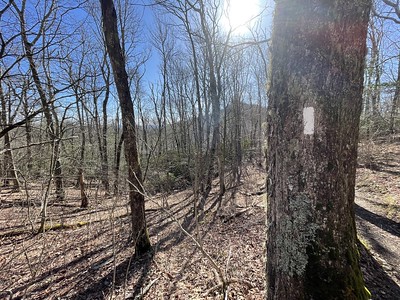
These people do not know what they are getting themselves into!
But they are going to make it to Maine!
This trail—-is so flat! I did not think it at the time! Only miles will tell you that.
Two years. Two years ago since we went to Georgia and started our Appalachian Trail thru-hike. I’ve always wanted to use the blog title ‘The Two’. Why? Because I am a hugeAlias fan and the first episode of Season 3 is titled The Two. It is about Sydney’s return to the CIA after two years, two years she has lost and her life is completely different.
I haven’t lost two years, but it sometimes seems like that. Two years ago I couldn’t have fathomed I’d be where I am today. Not that I am anywhere special, but a lot has happened in two years. I would have told myself two years ago to not be so panicky and homesick, to have enjoyed the first 1,000 miles more. That those five months would be with me for the rest of my life and I will always wish I could spend some more time on the trail, that I’d turn to the AT calendar at my desk at work and wish I was wherever that month’s photo was taken.
I often wonder how other people feel as the distance and years grow between their thru-hike start and end dates. All I can say it that you should do something big and interesting with your life, something that is meaningful to you and will make you remember it forever.
And the pink hair? I’ve wanted pink hair ever since I saw the pilot episode Truth Be Told. It was a good time to try that kind of hijinks, but sometimes I want to do it again in ‘real’ life.
So, with Springer Fever arriving, I’ll read some Trail Journals and ‘walk’ north with this years incoming hikers and enjoy the trail all over again.
I will wax poetic for years to come about August 11, 2010.
A year ago if you’d asked me where I would be today I wouldn’t have had a clue. And now, looking back a year later I would have told myself to stay another week or two in Maine and slow the heck down. We had a good pace, in fact, I loved our pace, but I would’ve like to have enjoyed Maine a bit more. Then again, I wouldn’t take back our summit day, the rare Class I day with a perfect sunrise and summitting Katahdin with some of our favorite people: Cubbie, Dilly Dally and Blue Rooster….and no one else.
A year later, though I’ve written more comprehensive blog posts about the hike, I still ruminate writing a book on the experience and on our Florida Trail hike. I debate on how to set it apart from every other AT hiking book there is out there. Maybe it will be published for all to read, maybe not. At least I could get it out of my head.
With Meghan and Jesse on the Potomac Bridge. I had pink hair. *kinda wish I could dye it again…then again, maybe not* Meghan’s Blueberry was just a glimmer in her eye.
Oh, hot and sweaty…almost half way.
So long ago, yet not.
See who else is making it to the mental half way point this year.
May 4, 2010, Rice Field Shelter in Virginia, Appalachian Trail
It doesn’t fail. There are always particular days that throw me back to last year. March 13: Started the trail, April 20: Getting close to Damascus, May 4: Dad comes to hike, Ashleigh slips away while we have a beautiful sunset.
I wish I was out there again and I wish she wasn’t gone. But of course I’m done with the trail and she really has left.
See, it really is about the memories you make, the little moments in time that somehow seal themselves to your soul. Eventually we may have scratchy brains that struggle to remember the exact date, place or name, but the memory is there.
I just like to try to hold on to them as long as I can.
There will be more dates, Memorial Day: Harper’s Ferry with Meghan and Jesse, Father’s Day: Tiorati Circle…..
Today is April 20th. And in pot smoking lingo it is 4/20. Now, I’ve never smoked pot but I do know some of the lingo and when I saw that it was 4/20 I remembered that we were on a ridge above Watauga Lake in Tennessee, somewhere near the 420 mile mark. I remembered this because there was a hiker named Strider, one of at least two named that, who was young, maybe 18, and had this desire to get to mile 420 on 4/20 so he could smoke a joint—or perhaps a few. He wasn’t anywhere around us on that date, but we were at shelter there and wondered where he was and if he’d dropped out by now. The last we’d seen him was leaving Erwin, TN.
And so, we would be getting close to Damascus, VA now and making our way for Mt. Rogers and the 500 mile mark on Pine Mtn.
Time flies. On the trail it is slow and meandering with only the goal to hike and get to a particular destination for the night. Back in life there are so many distractions, things to do, places to see…work.
I know I am blessed to have been able to hike another long distance trail this year and well, I know honestly I don’t really want to do another one now, but the allure is always there. Sometimes I miss the constant layer of dirt on my legs, heading to a privy or a tree, getting to a shelter and seeing friends, and taking a break next to the trail on a log or rock.
I’ve been following a few folks this year but it seems a lot are going slower than I expected and also that it seems the trend was a later start this year. So I am still reading about people in Hot Springs when we were miles beyond that by now. I’m ready to read about Virginia! I guess I am also looking forward to Patrice and Justin starting in June and I can’t wait to see the trail in reverse!
Alright, enough reminiscing.
Right now, 2800 miles later, I am trying to keep myself occupied between projects at our job. We’re back with the company we temped for last Fall and on a different project. We finished the first portion of the project last weekend and have another week or two before we go back for six to eight weeks for the rest of it. So far we are loving it and enjoy being outdoors and seeing a different part of Texas.
And since we have some time off again I am trying to catch up on some hobbies. Namely, reading. I’ve been wading through Northanger Abbey but am finding it to be the slowest of all the Austen books I’ve read. In fact, it’s a little boring. I cannot identify much with Catherine Morland’s character either. I think I am going to put it down for awhile and come back to it later. I’m actually thinking that I like Mansfield Park more than Northanger Abbey!
The first I picked up because it has to do with women in their 30s and shhh, but I’m almost 31. Crap. The second I picked up because of course ecology but also because it’s about long leaf pines and lost habitats. It will probably be the first one read. And the last because I figure I need to read another Bill Bryson besides A Walk in the Woods and because on the way home from an interview two weeks ago I caught A Way with Words on NPR and was fascinated.
A year ago:
-We signed our first log book.
-We saw our first white blaze.
-We froze our butts off in the freezing rain.
-We started a crazy, awesome adventure that I won’t forget.
Some day I will stop writing about it—maybe—we’ll see about that—but it’s still fresh in my head even if it was a year ago we started.
It really is like this! It was fun to look back and know exactly where some of these spots were. Ah, such a good trail. I’m getting Springer Fever a bit; it would be fun to watch all the thru-hikers for the year. Speaker was planning on hiking from Springer to Neels Gap in a week or two and see how all the hikers are doing. Ah, to be a fly on the wall of a shelter!
Meanwhile I’ve also got Spring Fever. My mom and brother have garden plots in a community garden this year. Chris and I went out and started a whole bunch of seeds and put three already started tomato plants in the ground. Mom had already done onions and potatoes. Looking forward to a good harvest a few months from now!
Heading out to Tandy Hills today to check on the trout lilies for the year. Plan on having some photos—hopefully they are blooming. Also contemplating a picture-a-day series and doing a weekly post on all of the photos.
Also wanting to start up the portrait photography stuff but will probably be a week or two before I get around to asking for guinea pigs.
After leaving Merf behind at Stratton we mosied on our way for the Bigelow Range. We stopped for lunch at the Cranberry Stream campground for lunch and privy before heading up. A parking lot is located pretty near the campsite and some day hikers had come by. One of them ended up talking on the phone and was hiking pretty close to us. It is one thing to use a phone in relative privacy away from a campsite, but to be hiking and talking on the phone??? Really? Chris turned around after awhile and told the guy off and eventually the guy fell behind. Don’t be an annoying day hiker! Don’t talk/text and hike!
The climb up to Horns Pond Lean-To had a few bouldering efforts, but was not nearly as bad as I was expecting. I wasn’t sure how fast we’d be able to move so I’d left our campsite for the night flexible. If it was slow we’d stop at Horns Pond, if not too bad we’d keep going to the Avery Memorial Campsite between West Peak and Avery Peak (rumoured to be very cold at night) or if we were cruising well we could make it to Safford Notch. At Horns Pond we’d seen in the shelter log that Moose and Tetherball and Cubbie and Dilly Dally had met up so they weren’t very far in front of us. It was unlikely we’d see them that night but possible within the next few days!
This section of the trail was crawling with dayhikers and overnighters. We stayed up at the top in the gloomy overcast sky for awhile taking in the view. From West Peak we tried to make out Katahdin but in the haze it was still not very visible. We descended down to the Bigelow Col and Avery Memorial Campsite. Looked like a cozy little spot but we were making good time so we kept on up Avery Peak, named for Myron Avery one of the AT founders. Again we stopped for a bit but the wind was a little brutal so we kept on hoofing it. On our way down we met a group of college aged kids (adults?) who told us to pass on a message to another group behind them with a member that’d hurt her foot. It was taking them longer to get up and over to the shelter and that they could turn back if needed. We met the other group shortly after and relayed it on and the girl looked miserable as she hobbled up the trail. I think they’d overestimated how far they could get that day!
And then finally we reached the 2,000 mile mark! Well, within a mile or two at least! There is also a very famous 2,000 mile paint mark on a road at the very bottom of the Bigelow’s but it is several years out of date so we didn’t take a photo there. This one is closer to accurate!
Coming down to Safford Notch was a bit slow, more rocks and slick areas to keep us crawling instead of bouncing down the trail. We walked around some very large rocks that formed small cave-like, moss covered crevices. We set up camp at the site and Chris went for water. A little later a southbounder came in and set up behind us and then some flip-flopping northbounders we’d met on West Peak came in and set up camp further away. I really liked this site, it had a haunted feeling about it, but perhaps that was just the overcast day.
The next morning we got an early start as usual because we were planning a 22 to Pierce Pond, a shelter that is a quarter mile from a hunting and fishing camp that offers breakfast to thru-hikers. It was a partly cloudy day but the trail was pretty nice as we went up a few false summits of Little Bigelow. On the east end of Little Bigelow we were walking down some of the wide rock expanses and met a few kids coming up from the Little Bigelow shelter. They had asked us if they were near the top—unfortunately we were closer to the bottom than the top! That’s always disappointing to relay or have relayed to you! We bypassed the shelter since most everyone we knew that might have been there the night before would have been gone already.
At East Flagstaff Rd we met trail angels performing some trail magic! Our last staffed trail magic! We stopped and chatted for awhile and found a few people we knew had stopped by that morning so we were excited to not be too far behind them. Walking around Flagstaff Lake was gentle and enjoyable. Several stealth campsites were noted, so keep that in mind if you are walking around that area. There was also a trail re-route that hadn’t been completely finished so who knows if we added any mileage to our thru-hike there or not. We had one minor climb up Roundtop Mountain, a mere bump in the woods from recent climbs, before coming into West Carry Pond Lean-to for lunch. I heard Moose talking before I saw her and shouted over to her. We found her drying off from a swim in the pond and eating lunch with Speaker! We hadn’t seen Speaker since Hanover and Moose and T-ball we hadn’t seen since New York! It was good to be reunited!
A few miles down the trail at East Carry Pond we found Cubbie and Dilly Dally and we hiked the rest of the day together in one long thru-hiker line. We pulled into Pierce Pond at 5pm, pulling one of the longest days we’d had in several hundred miles. It felt so good to make a decent distance by dinner!
The shelter and camping sites around it were very packed. A French-Canadian camping group had taken some some spots and there were several thru-hikers and section hikers at the shelter.
I sat on the rocky shore reading while Chris and T-ball went swimming on their inflatable sleeping mats.
Tetherball
An excellent spot to stop for the night! Before we went to bed that night the owner of the camp that makes the breakfast came down to get everyones orders for the morning. I can’t remember, I think it was between $8-$10 a person for the breakfast depending on if you wanted everything or only some of the items.
It was a very easy walk to the camp, a quarter mile and you could smell breakfast cooking. Inside the large cabin were various stuffed animals, photos from local hunters, albums full of thru-hiker thank-you’s and more.
It was a cozy place to slowly sip coffee and relax for the morning.
Hummingbirds outside on the porch.
Stuffing ourselves silly!
After breakfast we loaded up to hit the Kennebec River Ferry during its alloted hours of operation. The Kennebec is one of more formidable rivers that is unbridged and while some people try to ford this river, it has proven deadly to several people in the past. Now there is a free canoe service that is the official white blaze on the trail—the canoe itself has a white blaze on it. Everyone let us go first since we had a mail drop in Caratunk and wanted to get there before they closed for lunch.
On the other side we were greeted with a cooler of sodas, only a handful left, and some baked goods. I picked up a soda called Moxie and Chris got a regular soda. When I opened it in Caratunk I realized that I really didn’t like the soda at all. It has such a strange taste and I ended up letting Chris finish it.
Caratunk is a tiny, tiny town and other than some old Victorian houses we only saw a post office in the town. Nearby is a Northern Outdoors Resort which offers cabins and other spaces that many hikers take advantage of. In Caratunk we found the post office really easily and I had to really use the bathroom and there weren’t any public ones available. Luckily the postal worker lived across the street and she just told me to go right on in, that the door was open! I walked in and found someone else there and they helped me find the bathroom. Trail magic in the strangest places!
A pleasant walk ensued from Caratunk to the Pleasant Pond Lean-To. Lunch was had in the middle of the trail with Cubbie and Dilly Dally. We smelled cookouts from the shelter and we’d gone down in hopes someone was making food, but found none. Houses were on the other side of the pond so I am sure the wonderful aromas were coming from there. *drat*. Pleasant Pond Mountain was a bit of a pain to climb. We passed a few groups coming down that informed us we were definitely not too close to the top, which was disappointing because the heat was becoming a bit of a bother. Finally we arrived at the top to see some nasty clouds forming back south over the Bigelows. It was strange to see that we’d only been there the morning before and they were already 32 trail miles away. The top of Pleasant Pond was similar to many summits in the northeast, rock slabs with small plants peeking out of the cracks around it—not the ideal place to be if it were wet. We hurried down after some small talk with a southbound section hiker in hopes to get further down the trail and closer to camp before the rain came. Thunder chased us for awhile but only when we arrived at Moxie Pond did it start sprinkling and the majority of the rain seemed to have avoided us.
We were getting close to Bald Mountain Brook Lean-To when we found a beaver pond and realized we had to cross it on the west end. It was pretty fun to be walking on the beaver dam, but when we passed we didn’t see any beavers. It wasn’t much further before we arrived at the campsite and Chris decided to walk back to the pond because it was close.
Chris met a beaver who gave him a bit of a show!
Bald Mountain Brook Lean-To
It rained that night for a bit but we had a nice campsite with Cubbie and DD down below the shelter with a small stream in front of the site. The next morning was overcast and appeared to threaten rain. We had one climb for the day and what appeared to be a pretty easy walk to Monson, the last trail town. The trail up to Moxie Bald Mountain was enjoyable with cushy, moss covered trail and mystic woods. The summit of Moxie was slick from the night before but offered a beautiful site of the coming hundred mile wilderness.
We encountered two different grouse on our walk across Moxie and got a video of this one. Normally they seem to spook easily but these two were friendly enough to let us walk on by without flying away. At Moxie Bald Lean-to we stopped to read the shelter log and found that Moose and Tetherball had seen a moose in the pond that morning! We’d come all this way in Maine and had yet to see a Moose; lots of evidence but no animal. Perhaps we had hope yet!
We passed a few section hikers going south on our way to Horseshoe Canyon Lean-To for lunch. Before getting there we did have our first ford on the trail, the West Branch of the Piscataquis River. They’d told us of a supposed way to get around without having to ford but we couldn’t find the way and decided to just put our Keen’s on and go for it. The water was cold but we quickly got across and didn’t have any problems. We had another ford later on that day, the East Branch of the same river but this one had enough debris that we could manage to get across without getting wet—sorta. The last step where I was going to jump to shore I managed to finagle that and get my left boot completely soaked. Finding a cooler of soda on the other side made up for that! After getting our sugar calories and starting up the trail we met a man with a gigantic pack and dog coming down to refill the cooler! We said our thanks and kept on our merry way towards Monson. There were a few annoying PUDs between the cooler and Maine 15 but we finally arrived at the road at 5pm with some sprinkling rain threatening. We were planning to stay at Shaw’s, a hostel that had been boasted along the trail because of its breakfast. The place was packed but the owner showed up at the trailhead to pick us up and told us she’d manage to find us a place to stay or we could pitch a tent in her backyard. We took the double bed in the front of the hostel when we arrived—a bed sounded better than a tent!
Moose and Tetherball and a plethora of other people were at at the hostel that evening, including the section hikers we’d met earlier in the day. We had a maildrop at Lake Shore House, a gigantic box with 10 days worth of food for the 100 mile wilderness. We shook our heads as we looked at the box and knew we were sending a lot of it home! 10 days??? Not for seasoned thru-hikers. We were planning about six days to get through and in reality it was 5.5. The hostel was pretty nice, offering a nice bunk room upstairs, well appointed bathrooms, internet, laundry and hiker room with tv and couches. I was surprised how many hikers were crawling about the place, it seemed most were section hikers though. A few southbounders were there, at least one was getting off after pushing too hard in the 100 mile wilderness.
The next morning Cubbie and Dilly Dally showed up in the morning rain. We were planning to start until later in the afternoon which worked out for all the nasty rain. The breakfast at Shaw’s is good, but not nearly as good as at the Mountain Harbor B&B/Hostel in Tennessee. We said goodbye to Moose and Tetherball who were planning to get through the wilderness in five days and summit a day before our planned summit date. Who knew if we would see them again?
After a lunch with Cubbie and Dilly Dally at Lakeshore House we decided to finally get on the trail in the mid-afternoon. Cubbie and Dilly Dally were set to enjoy their last trail town and decided to basically zero in town that day. They’d camped near the road the night before so it was an easy hike to the road that morning. We knew we’d see them later on down the trail as we were probably going to have the same summit date.
And then we were there, The 100 Mile Wilderness. We would later find that it wasn’t much more of a wilderness than what we’d already seen. They tout it as having not much road access and no supply options but we met several people slacking several sections, so we knew it was possible to get out via forest and logging roads.
Our goal was to get to the Wilson Valley Lean-To for the evening, 10.5 miles from the trailhead. The going was more annoying than I imagined, lots of PUDs and annoying climbs that seemed to slow us down. Eventually we found a campsite near Big Wilson Stream right by the side of the trail. We had time to go further but Chris wanted to try some fishing so we settled in for the evening.
Campsite along the banks of Big Wilson Stream.
The following morning we had to ford Big Wilson Stream. You can see the guide lines across at the top for when water is much deeper. I was thankful that we did not have anything too deep to cross! We were planning to make it across the Barren-Chairback Range before the end of the day and had about 16 miles to do walk that day. We had a brief stop at the Wilson Valley Lean-To to see who’d been at the shelter the night before, and we set out on our way. It was definitely a slower day than expected, crossing Long Pond Stream without having to ford it and making our way up Barren Mountain for lunch. Along the way we met TinTin’s girlfriend Emily. She’d flown in to meet him along the trail but he hadn’t arrived in Monson yet so she set off along the trail to slowly hike along until he caught up. We hadn’t seen him since Virginia so it was nice to think we might get to see him again.
It was another overcast day and I could tell the clouds had rain on their agenda. We needed some water when we got to the Cloud Pond Lean-To but it was .4 off the trail so I dropped my back and walked downhill to the pond to grab some water. It was an airy walk to trot down the trail without a pack on. It would have been a pretty spot to stay for the night but we hadn’t made it very far at all. From there we were supposed to pass Fourth Mountain, Third Mountain and Columbus mountain but there were so many little hills that we lost count along the way. I swear there were at least 8 mountains in that section.
In the saddles between each summit we’d walk across bog boards through beautiful wetlands. We’d heard in the shelter registers that there was not water at the Chairback Gap Lean-To but several people had told us there was a small stream we’d pass about a mile or two before the shelter and we’d have to carry water up from there. Right after that we started hearing the thunder get closer so we donned our rain gear and started booking it. We had to get over Columbus Mountain in the rain but it was an easier climb than expected and before long we arrived at the shelter.
A flip-flopping northbounder was at the shelter and a couple of hours later we were happy to see Emily arrive. We weren’t sure if she was going to make it that far or not. I enjoyed that shelter because it seemed remote, more than likely because we were swarmed in the fog.
We were greeted by a sun-shining morning the next day at Chairback Gap.
We went further into the gap and found the dry spring and then went up Chairback Mountain. On the north side we saw the looming Whitecap Range our destination for the day. On our way down Chairback we got a disoriented. Poor blazing made it difficult to follow the trail. That side is covered in big rocks making it difficult to navigate and I hated to go further down only to have to come back up. Eventually we found the appropriate path and got off the nasty rocks.
At Katahdin Iron Works Logging Road we found trail magic in the form of sodas and whoopie pies!
Just what I needed to get my engine going for the rest of the day….mmmm sugar!
We had a nice walk along the West Branch of the Pleasant River before having to ford it. Once on the other side we were in The Hermitage and would pass a side trail to Gulf Hagas. We saw a few small waterfalls but did not take the side trail that many people boasted about. I wish we’d of gone back in there a bit but perhaps on our next trip to Maine we’ll stop in and explore that area more. If you have the time I hear that this is very much worth the extra miles.
Lunch was had at the Carl A. Newhall Lean-To where we met a southbounder coming down from the Whitecap Range. Once up on Gulf Hagas mountain we would walk a nice ridge with several peaks: West Peak, Hay Mountain and finally Whitecap mountain. All along the way we’d been following a really annoying hiker in the shelter registers, a hiker from Maine on his third thru-hike. Once we started getting to some of the straight up and down areas of the trail in New Hampshire he would draw these annoying cartoons about how whiny hikers were about not having switchbacks. He was pretty snotty about it and it got to the point that if I ever met him I would probably punch him. Anyway, on our way up Hay Mountain we found switchbacks being installed! I thought it had to be the best revenge to this guy, having switchbacks being put in by MATC volunteers.
Finally we arrived at the top of Whitecap! Mostly sunny at the summit we were able to stop and enjoy it for a good hour or so.
We poked through a small trail to the north side of the mountain where we could see Katahdin. This was the first time we’d really seen it on the horizon and there it was, a mere 73 trail miles away.
Chris had ordered a real kite several towns back, I think in Kent, CT actually and it had been put into our Monson mail drop. He was itching to try it out.
The wind was perfect for flying it but I was worried it would be stuck downhill on the rocks in some precarious position. Luckily none of that happened. We chatted for a bit with a family that’d hiked up from a road down below, about our thru-hike and what was to come. It started clouding up a bit so we knew to head down below tree-line in case the weather turned. The weather did turn when we arrived at the Logan Brook Lean-To. The campsites were full but we managed to find a piece of ground to throw our tent up in before the rain started. I’d tossed around the idea of going further than evening but since the rain started we nixed that idea. There were several flip-flopping northbounders at the shelter. Most of them had gotten off in Pennsylvania and come up to Maine several days earlier. It was hard for me to imagine that there were northbounders still in the Mid-Atlantic states! They would still have time to finish, and many did in October, but thinking of the cold weather they’d have to endure was not something I was interested in.
The rain cleared out by the next morning and I felt like the sky had traces of autumn looming in it. We’d only left Logan Brook Lean-To and were maybe half a mile down the trail when we saw something large 50 yards ahead. My eyes thought it was a downed tree until they adjusted and I realized it was a gangly moose in the trail! A MOOSE! It ambled off to the right of the trail and into the woods not letting us have enough of a good angle to get a picture, but we’d come 2,108 miles to see a moose in the wild! We talked for a bit in our excitement thinking of writing in the next journal that we’d seen a moose. WOOHOO!
We had some of our smoothest trail in a long time during this stretch. If you look at the profile maps of this area it will appear mostly flat with a gigantic 4K foot climb at the very end. We had one small climb at Little Boardman Mountain, where we took a snack break, but other than that we spent most of the day walking around ponds and streams.
There were ample opportunities for swimming and so many spots to camp. It would have been easy to go five miles and pitch a tent, move another five miles and pitch another tent.
Cooper Brook Falls Lean-To was magnificent and would have been a wonderful stopping point, too.
Along the flat trails in this area we passed a group of runners. Maybe they were doing a supported run of the AT? We also met a family that were hiking in to the Antler’s Campsite for the night. We had also tossed around the idea to stop at the campsite because of the good things we’d heard about it but when we arrived we found a group of teen boys being too rowdy for any sort of peace and quiet. We decided to go another three miles to the Potaywadjo Spring Lean-To. We were in luck—no one was there and no one else showed up that night.
The shelter. I poured over a newspaper that had been left there. Good times!
The fancy privy.
The spring at the shelter.
Another view of the spring.
On our last full day in the wilderness we were aiming for the Rainbow Spring Campsite 22 miles from Potaywadjo Lean-To. On the shores of Pemadumcook Lake we peered through the trees lining the shore to Katahdin looming closer. We followed Nahmakanta Stream on our way to its namesake lake. On the eastern shore we found a family who’d been car camping and the smells of breakfast were still looming in the forest air. Oh, bacon and eggs….
We weaved along the shore of the lake, poking out onto the sand shore at times and then back up a hill to the Wadleigh Stream Lean-To for a break. We had one minor summit up Nesuntabunt Mountain. It had some weaving turns that reminded me of getting confused back in the Grayson Highlands, thinking we were going down or up sections we’d already done. On a small side trail to an overlook at Nestuntabunt we had lunch. We took the view of Katahdin while munching on chicken and potatoes for lunch, trying to divy up as much snacks as we could for the last few days. We made a few phone calls and the sky seemed to threaten rain again so we packed it up and headed for our last miles of the day.
Down along Crescent Pond several fisherman were crowding the trail. I think there was a nearby fishing and hunting camp. At the Rainbow Stream Lean-To we took in a snack break among a gigantic group of French-Canadian kids. The were sprawled out across the shelter and most of the campsites so I was glad we were not staying there that night. A few new southbounders were at the shelter and one of them told us he’d gone up and down Katahdin, across Baxter State Park and then into the first shelter in the wilderness in the same day. That was a well over 20 mile day and for a newbie—wow. This guy was paying for it, too, and was going to be crawling over some very easy trail the next few days. Again we walked along more ponds and lakes as we got closer to our destination for the evening. We weren’t but a hundred yards from the campsite when we met a woman named Sweet Tea. Yet another northbound flip-flopper. She took our picture and our names and we each went on our merry way. There was only two other hikers at the campsite that night therefore there was plenty of space to set up camp.
Rainbow Lake
Making dinner down by the lake and the spring. We’d gone through the entire wilderness without seeing another northbound thru-hiker. I was anxious about who was just ahead of us and who might be behind us. There was a limited amount of spots at the shelter in Baxter State Park and it can be tricky if there is a conglomeration of hikers.
The day to we left the wilderness we were planning only to go to Abol Bridge Campground on the Penobscot River an easy 11 mile day. We got up early and though rain was lingering it slowly stopped before we made it to the Rainbow Ledges. I realized later that this was where manypeople take photos of Katahdin. However as we navigated the ledges it was blocked in clouds and we were unable to see anything. We crossed Hurd Brook and arrived at the very last shelter on the Appalachian Trail if you don’t count the one at Baxter State Park, especially since it isn’t open to everyone. We signed our last shelter log, a very full log book, so full that I barely had room to write anything on the tattered pages. We met a section hiker who was just about to leave the shelter from that morning and we made some small talk about our upcoming summit. I went to use the last privy on the trail and as I came out of the privy I slipped and slid all the way down the two or three stairs to the ground, slamming my right hand hard on the wet plywood. At first I thought I’d broken my arm but after a few tears shed and some cuss words I made it back to the shelter and we mosied on towards Abol Bridge.
Coming out of the wilderness we walked along the Golden Road before coming to the bridge over the Penobscot River. A crowd of sightseers were watching as rafters made their way down the rapids of the river.
Of course this was what we were most interested in. We’d finally made it to the mailbox of Katahdin. A mere 9.9 miles to the doorstep and 5 more and we’d be sitting in the living room.
At the campstore at Abol Bridge we found that the Nature Train, a group of hikers that had formed early on with Nature, a thru-hiker from ’09 re-hiking the trail this year, was still hanging out at the campground and planning on summiting the following day. They said Moose, Tetherball and Ponytail Dave had already made their way for Katahdin Stream campground. A ridgerunner was hanging out there to inform everyone on where they could and couldn’t stay and basic information on hiking up the mountain. We weren’t sure what we were planning to do yet so we just went inside and bought as much junk food we could eat for lunch, filling up on chips and queso and microwaveable hamburgers as a last gorge.
Once our stomaches were sated we were able to focus on the task at hand—where to stay for the night. We decided against stealthing across the street in favor of paying for a campsite in the campground in order to get a shower. Stealth sites were technically fee based but one could get away with staying there for free. We talked for awhile to the ridge runner and another hiker who’d been ahead of us and already summited. He’d actually summited twice, both times in an attempt to see sunrise. Unfortunately the weather hadn’t cooperated and he’d been unable to have a nice sunrise. We found out that we could actually start our climb at 2am from Katahdin Stream Campground in order to see sunrise. This was appealing but we would only do it if we knew the weather would be good.
Throughout the day the mountain was in and out of the clouds but it was a bright and sunny day for the most part. We knew it might have been a perfect day to climb but we were holding off in hopes of Cubbie and Dilly Dally catching us to summit the following day.
We waited for most of the day thinking they’d roll in but they never did. It was so nice to relax the entire day, take in some reading and catching some sleep.
Since we had only 9.9 miles to go we didn’t rush to get out of the campground but we were interested in getting our names on the register at the trailhead so we could reserve our spot at The Birches, the shelter at Baxter State Park reserved for northbound thru-hikers. They limit the number of people who can stay there and if you do not have a reservation at any other campsites in the park you are not allowed to stealth elsewhere either.
The sign in sheet.
It was a really easy 9.9 miles through the park. A beautiful trail along several streams, including the lower Katahdin Stream, a ford of the Lower Fork of Nesowadnehunk Stream (kinda deep for me!) where Chris managed to rock hop but I decided to ford. I was impressed when we arrived at a parking lot and saw their privies—incredibly clean and well maintained. Baxter State Park has no running water and bathrooms are privies like the rest of the trail. We were passing day hikers left and right and our pace was a nice clip. Finally we arrived at the Katahdin Stream Campground where the park headquarters was located but found that the rangers weren’t on duty at the time.
A quarter mile down Pack Tote Road lies The Birches. We were the first thru-hikers to arrive so we reserved our tent for the tent pad.
I walked back up to the the ranger station to pay the ranger for camping, to leave a message for Moose and Tetherball who were on Katahdin and to fill up our water from Katahdin Stream. We made several trips up and down the road before running into Moose and Tetherball on their way down to see us. They raved about their awesome summit and showed us their summit photos making me instantly jealous and wishing we’d gone up. But, I had to be patient, we’d get ours very soon.
I killed time by reading a book and donning my moose antlers that I’d bought as a gag at Abol Bridge.
Cubbie, Dilly Dally and Blue Rooster showed up later in the evening and we bombarded them with our idea to summit at sunrise. Cubbie and DD were game but it took a bit of enticement to get Blue Rooster interested. Everyone had been planning on getting up early, just not *that* early. Moose and Tetherball had told us of the insane amount of dayhikers on the summit and we weren’t keen on having a crowd while up there. Cubbie and DD had bought hot dogs from Abol Bridge and brought them to The Birches for one last feast. We gobbled up the dogs and chatted with a French-Canadian couple who had come up the Blueberry Ledges trail and just said they’d hiked through the wilderness. They were actually started at Abol Bridge and were planning to go down to Chimney Pond the next day.
Wrapped in clouds on the summit, seconds before getting to the sign. The clouds were gone in a few minutes.
And then we went to bed. And soon it was 1am. And I don’t think I can write more about Katahdin than what I wrote in my summit post. It was one of the most amazing experiences I’ve had. I wouldn’t change my summit for anything. The peace on top, being with friends. Oh, I guess I can tell of my kite mishap. The wind was incredibly strong up top and Chris had his kite that he was desperate to fly. It was very hard to control and Chris wanted to get in the middle of the bolted down sign to have some leverage. He asked me to come hold the kite while he got in the sign. I had hold of the string for about half a second when the wind pulled and up I went and across the mountain about 15′ before I let go of the kite and slammed down into the rocks. The kite went tumbling down Katahdin and we couldn’t see it. I was glad I had the sense to let go because I would have been down the mountain, too. I carried a bruise on my right thumb up until about three weeks ago. It finally worked its way out as my nail grew. A few weeks after our summit we got a message from fellow thru-hikers Sugarbush and Dethmarch informing us that they’d found our kite on the mountain! It has since been returned to us but hasn’t been flown yet. I still owe them a little something for finding it and sending it back to us!
I only wish we’d taken more photos on our way down to show some of the ways we had to climb up, more perspective I suppose.
When we arrived back at the ranger station we found we had a Class I day. The next week would be full of Class I days, something of a rarity.
We had our very worst hitch out trying to leave the park. It took us three hours! Three hours!!! Since we’d come down it was nearly lunch time and no one was leaving the park. The ranger had told us that we could try hitching either in the parking lot at Katahdin Stream or at The Birches on the road. We’d decided to split up, with the other three staying at the parking lot and Chris and I at the Birches. After about thirty minutes we saw the other three drive by in a car! Bummer! We had loads of people ignore us, some stop and ask if we needed a ride only to tell us they had a full car. Why stop then?? Gah! Eventually, hungry and fed up, we got a ride in a mini-van driven by two sisters on a vacation with their kids. Thank goodness! We squeezed in the back of the van in between all of their car camping equipment. We watched through the back windows as we passed the other parts of the park that we wouldn’t have a chance to visit, beautiful ponds, campgrounds, passing the Abol Slide.
And then we were in Millinocket. And it was really, truly over.
We decided to stay at the AT Lodge but first we had to get food at the restaurant owned by the same people. Chris was fighting a raging headache and I wanted to sate my hunger appetite. At the hostel we showered and took a long nap. When we awoke we talked to the three that had gotten their hitch earlier.
It was weird to be done. It felt like we still had miles to go, that this was just a zero day. But it wasn’t. We all had a last dinner at a steak house down the street and since we still had a desire to walk we went all the way to a CVS a mile or two away down the road.
The next morning we had breakfast at the AT Cafe and then spent some time in the thrift shop getting town clothes. It was nice to fit into some very small numbers, numbers I hadn’t seen in several year. We felt like different people with jeans on. Cubbie and Dilly Dally had a ride set up to go to the airport in Bangor, so we said goodbye to them early in the day. Chris and I walked all over town that day, did some laundry and waited for my mom.
Mom showed up at dinner time having driven up from Boston. We briefly showed her the town and we drove east away from Katahdin and away from the trail.
Since we’d stayed in Maine for several days sightseeing the entire feeling of being done with the trail hadn’t occured. One day we drove through Monson and then down and around the Golden Road, taking her to Abol Bridge where she got a view of Katahdin. I felt very sad knowing it would be a good long while before I got up there again. We went to Millinocket in hopes of finding Merf or any other thru-hikers at the hostel. Everyone was down at the AT Cafe. We were reunited with a vast many hikers we’d hiked with including Merf, Caboose and Spark, TinTin, Turkey and Thrasher…I was glad we were able to see Merf again.
I finally felt like it was really over after that. We’d gone from Georgia in March to Maine in August.
2,179 miles…we were the same people but vastly different. You can’t even explain what the trail does to you or how you feel about the trail. It’s easy to forget the rain days, the PUDs, any scary moments and only see the flowers, the easy trail, the laughs and the people. But, there’s a good reason why some people become part of the Trail, hiking it multiple times, volunteering, going to trail conferences.
I don’t even know how to end this post! We’ll go back to some of these places again one day and perform trail magic. There will be daydreams and following Trail Journals every year and checking in on White Blaze every once in awhile.
Coming into Maine was an awesome feeling. We didn’t let the fact that it is the second longest state on the trail daunt us, we’d heard so many good things about Maine. Maine is beautiful but tough and You’ll love Maine, it’s a real treat!. Except that the first miles into Maine really, really sucked. Errrrr….they were just really freakin’ hard.
Some places just involved going too incredibly slow up and down jumbles of rocks I thought we would never get anywhere. At this point everyone kept asking us when we might be done but I honestly couldn’t tell them anything. I felt like guessing an exact date was futile and if we bought plane tickets, that we might or might not make it in time. All I knew was that the first miles of Maine were going to be difficult.
We had made it a mere 7 miles before lunch, a pathetic mileage for us. We lunched on a false summit of Goose Eye Mtn’s East Peak, where we looked at the wilderness around us. Merf had gone to find some bit of privacy for using a tree; not much was there growing among the alpine plants. When she returned she showed us how she’d stepped off into what she thought was a hard surface but was really a bog hole. Careful where you step up there!
I really wish I had a photo of how we had to get to the top of Goose Eye’s East Peak because it was pretty hilarious, another very difficult ladder that was just a big fat pain in the ass. Just preparation for Katahdin! Walking up on Goose Eye we could see the north peak and then what appeared to be a nice walk along some alpine bogs. When we’d left Gentian Pond Shelter that morning we’d left with the intent on making it to the Speck Pond Shelter nearly 15 miles away. What was between us and Speck Pond was the Mahoosuc Notch and it was probably an ambitious plan to go that far. We’d been told by many people that we should stay at the shelter just before the notch, Full Goose Shelter, and tackle it first thing in the morning.
Along the path to the Full Goose Shelter we walked along the alpine trail and among many muddy bogs. Most had planks we could cross but many didn’t. There was one particular section that was just impossible to cross without getting muddy and well, we went right on across. Then at some point right after the mud bog we walked down more slick rock slabs. I’d been very careful since we’d started doing these slick rocks in New Hampshire as I am well, ok, I’ll admit it, a klutz a lot of the time. But, my carefulness didn’t pay off at this point and I slipped on the rocks. I’d slipped many times before and nothing had been broken but this time my right hiking pole went underneath me and when I stopped sliding I realized the pole was snapped in half. I was none too pleased at this because as soon as I started walking I felt very unsafe without my fourth leg. Damn, Damn, Damn! I was days from a town and cell service wasn’t good so there was nothing I could do but learn to hike with one pole.
When we arrived at the Full Goose shelter we found Snack Attack waiting for us. It was still 2.5 miles to the west end of the Mahoosuc Notch and it was nearing 3pm as it was. We filled up on water, looked for a hope of finding someone that might have left a hiking pole behind and then continued on to the notch. We were descending to the notch when we met some southbounders and asked them what they thought about the notch and arm. We’d heard even worse things about the Mahoosuc Arm.
The notch is an absolutely different experience than anything else on the Trail. It’s bouldering, squeezing through crevices, jumping from rocks to rocks and hoping not to slip in the holes where patches of ice and snow still linger in the middle of summer. We’d heard about a moose that had died several years previously; thru-hikers had come through right after it’d fallen into the notch and saw it suffering while it was still alive. We’d heard once it died that the stench was overwhelming in the notch. In every crevice we searched for the bones but never saw it.
We when emerged from the 1.1 mile notch it had been nearly two hours! It didn’t seem like that, but I was getting hungry and it was already 6pm. The end of the notch is flooded heavily from a beaver dam so where the trail really was it was under water. We skirted the side of the water filled notch and found a tent set up in a clearing. It was Cubbie and Dilly Dally who’d done I think like 8 miles that day and had called it a day after doing the Notch. Our plans of hiking 1600′ up 2.5 miles on the Arm were nixed after collapsing at the campsite with the group. Merf and Snack Attack stayed with us, too. Our one reason for going up the Arm was that it was supposed to rain and I didn’t want to make the climb any worse. The Arm is one big rock face with some trees and a bit of dirt and moss lining the sides. Camp was set up and dinner was eaten and not long after being in the tent the rain started.
We got up the next morning and the sun was trying to peek in from the east through the notch. There were still clouds around and it seemed to go back and forth between wanting to be sunny or cloudy. We headed up the Arm before anyone else and at first it wasn’t too terrible, but then we found the rock. We pulled ourselves up in places, clung to the sides of the trail where dirt still existed, grabbing hold of trees and trying to find the ones that hadn’t been pulled on for years by thru-hikers—those were wobbly. When a side of the trail proved to be harder to go up, we’d find a crack in the rocks that provided some traction and we’d slowly walk to the other side and walk that side until we had to do the same thing again. I was just glad we went up the Arm instead of down.
This went on and on until we finally reached the very top of the Arm and were were relieved for it to be over! From the top we saw Speck Pond, the highest body of water in Maine at 3500′. Down we went to Speck Pond shelter where we stopped for a snack break where we met a few southbounders and section hikers. We were excited to hear that apparently the trail got moderately easier after Baldpate Mtn and then even easier after Stratton and the Bigelow’s. Thank goodness!
After Speck Pond we had another roots and rock climb up Old Speck Mtn and then what seemed to be a pretty decent downhill towards Grafton Notch. We were finally able to move again, it seemed, but still not at our usual 2.5 to 3 mile and hour pace. Before we arrived at Grafton Notch we stopped at a nice rock overlook that faced towards the Baldpates and had lunch with Cubbie, Dilly Dally and Merf. Taking advantage of the noontime sun we took our boots and socks off as was habit to let everything dry.
After an easy downhill we arrived at Grafton Notch, signed the trailhead register, used the privy at the trailhead and then made our way for the Baldpates. I’d been eyeing some clouds that could potentially turn into storms later on. We made excellent time on the gentle sloping trail to Baldpate Lean-to, passing a group of adults that seemed to be part of an Outward Bound type group. Some of them were having trouble and a day hiker was talking to them about water sources. We stopped at the lean-to for a brief snack and privy break and I could tell through some of the trees that the clouds were looking more ominous. We started booking it in hopes of getting over the bald Baldpates before bad weather.
The trail up was eroded and worn similarly to the Arm. A crew of MATC volunteers were working on creating a new trail adjacent to the current trail. Once on top of Baldpate we saw the beautiful rocks of the mountain, sculpted by weather and years, dotted with stunted trees in the swag between the two peaks. Down in the swag we saw the rain coming from the northwest and stopped to don our rain gear. We looked back in the expanse and saw Merf several hundred yards behind us.
Merf shot this photo of us trying to scale our way up the east peak while walking into very strong, what I felt to be at least tropical storm force winds and in a very quick rain shower. The wind was insane! I tried to stay low and close to the rocks as I pried my way up. On top it was beautiful, puddles of water in some of the depressions, but it looked like more rain so I wanted to get down as soon as possible. That wasn’t exactly a fast prospect. Going down some of these rock slabs and faces is often times much worse than going up them. There were many scooting episodes, holding onto trees and swinging down the trail.
Eventually we arrived to the Frye Notch Lean-to, a mere 13 mile day, but it was still early enough to enjoy the evening. Snack Attack was already set up when we arrived and told us Cubbie and Dilly Dally had kept going to stealth somewhere else. A couple of southbounders arrived later on and we picked their brains about the trail ahead. We were hoping to do a 15 the next day and a 17 or so the following day and were curious if that was within reach. They said that it probably wasn’t and that there was some serious erosion and rock slides on one mountain that it was overall tough. Hrmmm, didn’t sound good.
After leaving the shelter the next morning we found the trail to be pretty good, actually. We trotted down to Dunn Notch and Falls in a good time, stopping to get a first morning snack at the creek. Near East B Hill Rd we saw several good stealth sites that we envisioned Cubbie and Dilly Dally staying at the night before.
We passed Surplus Pond and Wyman Mountain (a blink and you’ll miss it mountain) and a few miles prior to arriving at the Hall Mountain Lean-To we met Traipsing Platypus and a couple called The Griswald’s with their dog Otis. It was the first time we’d met The Griswald’s but we’d been following them for several hundred miles in the trail entries. They’d started in Harpers Ferry and were planning a flip-flop, hiking south from Harpers Ferry to Georgia after they reached Katahdin. We chatted for a minute and then kept on going. They passed us pretty quickly because they were much faster hikers than we were, but caught up to them at the Hall Mtn Lean-To. It was just after 11 am and we’d made 10 miles already. Those southbounders were a bunch of—well, liars. Or not. Perhaps it was hard for them, but for us northbounders it was easy-peasy miles to make! We were also none to pleased to read the entry from those southbounders in the shelter. They’d basically slammed the MATC about lack of trail maintenance (what??!) and dissed the landslide that was ahead.
After lunch we beelined it for Moody Mountain. It was there that we did see the damage from the recent landslide. We had some rerouting to go around but it really wasn’t that bad and other than some strenuous straight up climbing, which was to expected by this time on the Trail, you couldn’t blame the MATC for a landslide or for slacking on trail maintenance.
We arrived down at South Arm Road well before dinner and we found a stealth site at Black Brook that would be perfect to stay at. While on Moody Mountain Chris and I’d come up with the idea to either hitch or call a shuttle from the local hostel in Andover to get a ride to eat dinner and pick up some extra snacks. We’d planned one of our longest resupplies in awhile and while in Gorham we’d skimped on extra snacks. Now several days in we were wishing we had extra food to eat after our meals. Snack Attack was game and we waited for Merf to come down and she was game as well. We made a call to the Pine Ellis Lodge and they came to pick us up awhile later. It’d been quite a while since we’d all been in a car, or at least inside one and not hitching and the guy who picked us up drove like a maniac. The road was very quiet and not heavily used, but we all looked at each other incredulously as we sped down the two lane road.
The only thing open in Andover was the general store and luckily it served good grub. We ordered food, did some window shopping on what snacks we might buy and then after gorging ourselves on dinner I spotted a Carvel ice cream cake tucked away in their ice cream freezer. It didn’t take long to convince everyone to split it! Ohhhh, yeah! One ice cream cake split four ways!
Back at the campsite we rolled in and set up camp. Super Tarp made another debut and we nestled our tent under the evergreens. It had drizzled on us while we waited for our shuttle but now it was quiet beside the stream.
We had a 2200′ climb the next morning from the road up to Old Blue Mountain. We’d heard a few people call it tough but I felt like it was a pretty easy climb. It had it’s moments but in it didn’t have any different challenges than the mountains we’d already gone up. At the top we stopped to eat whoopie pies we’d bought in Andover and Chris flew the Spider Man kite he bought in Gorham. We descended the mountain and walked a nice stretch of the trail between Old Blue and Bemis. The morning was beautiful and the sun poked through the evergreens throwing gorgeous rays of light onto the pine needle laden forest. We caught up to Traipsing Platypus and The Griswald’s and walked around them for awhile as we came to the Bemis summit. Lunch was at the Bemis Mountain Lean-To with everyone except Snack Attack who’d kept going despite saying he might stop at Bemis for the day.
Walking down from Bemis.
Somewhere down from Bemis I’d taken a sip of water and managed to choke on it. I’d gotten it swallowed but my air passage decided to close up and I started wheezing and was not able to speak. Merf and Chris were behind me trying to figure out what happened but all I could do was suck air in as best I could and ease the muscles around my throat. Eventually they relaxed and I was able to cough and say what had happened, but for a few seconds I was very nervous about regaining an appropriate airway to breathe. Ugh!
After a descent down to Bemis Stream we had a fairly steep and wooded climb up to Maine 17. We climbed right out to the road where we found a bench to sit at to over look the valley and mountains we’d just come from. It was a spectacular sight to behold. Maine appeared to be truly a wilderness, vastly different from the views we had in the mid-Atlantic states where we saw cities and lights galore.
We arrived at Sabbath Day Pond Lean-To, our 17 mile day, for dinner. The day was much easier than the southbounders had related and I was glad for the easier miles we had now. The shelter was crowded, a French-Canadian group of boys had taken up most of the tent sites and pads, some southbounders were in the shelter and others were scattered around the area. Luckily one of the French-Canadians gave up their tent site and let us stay there. I was nervous they’d be rowdy all night—we cranky thru-hikers needed our beauty sleep! That night we heard our first loons out on the lake. They made their ethereal calls throughout the night awakening me from sleep a few times.
Town was on the agenda for the next day, Rangeley, for a resupply and a stay at Gull Pond Lodge, a hostel. An easy 10 miles got us to the road well before lunch. We found a trail magic cooler waiting for us at the road as well as Snack Attack who always hiked out earlier and faster than the three of us. We waited for quite awhile trying to get a ride, sending Merf out to try to hitch. Suddenly on the other side of the road a man and his little daughter, maybe six or seven, came out of the woods. They’d spent the night at the first shelter two miles up and were heading back to Rangeley where they lived. We asked if they could perhaps give us a ride and we were in luck! WOO!
Chris and I rode in the back of the truck on the way to town, watching as we passed Saddleback Mountain, what we’d have to climb the following morning. Town was a quaint vacation village with a grocery store and small tourist shops. Small enough to have what we needed but not too touristy to be overwhelming. We made a stop at the outfitter to try to get my pole fixed but resorted to having them call Leki to get replacement pole parts sent ahead since they didn’t have them in the store. We called Bob at the hostel and told him we’d meet him at the grocery store after we had lunch and went to the library. Lunch was a barbeque joint that was attached to an ice cream store. Merf and I went on a search for a bathroom and I wanted to just find a tree to pee behind—finding a public bathroom proved to be pretty difficult in this town! The bathroom at the town park was open and finally we had sweet relief. After lunch we topped it off with ice cream, blueberry for me.
At the lodge we found a few southbounders and section hikers already there. The hostel is run in the home of an older man who has rooms of bunks upstairs and a very crowded space downstairs for hikers. He lets hikers use his kitchen so we’d brought food from the store to cook for dinner. Gull Pond stretched out from the backyard of the lodge and we watched a beautiful sunset that evening.
Relaxing….
Tight quarters, but a good nights sleep in the bunk room. We said goodbye to Snack Attack here in Rangeley the next morning. He was planning to zero there since he wasn’t going to be able to have a ride from Katahdin until days after we were planning to summit. With the recent easier trail we’d been able to estimate a finishing date and were able to finally buy plane tickets.
We were dropped off a little before noon the next day planning an 11 mile day to Poplar Ridge Lean-To. We stopped at Piazza Rock Lean-To for lunch and were astonished to find that Moose and Tetherball had caught up and had thought they’d catch us at the shelter the night before, but we’d stayed in town. Drat! We knew they’d go further than we would that day and had no chance to catch them for awhile.
The double privy at Piazza Rock Lean-To. At the shelter we met some dayhikers who were searching for their lost seven year old. He’d wandered off near some caves and had not been seen. Before we left it seemed like they’d found him as they’d left the area. Chris and Merf stopped in at the caves near Piazza Rock before we made our way up Saddleback.
Several false summits got us excited to get to the real top of Saddleback. It was here that we were supposed to get our first glimpses of Katahdin. Unfortunately it was too hazy to really pick it out in the distance, but we found a few peaks far off that we thought might be it.
Huddling out of the wind for a quick break.
Hiking along the rock strewn trail of Saddleback and The Horn was pretty awesome despite the wind.
We met a few new faces at Poplar Ridge Lean-To that evening, including Ponytail Dave. Turns out he’d hiked in the beginning with Moose and Tetherball and was excited to hear they were close by.
We had a pretty easy going morning on our way to the Spaulding Mountain Lean-To for lunch. Some climbing was involved but it seemed smoother and less rock slab climbing than previous mountains. We met a few more southbounders but for the most part it was quiet. At the shelter the trail register had jokes about missing Mt. Abraham to the south, because it seemed that previously the AT managed to find every peak it could possibly go over. At lunch two weekend hikers came by to rest and talked about other sections of the trail they’d done.
At Spaulding Mountain after the shelter we had only 200 miles left of the trail. I’d imagined the trail went to the summit of Spaulding, but in another AT surprise it bypassed the summit with a blue blaze to it instead. Sugarloaf Mountain was our next destination, the second highest mountain in Maine, after Katahdin, but again the trail didn’t go to the top. The majority of this mountain is a ski resort but luckily we did not see that aspect of the mountain and mostly saw the wild side of it. Once on the west side of the mountain we started descending into the Carrabassett River valley. The trail then became a very dusty and rocky trail, more reminiscent of trails out west not of what we’d been on for the past several hundred miles. It was steep most of the way down and hard on our knees.
At the river Chris decided he wanted to fish for awhile and we’d tossed around the idea of going further than the Crocker Cirque campsite a mile past the river. But, we changed our minds in favor of relaxing by the river and relishing the trail instead of rushing it more. We had only the rest of the day and morning with Merf since she was getting off to zero and resupply in Stratton.
For three hours Chris fished, catching trout and losing trout. We thought we might have some for dinner but no such luck. Merf and I curled up in the sun next to some rocks letting the sound of the river put us to sleep. Sometimes I read and wrote a bit, tried to figure out upcoming mileage, but for the most part we just enjoyed the afternoon.
The Crocker Cirque campsite was listed at .2 off the trail but when we found the blue blaze to the site we also saw an easy stealth site right next to the AT and to the water source so we opted to stay there instead.
We caught up on some phone calls, made dinner and enjoyed a nice snooze in the tent that night.
South Crocker was a bit rocky going up, in all the Crocker’s were an easy traverse. In the privy at the campsite we’d read in the register about a hiker we’d been following for awhile, Switchback, who’d said as a kid the Crocker’s were her first backpacking experience. After seven moderate miles we arrived at Maine 27 where we said goodbye to Merf. Resupplying and taking a zero, she was planning on finishing the trail several days after us and was not in as much of a hurry as we were. Not that we were in a hurry, but she had no one to pick her up until then so why rush?
It was bittersweet to say goodbye to someone we’d been hiking with for so long. We’d talked about so much and I felt so close to this trail friend of mine. She made us laugh with some of her goofy antics and it would be sad not having her with us.
So, we said goodbye to Merf for good—or so we thought!