Trail Tales 14: Massachusetts
Relevant posts:
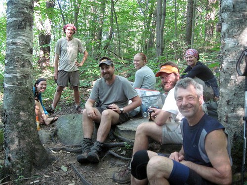
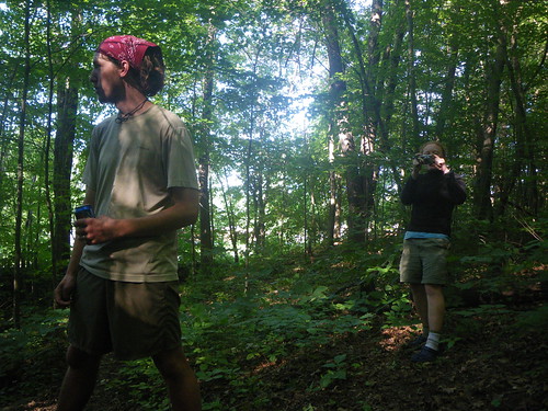
Group Hiking
Make Time’s Thru-Hike Completion
Inch by Inch, Rock by Rock

I have to say that Massachusetts surprised me. It turned out to be a lovely state and also a plant community and ecosystem change.
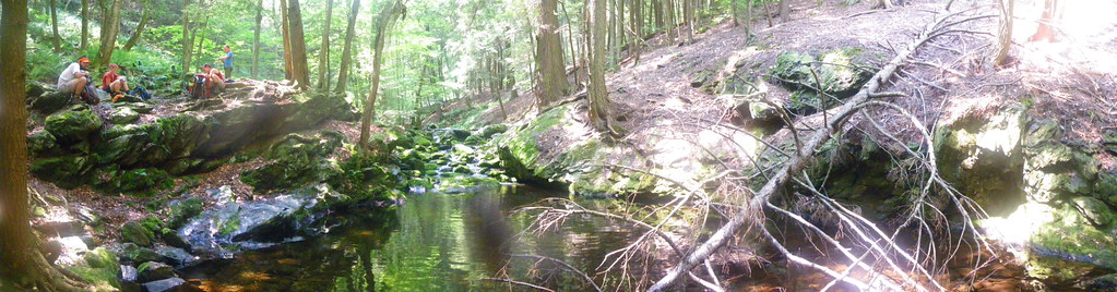
Once into Mass we descend into Sages Ravine, a *bleeping* cold water source. I prefer my water Gulf of Mexico warm but the rest of the crew braved the water for a bath.
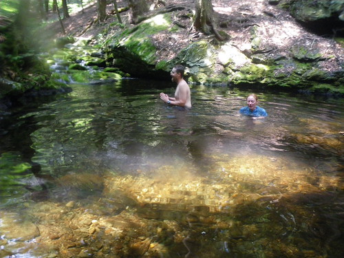
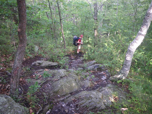
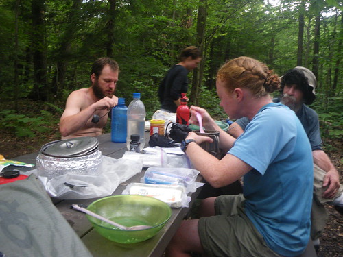
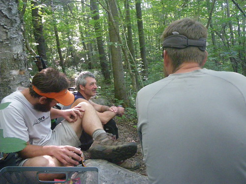
Chris and Merf
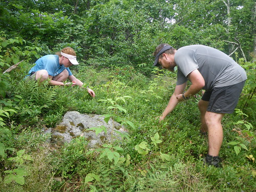
After getting cooled off we headed for Race Mountain where we stopped to pick blueberries for long periods of time.
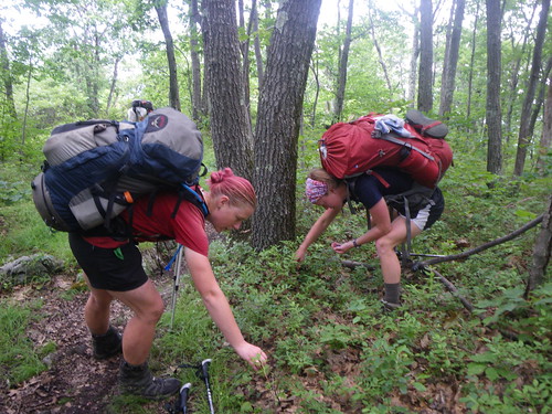
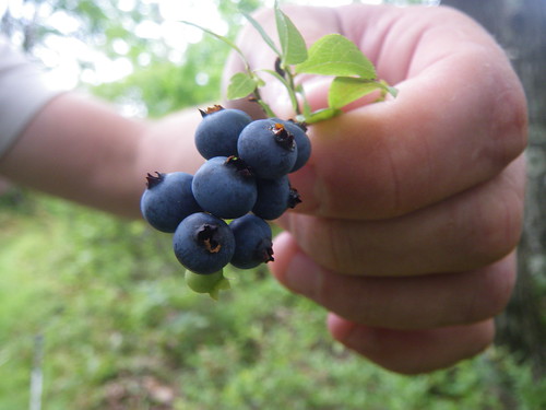
It’s impossible to resist a clump of sweet and delicious berries! We sat for a long time on several Mr. Everett false summits before realizing a thunderstorm was coming. You can read more of that in the first post listed above, but we had planned to finish early that day at the Glen Brook Lean-To, and instead we took our leisurely time eating blueberries and soaking in the trail. After getting near the top of Mt Everett the lighting had started and Caboose and Spark had gone much faster and were ahead of us, while Chris, Merf and I were trying to stay low and out of the rock areas. The top of Mt. Everett is scrubby and has a view so we were definitely exposed. We were most of the way down the mountain when the bottom fell out but luckily we were close to a privy and saw Caboose and Spark and a bike rider squeezed inside, so we joined them.
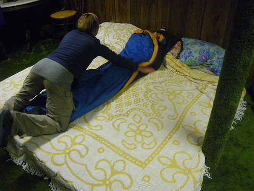
We got to The Hemlocks Lean-To and found a boyscout troop had taken up the entire shelter so we made our way to the Glen Brook Lean-To which was only .1 down the trail. There we found a younger couple, I think the girl was something like Tinkle Fingers or Sparkle Fingers—something strange—and they’d just got on the trail at Harpers Ferry with no real plans on if or when they were going to finish the whole thing. After drying out we set up camp for the night and hit the sack. Caboose and Spark were planning on resupplying in Great Barrington the next day and were leaving early so they could get in and out and miss the rain for the next day as well.
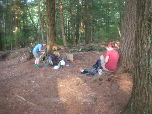
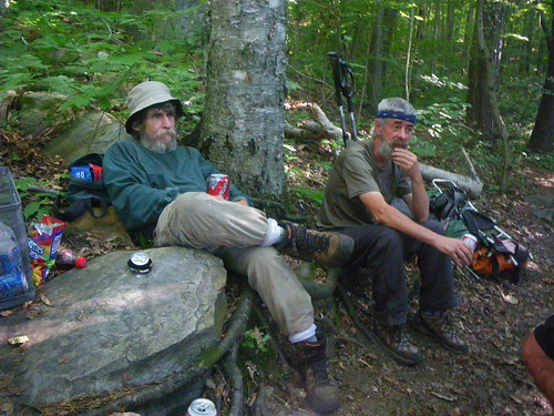
Chilling by the bear box the following morning at the Glen Brook Lean-To.
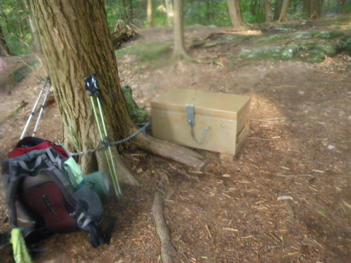
Some sections of the trail have bear boxes that work pretty well. It’s better than having to hang your food.
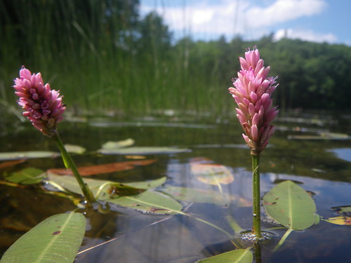
Somewhere near Jug End.
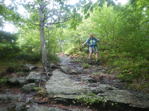
A particularly slick area near Jug End.

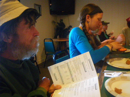
Our goal for the day was about 22 miles to the Mt. Wilcox North Lean-To and we were in a hurry to try to get there before possible late afternoon thunderstorms. After descending from Jug End we walked through some forested swamp areas that had potential for really nasty bugs. We’d heard that Mass had a bug problem but so far we had no major issues. We passed monument for Shays Rebellion and kept on going to the road for Great Barrington where we were planning to stop at a place .1 off the trail to get ice cream or sodas. We found the place closed but an antique store next door had sodas but a restroom that was not for customers. Luckily the store that we thought had ice cream ended up opening, no ice cream but the lady was nice enough to let us use the bathroom and we moved down on our merry way.
We crossed the Housatonic River for the umpteenth time (and was given a warning from the non-friendly bathroom lady not to filter water from the river because of chemicals and such) and headed up East Mtn, which showed us some roundabout trail maintenance (going up and over rocks for no reason) and a few false summits before we made it to the Tom Leonard Lean-To for lunch. When we showed up we were greeted by a guy who immediately recognized us and said he’d met us somewhere on the trail already. He had to state a few locations and shelters before I realized it was Blue Jay a previous thru-hiker who does large chunks of the trail for fun every years. We’d met him at the shelter near Tinker Cliffs in Virginia back in May and he’d been doing the Virginia Section. He’d hiked up to the Tom Leonard shelter to do some trail magic, was looking for Sly Jangle and we told him he was a day or two ahead of us. Also we met Make Time here and found out that our friend COB from back in Georgia was going to be arriving back on the trail after a few zeros and we should run into him again shortly. Make Time had taken some time off in Great Barrington and was only 40 miles or so shy of finishing his thru-hike within the 365 time limit. He only had to make it to Dalton, Mass. You can read more about his story in the post above.
Caboose and Spark showed up just around the time we were going to leave and so we all hiked together to the Mt. Wilcox North Lean-To.
After passing some trail maintainers near Blue Hill Road we stopped for a bit at Benedict Pond. It was a peaceful, overcast walk the rest of the afternoon, past something called The Ledges (that we never saw) and over a few unlisted ups and downs before we arrived at the shelter.
The shelter was .3 down the trail and we had some trouble figuring out where the best water source was. Make Time showed up and completed our quiet little group.
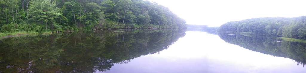
We’d planned to get to the Mt. Wilcox shelter because it was only 14 miles from Upper Goose Pond where we were planning to spend most of the next day. It was a pretty easy walk to Upper Goose Pond, though sometimes it seemed long and I felt anxious just to get there, to this long awaited, little respite in the woods. Sometimes it gets frustrating when landmarks aren’t labeled in the woods so sometimes you will wonder if you’ve passed them or not. We walked through some fields around Tyringham/Jerusalem Road area before ascending up a mountain and continuing on towards UGP.
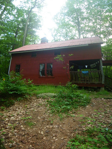
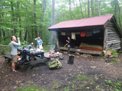
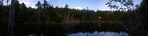
The Upper Goose Pond cabin is operated by the Appalachian (Money) Mountain Club and is by far much better than any of their huts in the Whites. For one, it’s free and donations are accepted, the people are super nice, and you get breakfast! There is no electricity, but it feels so cozy and wonderful inside. There are books to read, lots of places to lay and rest, newspapers to catch up on, and of course the pond to go swimming in.
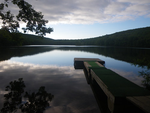
The water was still too cold for me so I spent most of the afternoon sunbathing on the dock with Spark and Merf, taking a nap and resting. I moved indoors later to rest some more, just enjoying the peaceful area. COB ended up showing up later that afternoon and we got to catch up with him for a bit. He was planning on catching up with Make Time to help him get to Dalton.
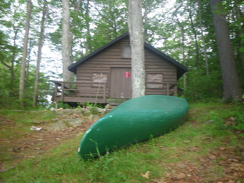
You can take their canoes out, too.
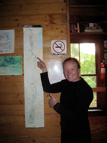
Merf pointing to where we were on the AT map. Long way to go still!
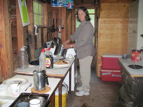
Our caretaker at UGP.
Inside the cabin. I was very reluctant to leave the next day, the place felt like a hostel in a way, something that I could get tied down to. But, we headed out, with our original intent to stop at the Kay Wood Lean-To 3 miles from Dalton.
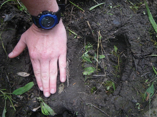
In Mass we saw our first moose prints! Sweet! We also saw moose scat but never saw a moose. We had a really easy walk that day, around several ponds, through some overgrown vegetation that needed some maintaining and we started enjoying some of the wonderful conifers that were starting to appear. At the October Mountain Lean-To Caboose, Spark and Merf caught up to us from the morning and told us of their idea to run ahead of COB and Make Time in order to throw a surprise celebration for Make Time at the finish line in Dalton. We loved the idea, but even though we were planning to speed up and do some extra miles we decided to try to stop at the Cookie Lady’s house at Washington Mountain Rd. Unfortunately they were not there, but we signed their log book and ate lunch at their picnic tables. Chris decided to water their plants since it appeared they were on vacation.
Shortly after deciding it was time to move on we met Hit & Miss, our first southbounders. They just ‘seemed’ to be southbounders by the looks of them, full of confidence and carrying packs that most northbounders didn’t carry. After chatting with them for awhile we hit the trail and maybe three or four miles later they come running up behind us having changed their minds and deciding to head into Dalton with us for another day! What a surprise!
Hit & Miss had stayed at trail angel Tom Levardi’s house the night before and convinced us that we had to stay there as well. So, we ran into town, Caboose and Chris borrowed bikes from Tom and ran to a liquor store to buy beer for Make Time (since we’d found out the type he liked back at the Tom Leonard Lean-To) and came back in time for us to sit at the trail head near the CSX Railroad crossing.
Strider, Caboose & Chris.
Merf & Hit
Hit & Miss
Make Time and COB coming down the trail
Soaking it all in…the trail is done for Make Time!

We walked with him to the exact corner in Dalton where he and his wife got off the trail.
Make Time, making time!
After all the hullabaloo of finishing we walked a bit down the road to a pub to eat dinner. Everyone who was staying at Tom Levardi’s showed up.
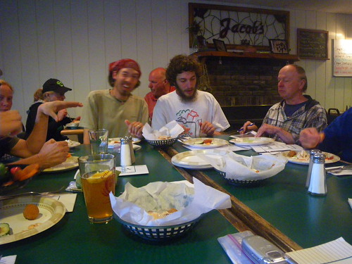
That’s Tom in the back right corner.
Caboose, Spark and me
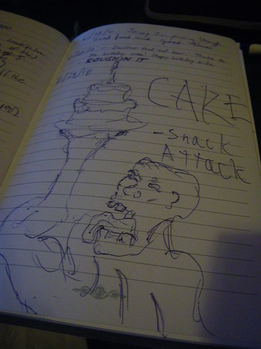
Snack Attack’s fun drawing in the log book at the pub. We’d missed him by a day.
I am not sure on the full story of how Tom Levardi came to let people stay in his house, but he has many beds for guests, including his couches, but somehow Caboose, Spark, Chris and I got to share this pallet bed in the basement. It was a little bizarre, but we made it work. If the trail shows you anything, it’s that you make the best of whatever situation it throws at you, including strange pallet beds. Tom is very gracious and gets ice cream for every one, and we stayed up and watched The Royal Tennenbaums for awhile before hitting the sack. Since we’d previously decided we were going to make it into town the following day and instead we’d made it in that night, we decided to zero in Dalton since we hadn’t had a true trail zero since Damascus, Virginia (this is minus the time we came home for 5 days), so we felt like we needed a real zero. Merf was staying as well, but Caboose & Spark were moving on to get off the trail a day later to go spend the 4th of July with family.
In Dalton there isn’t a good resupply, so a convenience store has to suffice to get you to North Adams. There are several restaurants to eat at, the library is good and the motel we stayed at for the second night was nice and had free internet and a cat to sit in your lap. We heard Little Brown had arrived that day and that the Traveling Circus wasn’t too far behind.
We left Dalton on July 2nd with the intent on making it up and over Mt. Greylock and a destination of the Wilbur Clearing Lean-To 20 miles away. The walk out of Dalton was pretty nice, we passed a few ponds, met a kid selling lemonade for I think $1 a glass in half filled Dixie Cups, stopped for lunch at an ice cream store in Cheshire and then ran into Merf and Little Brown on our initial ascent up Greylock. This would be our first time over 3,000′ since North Marshall Mountain in the Shenandoah’s.
We stopped for water and rest at the Mark Noepel Lean-To and I remember Little Brown asking me since I was leading why I was taking the trail on all of the rocks. I laughed and told him he really needed to talk to the trail planners, not to me, but it was foreboding of what kind of trail the trail would become in a few hundred miles.
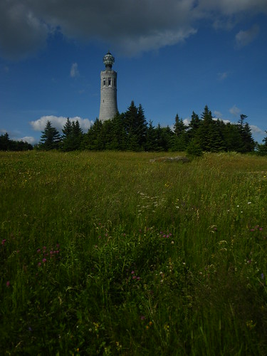
It’s always disappointing to climb a mountain that people can drive their cars up to. Greylock has a lodge on top and a restaurant and we thought we might catch dinner but it was only available for guests. You can pay to stay there as well, but we’d just zeroed so we passed.
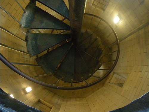
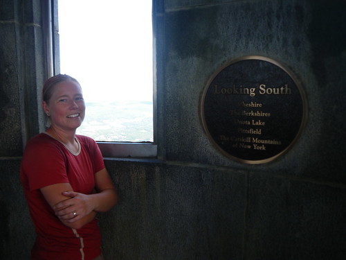
The stairs to the top of the tower.
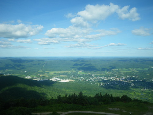
From the tower
We met Catman here for the first time. I’d seen his logs for awhile but had never run into him. On our descent of Greylock we ran into some iffy white blaze issues, as in there weren’t any and it wasn’t clear where the trail went. There is a typo in the trail book stating that you would have to descend almost 1,000 feet in .1th of a mile! That would be some rock wall scaling and it certainly didn’t happen.

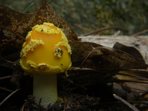
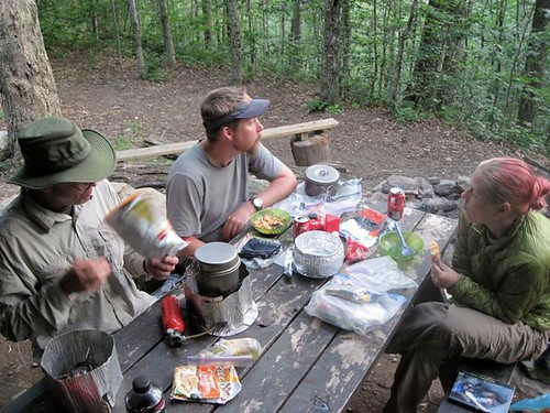
Not sure what I am eating here…this is Merf’s photo that she left me lift (along with a few others on here).
Dinner at the Wilbur Clearing Lean-To. The shelter is .3 off the trail, and by this point in time you really don’t care that it is that far off the trail. Half a mile or more, eh, maybe, but this, not so bad. We ran into a trail maintainer there and a few others doing some section hiking but went to bed for a cozy night.
The next morning we had a pretty easy walk 8 miles into North Adams for a resupply. Merf was meeting her friend Jim there and he was going to hike with her, perhaps until the Whites, but wasn’t quite sure how far yet. We ended up hitting a grocery store somewhere west down the road, shopping in a food wonderland and eating bagels and sandwiches before hand. It’s always a mess when having to repackage everything right there in front of the store, but you get it done and try to stay out of everyones way. After Jim arrived we set off down the trail heading for the Vermont border which we hit only about six miles later. At Eph’s Lookout, .6 from the Long Trail’s southern terminus and the Vermont state line, we met a group who were starting the Long Trail that day. It was hazy and humid, the bugs were starting to get worse.
The bugs—that would be Vermont.
You May Also Like
One Comment
Patrice
Mass sounds nice! I’ve heard so much about Upper Goose Pond (especially from the Barefoot Sisters books) that I think I will definitely “plan” for us to zero there. It just screams relaxation!