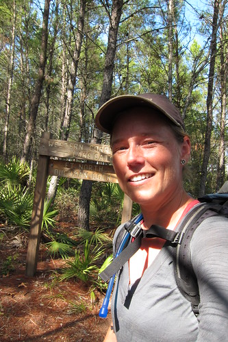
Florida Trail Tales 5: Lake Mary to Buckman Lock
After resting up in the hotel in Lake Mary the next morning we ate a filling breakfast downstairs, grabbed a sandwich from the Publix deli (best ever!) and set off on our way. We were aiming to get close to Ocala National Forest so we could walk in the next day. We still had some roadwalking to do, however, and that left us to follow more of the Cross Seminole Trail through some neighborhoods. Eventually we caught up to Max and Amanda from Chuck Norris’ crew and subsequently played leapfrog with them while we paralleled Markham Road and walked up C.R. 46A.
At the C.R. 46 junction with 46A we headed north into the Lower Wekiva River State Park. I initially thought we walked through the park to the north, but instead we walked north, then back west and south to avoid a bit of the road. It was a nice walk through there, but a seemingly silly alternate for getting off the road because we just ended up back on the road anyway less than a mile later.
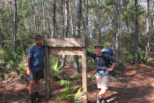
After heading west down 46 and over the Wekiva River (looked like good paddling!) we finally saw the entrance to the Seminole State Forest! Finally, back in the woods!
At the entrance, which apparently we were supposed to pay at the self pay station but somehow we overlooked that, I did notice a sign that appeared to be more of a general information sign about prescribed burning. I should have taken more note of that for about an hour later down the trail.
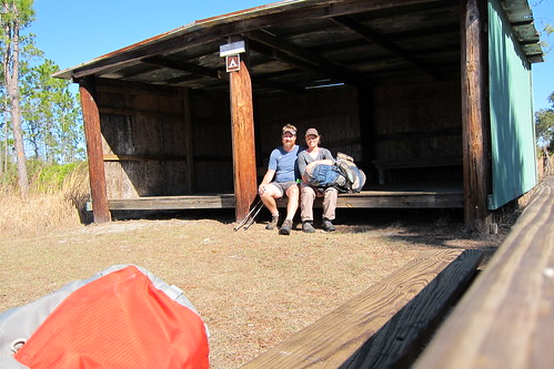
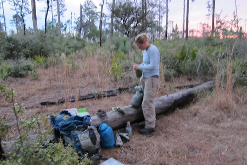
We came to our first shelter on the FT here and felt like we had to sit in the shelter and needed to sign a log book, but there was no log book. It was almost like old times on the AT, but there wasn’t a group of people to chat with. I kinda wished we could have stayed there for the night but it was still before lunch at this point.
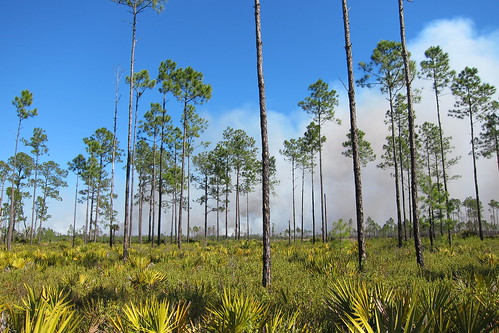
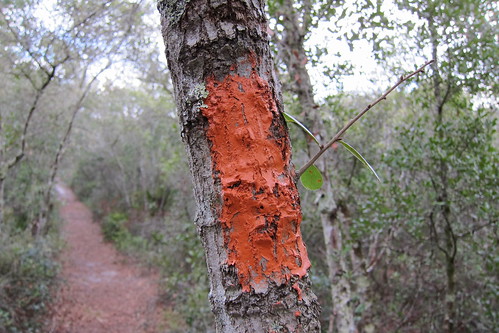
Not long after leaving the shelter we noticed smoke in the distance and heard/saw helicopters working in the area. We kept an eye on it as we walked north, not sure where exactly the trail would go in relation to the fire. The trail weaved through recently burned areas complete with charred pines and the burned remnants of saw palmettos. Don’t worry, the palmettos will come back! It was a bit difficult to follow the trail in a few places, but we looked for footprints and the tell-tale signs of a trail.
We kept getting closer and closer to the fire and it seemed to get larger, too. The helicopters were starting more lines further north and I was getting frustrated because I didn’t know if it was going to encompass the trail. At one point the flames rose high and the smoke billowed ominously. We backtracked to a fire road in case we needed to bail out. Chris tried to look at the map and figure out where it was in relation to the fire and we determined that we would be ok and that if we really had to we’d jump in Blackwater Creek, our lunch destination and a campsite.
At Blackwater Creek it seemed the fire was dying down so I tried to eat lunch in relative relaxation, but towards the middle of our hour break the helicopter came and more smoke started coming out, this time it appeared closer. Gah! Off down the trail we went hoping to outpace the fire as we moved north.
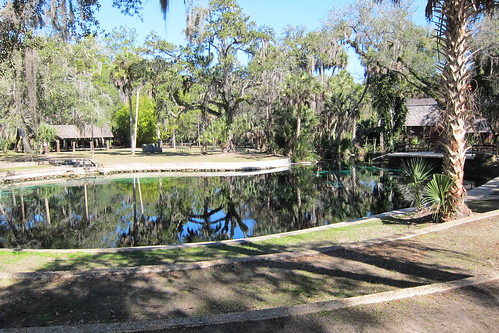
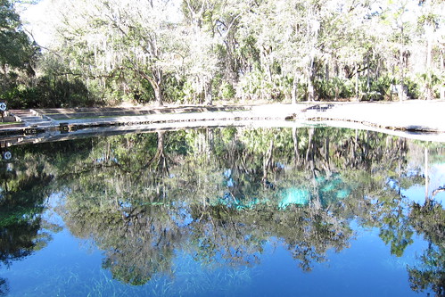
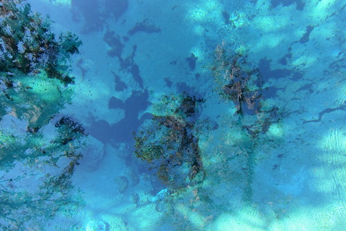
We took another break at Sharktooth Spring campsite since our lunch was cut short, laying in the open meadow next to the picnic table. The fire seemed to die down and a few times the helicopter passed right over us and I knew they had to see us lying there. The campsite is true to is name and we found the spring by accident after missing the main trail turn and following the side trail down to the spring. It was our first spring on the trail and a nice sight to see!
Through the rest of Seminole State Forest we walked in relative ease, knowing the fire was out and trying to enjoy the area. We passed through a cypress swamp, luckily walking on a road through it instead of in it, and a forest ranger drove by in a truck as we waved to him. On the north side of the park is an open field where we spotted the helicopters used in the prescribed burn. We we exited the park on the north end we came to a mailbox, commonly used for log books or information on the trail, where we left a note for the FTA and the forest service that they should have posted closures or re-routes on the trail head due to the close proximity of the fire to the FT. It could have been dangerous and general signs about prescribed fires isn’t good enough. We even tried to call the forest service at several numbers when we’d backtracked but to no avail, no one answered!
At SR 44 we had a several mile roadwalk north east to get through a subdivision and into another wildlife management area.
We were minding our own business when a car turns around and pulls over on the side of the road. I figured it would be someone just curious about the trail or asking if we needed a ride, but it turns out they were geocachers that we knew from geocaching events. They knew we’d been out hiking the trail and had questions about it and we talked for awhile, got some trail magic sodas from them (mmm!) and they gave us the low-down on some of the trail through the Royal Trails subdivision. Royal Trails is a larger property subdivision, more suited for living in the country, bigger yards and a quieter neighborhood, but a subdivision nonetheless.
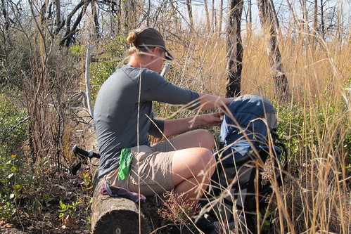
By the time we reached the turn off for the subdivision we were feeling the day wear on us. We’d started later since we’d been at the hotel, been delayed with the fire, met our geocaching friends and well, we would’ve pitched the tent there had it been appropriate. Instead of being dopey and lazy we kept on going, weaving through the streets until we finally followed the trail back into the woods behind someones house. There we found a stash of water left by someone specifically for FT thru-hikers! We topped our water off and kept on going. At this one I was getting seriously end-of-the-day-itis and was looking at potential campsites as we passed them.
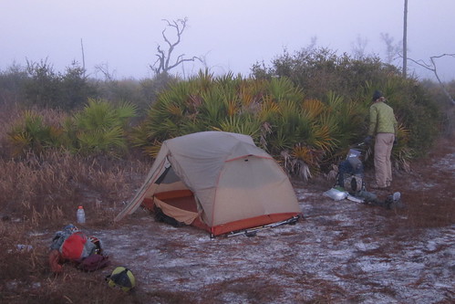
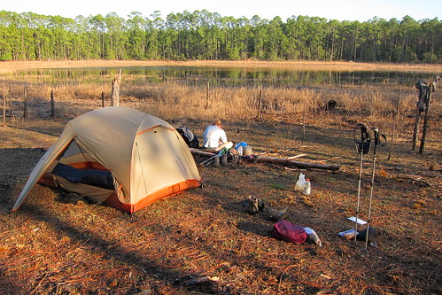
Finally we found a place to camp at the junction of two sand roads in the middle of an unknown wildlife management area. We hoped no one would come offroading in the middle of the night!
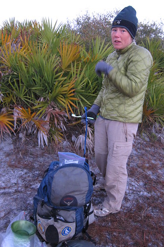
I was glad to have my gloves and hat the entire trip. It got cold in the evenings especially when the wind kicked up and many mornings we had frost on the tent.
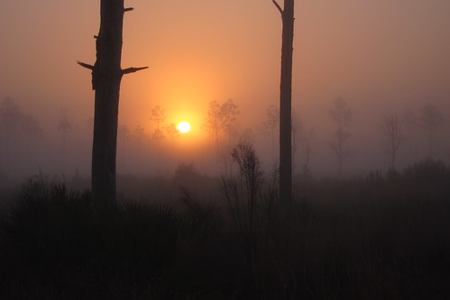
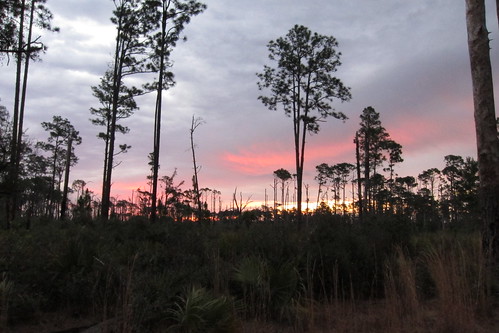
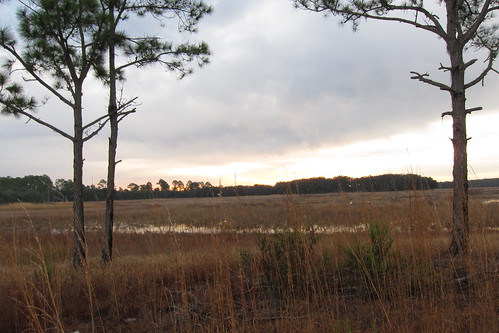
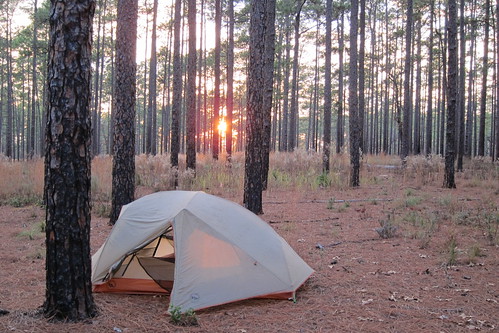
Sunrise the following morning! Nice isn’t it?
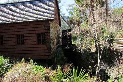
The next morning we followed Maggie Jones Road, a fill/dirt road in the middle of nowhere bounded by private property and cattle ranches. There was some poor blazing in this area, with what appeared old double blazes that threw us off for a few minutes before we decided not to follow them and stay on the road. Good decision! Eventually the trail ditches the road and onto private property to the west, through sand scrub areas, following close behind rural homes and interesting, alligator infested (probable!) ponds. Finally we emerge at at a Boy Scout camp where the book said we could fill up on water at a spigot on the back of a shed. We located that and saw across the field the many cars and Scouts out for the weekend.
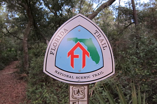
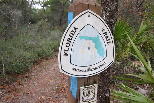
We end up back on Maggie Jones Rd. for a minute, cross C.R. 42 where one can go into Paisley for a resupply if needed, and then spot the sign for Ocala National Forest!
We must’ve not been in a very photographic mode that day because we have no photos from this section! We’d never hiked this section to Alexander Springs so it was new territory in ONF for us.
Sandhills dotted with pines are the predominate habitat of this area with some low-land stream and marsh crossings which are thankfully, at least mostly, built with bridges or bog boardwalks. Sometimes you’d find some rickety ones in need of repair but we traversed them with ease.
By lunch we’d made more than half our miles for the day and only had about seven to go. We found a few downed logs in the middle of a palmetto thicket and made that our lunch spot, sprawled out, took off our shoes and made ourselves at home. At the beginning of our lunch a couple from Michigan or Minnesota came by saying they’d been doing parts of the FT in out and back sections through the public land portions. We were packing up when they returned.
Soon enough I noticed the side trail to Alexander Springs and got giddy that we were getting closer to our campsite for the night.
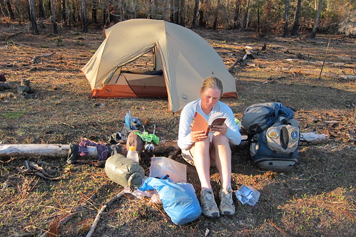
We arrived at Dora’s Pond at about 3:30pm with enough time to sit and read. I’d been carrying Persuasion for so many miles already that I decided it was time to start reading it! Now I was hooked!
I was nervous about there being water in some of the ponds as some of the smaller ones can dry up during the winter dry season. But, we were happy to see plenty of water in the pond even though it was lower than usual. This was the first campsite that we heard the weird barking/yelping noise. It started off on the south side of the pond and came closer and closer, passing by the tent within a few feet and eventually off into the distance. So far the best guess from friends is that it was a fox which I’ve pretty much confirmed from listening to this.
Since we’d hiked this section before I was able to feel my way through how we were doing on miles and time and guessing at what was coming up next. At a dirt road crossing we entered Farles Prairie and found ourselves encountering what we later found out to be the Rainbow People. A large group of cars and an old school bus painted with Fat Kids Kitchen on the side of it were parked on the side of the road. Cardboard signs about the super bowl were hanging on the trees, random trash bags were on the trail and finally we started seeing tent cities forming.
We passed what I’d just say would be modern day hippies, a mix of 90s grunge look with a little of the late 60s mixed in for good measure. Most of the group were young from late teens to early 30s but a few were in the middle to late age category. Many had dogs, some were riding bikes down the trail and it seemed to be overall chaos. We passed one tent city and would walk a few hundred feet and find more and this continued for at least two miles through Farles Prairie. Our first thought was that they were not known to ONF officials and planned on reporting them as they were being kind of rough with the vegetation and there was trash everywhere.
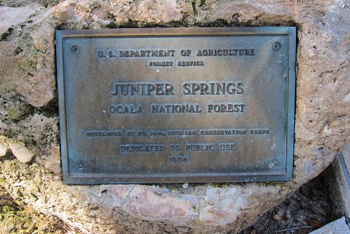
Finally it seemed we’d passed the last camp and we were able to hike in relative peace again. Later on we found a whole pile of garbage and old signs from what appeared to be their last camp area and we were definitely peeved at this point. When we arrived at Juniper Springs for lunch we alerted the park ranger at the gate who told us they had a month long permit to be out there. Oh well. I hope they understood all that trash!
We’d been looking forward to having lunch at Juniper Springs so we could eat at the concession there, buying microwaveable burgers and ice cream to eat while we sat out under the pavilion by the spring.
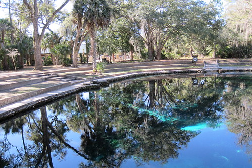
It was Saturday (or Sunday, whatever, the weekend!) and I was very surprised at the lack of people at the spring. I figured that it was a beautiful winter day in Florida, perfect weather and why weren’t more people there?
After our lazy lunch we continued north into more uncharted (for us) ONF territory. While we’d been in shade most of the day in the Farles Prairie section, this one turned out to be very much in the open and with the scorching mid-day sun coming down, it proved to be a parched hike. A mile or so in we started seeing adults with children hiking out from Hidden Pond campsite. These were hardcore hiking parents, some toting off-road wagons, kids on their backs or in unwieldy strollers. We’d pass a group of 5 or 6, walk a little ways and find a few more. This continued until we did see the very last group a couple of miles later and they all asked how far they were to Juniper Springs. I was just impressed that they were all backpacking with kids ranging in age from baby to elementary age.
Further north we climbed up steeper sandhills that allowed us to have a mountain like feel of the area even though we couldn’t have been more than 50 or 60 feet up. It provided some scenic views of the palmetto prairie and felt a little more like the AT in some sense.

See that bird? Yes, there is one there, on the right hand side near the tree leaning to the right, that’s a Florida scrub-jay. We saw several in this area but our camera zoom capabilities were not good and they were flighty birds so no good pictures, but they were fun to hang out with for awhile.
After seeing the birds for a few minutes we descended into a little depression where we saw our first bears of the trip! ONF is one of the best places in Florida to see bears as there is such a large contiguous space for them to roam. They dashed up the other side of the depression and into the palmetto thicket. Once we got to the top of the hill we met another couple coming down the trail who’d seen them as well. We chatted with them, Mike and Meredith we later learned their names to be, and said we were hiking the FT and were headed for a campsite near the trail head for the night. On the way we passed a father with two kids also out for a late evening hike, by this time the sun was getting ready to set.
We’d started setting up camp when Mike and Meredith came back and talked with us for awhile longer. They were mostly curious about food and how we carried it. We said goodbye to them only to have them come back 10 minutes later with a grocery bag full of snacks they’d had for their camping trip. Even though we still had plenty of food and were going to a maildrop the following day we took a few of the snacks anyway. Thanks Mike and Meredith if you happen to read this! It was great meeting you! I think that was one of the aspects of the FT that perhaps we didn’t get as much of on the AT—telling people about the FT because the majority of people didn’t know about the trail at all.
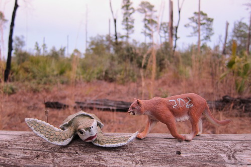
‘Panther and Ridley’ or ‘kitty and turtle’ according to Zoe.
As the sun set we heard a holler from the trail and made our a dark figure approaching us. It was Speaker! We’d passed him and the rest of the Chuck Norris crew at the Seminole State Forest when most of them got off the trail to go to another hiker’s birthday bash. Chris and I’d been debating how soon Speaker would catch us and I thought it might have been one more day but he’d pulled a big day and caught us that evening.
Another nice sunrise, despite a threat for rain early that morning.
We set off for Hopkins Prairie that morning and it turned out to be a beautiful section, much better than Juniper Prairie.
There is a blue blazed side trail following a forest road around the prairie for high water times, but we were able to follow the trail through the prairie. As you follow the trail we weave around all sorts of little islands dotting the wet prairie, following the perimeter around them, sometimes cutting through to get to the other side. On the map you can look at the trail and wonder why it is doing all these loopy turns but once on the ground and seeing it you would definitely want to stay on dry ground!
The blue blaze side trail to Salt Springs. It was a long hike and not worth detouring for a resupply, but would be a good place to start as a trail head.
We had lunch somewhere in the middle of the trail and it was starting to become blazing hot out and unfortunately we’d found a scrubby area to eat so finding a spot in the shade was difficult. A little while later we ran into another couple doing a short few days in the northern section of ONF and chatted with them for a bit. They were eating ramen for lunch in thru-hiker fashion! I would’ve expected more from weekenders!
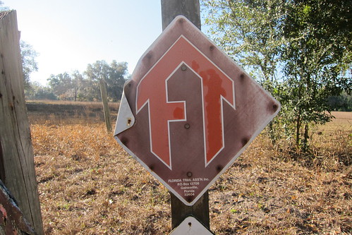
A nice sign at a county road crossing. There should be more of these out there!
There it is! We found the northern eastern/western corridor connector which we’d last left at Three Lakes WMA.
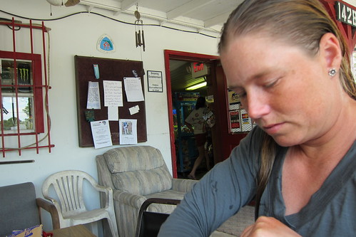
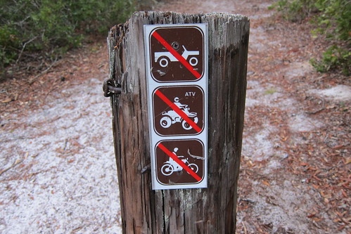
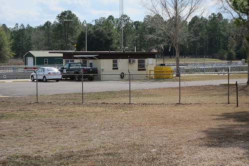
Shortly after we found the blue blaze to the 88 Store a biker bar/convenience store where hikers can refill their water, take a shower, pick up a maildrop and get some food. You can even get permission to camp behind the store if needed. We’d planned a shorter day because of the detour, like 17 or something, so we arrived early in the afternoon and decided to take a few hours to shower, drinks sodas and go through our mail drop. I would definitely recommend this place for a maildrop as the people running the place are hiker friendly. In fact, this is probably one of the only places on the FT that resembled a hiker friendly spot on the AT. You could kick back and relax, sign their register and in general talk to locals about the forest. Most of them were ORV owners and I heard some disparaging comments about the lack of ability to use some trails with an ORV, but as a hiker I completely understand why there are those rules.
We’d been there for a few hours when Speaker finally showed up. We’d lost him sometime around Hopkins Prairie and knew we’d see him at some other point. He’d taken to adopting the style of hiking that the Chuck Norris group had been doing, taking lots of frequent breaks. Chris and I preferred to go at least two hours before taking a break unless of course we had to use the woods in some manner. After Speaker showed up we started talking about the threat of rain two days from then and decided to push past Grassy Pond, our initial campsite destination, and stealth somewhere else further down. This would put us further down the trail and if we did more miles the next day we’d could enjoy a shorter day in case it rained two days later.
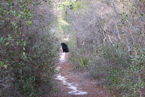
On our way to the stealth site we ran into our second bear of the trip. This fella was not shy at all and just hung out on the trail blocking our way. We’d inch up, it’d inch up. Finally after playing this game for five minutes or so it dashed off into the scrub.
We found one of the prettiest campsites we’d been in that evening in the midst of a pine forest. We heard another fox that night, this time further off in the distance.
It was a beautiful hike through the last section of ONF, up more sandhills and past white banded pine trees for red cockaded woodpeckers. Didn’t see any RCWs though.
We really were on a roll in this section making better time than expected yet again. As we got closer to Rodman Dam we decided we’d try to make it to Buckman Lock for a late lunch.
Rodman Dam marks the north end of ONF and blocks water from the Ocklawaha River to form Lake Ocklawaha. The cypress snag lined lake would have been a beautiful photographic opportunity in a foggy morning sunrise! Fishermen were crawling over the dam and in the spillway area. We cut back into the forest north of the dam paralleling a road before crossing it and heading for the Cross Florida Greenway.
Once on the greenway, which is a large levee made from the dirt that was dredged to create the paralleling canal, we cruised along easily. I was expecting to see people on it, but it didn’t appear to be used very often. This would have been a great area to stealth camp with access to water down at the canal and camping up on the levee.
About four miles later and nearing 1pm we arrived at Buckman Lock, the lock that allows boats to leave the canal and head for the St. Johns River. Hikers have to cross at particular times when the lock is open or call the FTA and get the gate combination to cross.
We pushed the buzzer which emits a loud buzz from the speakers above the office building and the lock keeper came over to let us through. Speaker was still behind us somewhere and we informed him that he’d be coming up soon.
Now, there is also a campground with port-o-potties on the south side of the lock so if you can’t cross or don’t want to cross, this is a viable option for camping.
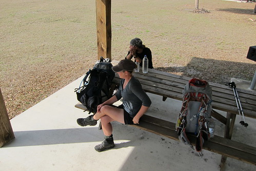
Across the lock we found several covered picnic tables with tap water but the restrooms and visitor center were closed. We lingered for almost two hours before deciding to carry on despite feeling lethargic.
Next up we’ll traverse through pine plantations and several conservation areas!
2 Comments
Amy
I can’t wait to hear about your hike thru the Crawfordville/Panacea area. I’m heading down there at the end of next week for the first time to visit my boyfriend. When you said you were going to hike the FT, I checked where it went and it goes right thru his area. 🙂
Pingback: