Trail Tales 7: Southern Virginia (Damascus to Pearisburg)
Relevant posts:
500 Miles
Ponies
Magic Bus
Section Hikers
A Beary Special Post
Beautiful Woodshole Hostel

Well, I did find a few photos from Damascus, this one being The Place, the hostel we stayed at. When we arrived in town we ran into Pirate and his friend at the outfitter and they told us where to find the hostel, next to the burning pile of rubble. Sure enough there was a pile of rubble as the house next door had burned down!
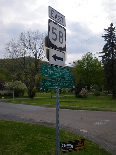
The trail goes straight through Damascus so it is easy to stop in and resupply.
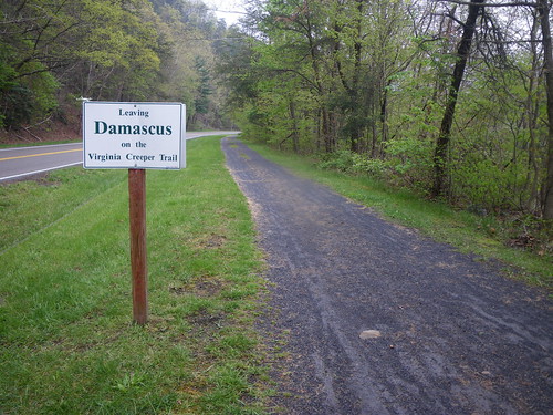
Apparently after talking to a few other hikers we learned that the AT used to follow the Virginia Creeper trail. I think it would have been awesome for it to continue down the trail as the VC trail follows streams and is very beautiful. However, the AT is now rerouted off of roads and other trails, in most parts, and the trail only stays along the VC in a few points. After heading out of Damascus our goal was 16 miles to the Lost Mountain Shelter. We started gaining elevation and the trail was definitely easier than it had been the previous states. On our way to the Saunders shelter we got a bit lost, following a blue blazed trail after the white blazed one hadn’t been properly painted. We wandered around down on the VC trail for awhile before realizing our error.
We had a beautiful day climbing up the highest point in Virginia, well, almost to the top of Mt. Rogers. The trail bypasses the viewless summit and we had lunch at the Thomas Knob shelter. It wasn’t long after we finished lunch that we realized a storm was brewing and we still had five miles to go to get to the Wise shelter and make it across the Grayson Highlands.
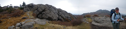
The Grayson Highlands are such an awesome place, covered with ponies and awesome rock formations. It was a magical place that I’d love to explore with more time.

The park was also extremely busy with hikers crawling over it everywhere.
We go to the shelter at a decent hour and in time for the rain to start. We met up with a section hiker who was doing Pearisburg to Erwin and it was interesting the next morning when he told us “Have a nice life!”, which is basically how it is out there, you won’t see anyone ever again, much less know their real name.
Our next day was to be our biggest, 20 miles, and also a milestone of passing the 500 mile mark on Pine Mtn.

Comers Creek Falls.
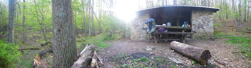
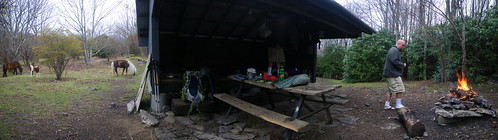
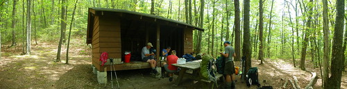
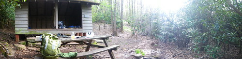
Trimpi Shelter.
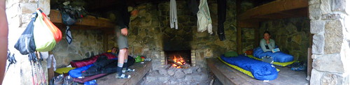
Trimpi shelter, one of the shelters that have fire places.

There were a ton of morel mushrooms at this campsite, verified by others in the shelter log, so we picked some and ate a few for dinner. We also had an extra dinner from the section hikers the night before so we ate that as well, but either the mushrooms or the extra dinner made us a bit sick.
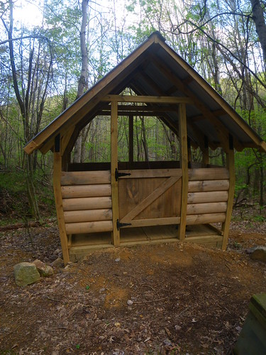
A nicer privy in the south. I loved being able to breathe! The privies that are more enclosed tend to be dark and suffocating. Half the time I’d leave the door open and hope no one would walk around. It is common courtesy to shout at the privy and ask if anyone is in there!

Rain was on the agenda for the next day with drizzle and some downpours that ended up soaking my pants since I decided not to put my rain pants on. Luckily we made it to the Mt. Rogers Visitor Center where the Partnership Shelter is located. This is one of the first places on the trail you can order pizza for delivery. The shelter is located about a quarter mile down the trail from the visitor center, but the visitor center has a pay phone, restroom and soda’s to buy. Pretty nice place to break! We took our leftovers to the Chatfield Shelter for the night where a full shelter forced us to pitch our tent.

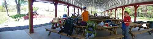
Packing up the next morning. Our next goal was to hit up the town of Atkins four miles away for a resupply and a stay in a motel.

The Exxon and other gas stations on the road intersections are a great resupply and the Exxon has internet for customers. We stayed at the very cheap, but moderately clean motel next door.

The barn restaurant has the best food and for cheap! We ate there for every meal.

Heading out of town we ran into the Traveling Circus at various locations as we headed for our destination on Lynn Camp Mtn for the night. We also were lucky to come across some trail magic near Va. 42, peanut butter sandwiches and sodas!
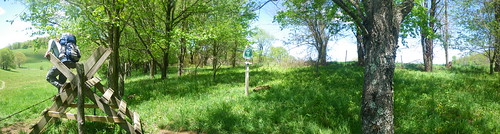
Several stiles to cross farm fields.

This section is plagued by a series of mountains that are generically called Brushy Mountain. You’ll go up one and down another and they aren’t even near each other! It’s similar to the Low Gap’s and Deep Gap’s you run into in the south.
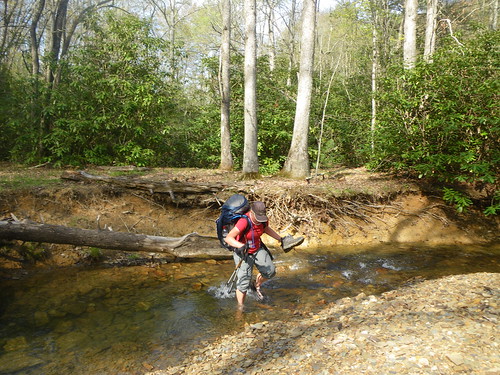
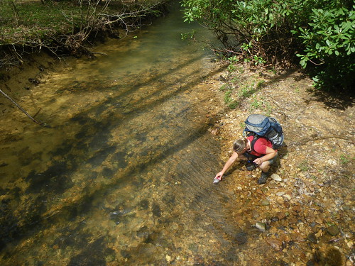
After going up Chestnut Knob and across a rocky ridge we passed Jenkins shelter in favor of a campsite that was in the middle of a stream. A little water crossing and we were there!
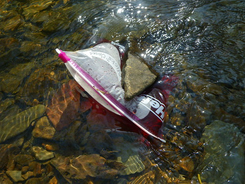
Making jello in the stream. We learned this from another hiker and thought we’d give it a whirl. It was the only time we made it but really delicious!
The next morning we got up early to go into Bland. It wasn’t our initial intent to go into the town but we’d only resupplied a few days back in Atkins so we had to go into town. Luckily Dark Star’s grandparents were meeting him and graciously allowed us and another hiker Beefstick to tag along and get some food in Bland.
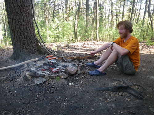
Since our goal was to the Helveys Mill Shelter only three miles past Bland we carried out some food to cook over a fire! Nothing beats eating ‘real’ food for dinner.
At that shelter was where we first met Bulldog the blind hiker. I wonder if he finished?
Jenny Knob Shelter for lunch. This is where we last saw our friend Red Hat who was making her way south to Damascus for Trail Days. I remember my lunch from that day involved some cheese dip in a can with pepperoni and tortillas. Mmmm!
Good ol’ switchbacks!
That day was the day we saw our first bears (see post above), not too far before…
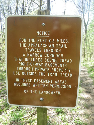
the Kimberling Creek suspension bridge. At Va. 606 we took a detour west to have dinner at Trent’s grocery. We thought about staying but heard some sketchy things about the cleanliness of the showers and so we decided to eat dinner and make our way back for the bridge where we pitched our tent in the rain. We ended up pitching it in a place where water was running and Chris’ pack ended up with a bunch of water and some ants who found refuge and some crumbs.
It was a fairly relaxing morning walk to the Wapiti Shelter, lots of flat ground and water sources everywhere. There was a side trail to Dismal Creek Falls which we bypased.
Wapiti Shelter for lunch.
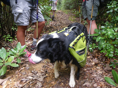
Shortly after we left we ran into a dog and his companions, one of which said his name was The Captain. He told us that he lived outside of Pearisburg on the trail and to stop by when were near, that we could get sodas and pitch a tent in his yard. I was skeptical about it at first because no one had even mentioned this guy before.
Once we got on top of the nameless mountain, or at least in our book, we got a nice view of the valley in which Pearisburg resided. At Sugar Run Gap we could have easily taken the road down to the Woodshole Hostel, but since we were planning on meeting my dad in Pearisburg the following evening and staying at the hostel we thought it was pointless to skip the 8 or 9 miles into Pearisburg so we kept on going to the Doc’s Knob Shelter.
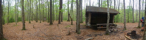
Doc’s Knob Shelter. I just remember asking Chris about two minutes before we saw the shelter if he thought we were close, to which he said we were. He got so good at determining our speed and time that he was usually on target about our arrival! This however changed in the northeast when we slowed down and seemed to be in a time warp. The privy at this shelter is kinda dark and spidery, ick!
We had a drizzly morning to walk into Pearisburg, but it was peaceful. Once we arrived down into the town we had to walk off the trail and uphill to get into town. We were walking along the not hiker friendly roadway when a car pulled up and we saw hikers we knew, Turkey & Thrasher and Sheryl and Diesel (the ones who taught us about jello) with Neville, one of the owners of Woodshole Hostel. She asked if we needed a ride and we told her our story and she knew right off the bat who we were. We kept walking up the hill to the post office where we had a package and stopped in at a Chinese buffet for lunch. Eventually we got picked up from the post office by Michael, Neville’s husband and we made the trip out to Woodhole.
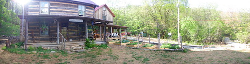
It’s such a beautiful, quiet place.
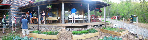
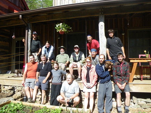
Group shot of some of the hikers.
Dad finally showed up later that night with his ride from the Roanoke airport. Unfortunately the airline lost his bag and so all he had was some toiletries and a carry on bag. Leaving early the following day was out of the question so we had to wait for quite awhile the next day for the courier to deliver it in town. After that we headed out of Pearisburg and into the Virginia hills.
Next up: Pearisburg to Shenandoah!
You May Also Like
One Comment
Stacey
I haven’t been to visit your blog in what seems like forever! Sorry about that. I am having fun catching up on your posts, especially the AT posts. Its fun to see the trail from anothers perspective. It already seems like a lifetime ago, its fun to look through and have memories triggered. Fun! Thanks for sharing your perspective on the trail!