Florida Trail Tales 2: Lake Okeechobee to River Ranch
This entry will be less heavy on photos as this is where our SD card went on the fritz. Instead I will try to paint a majestic picture with my words. Or not. I’ll let you decide.
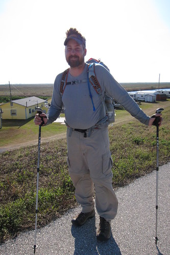
After leaving our stealth site at John Stretch Park we ascended the Lake Okeechobee dike. We’d originally planned to go around the east side of the lake even though it is a few miles longer, mostly because it had an extra city or two for food. Yeah, we plan for food. But when Shamrock Steve told us about the dike being closed on that side we altered our plans and went west.
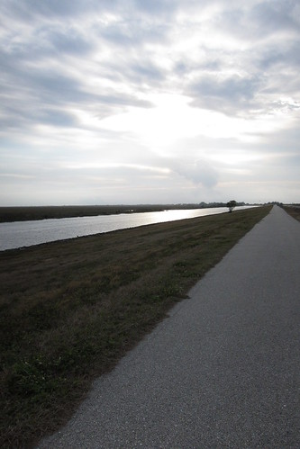
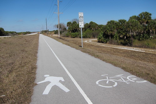
This area of the dike is paved for bikes and we did see a few biking and a couple others walking. We were excited to be only about 9 miles from Clewiston and planned to stop in for lunch.
We arrived a bit early so we sat at the Mexican restaurant, I think Sunrise was the name, for about twenty minutes before it opened. I’m disappointed to say that I think this was our only Mexican food stop the entire time. That’s usually our first restaurant choice in a town, but we just didn’t get that this time. The trail comes off into the town a bit here to go around a lock structure and then back up onto the dike.
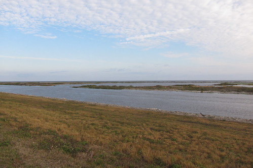
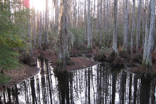
Once back up on the dike we started going back into a wilder scene and for the most part it was a nice jaunt along the lake. The lake becomes more marsh and cypress swamp on the edges, but there is still the deep channel for boats that parallels the dike at this point. We saw a very nice yacht-ish boat and thought of our friend Snack Attack and his drawing in Connecticut and it being a fancy place. We decided Lake Okeechobee is a fancy place. (which it’s not. At all.) We stopped for a quick break at one of the water control structures and talked to one of the people working it. He’d told us of a few people who’d come by so we could gauge who might be ahead of us.
We were also excited about being able to stop at Uncle Joe’s Fish Camp for an afternoon soda break. Some other snacks can be bought here and if you wanted I think you can tent or rent a little cabin here.
We continued on our merry way.
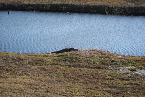
Not too many alligators were seen but when we did there were a few larger ones!
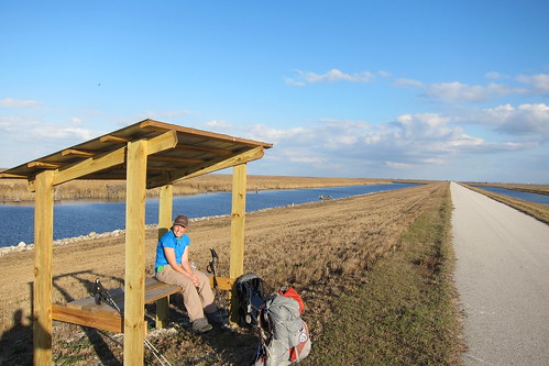
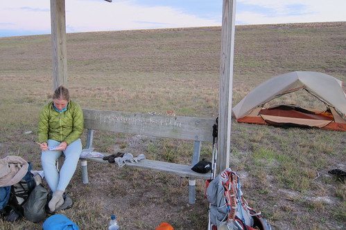
Every few miles or so there are some nice covered benches to rest along; we stopped at this one for a few minutes but it was too early to stop yet.
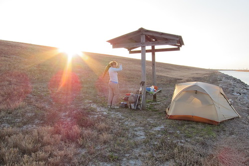
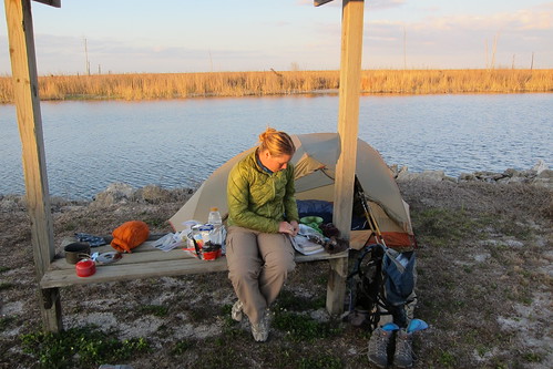
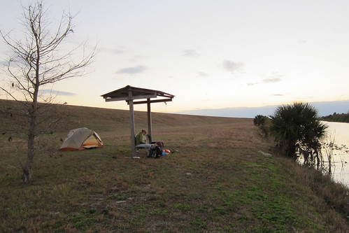
A few miles later we found another one that was more appropriate for camping at and set up for the night. No trees to bear bag here, and mostly we’d be concerned about mice and raccoons, so we hung it on the covered area and hoped for the best. At least if anything we were going into Moore Haven the next morning to resupply.
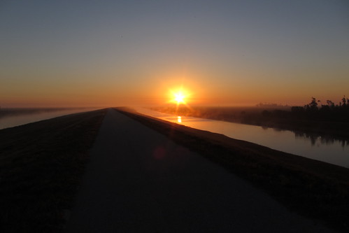
Sunrise the following morning.
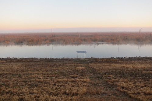
I think this was listed as a designated campsite, but really, you can camp just about anywhere down at the base as long as it is flat.
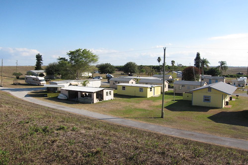
In Moore Haven we are forced to get off the dike and roadwalk up and over the bridge across the Caloosahatchee River. For some reason we cannot go through the lock. But, at least we get to go into town and so we were able to eat Burger King for breakfast and run into the grocery store to pick up a few snacks to get us to Okeechobee for our resupply. On our way out of town and back to the trail we ran across and RV park on the west side of the lock. Apparently anyone can have a $5 brunch on Sundays. Dang it! Or was it Saturday? I dunno, it was the weekend and there was brunch and we missed it!
The woman manning the RV booth told us there was a couple biking around the lake just ahead of us and we saw them in the distance for several miles until they just faded away.
We thought we were in for a roadwalk when the trail left the levee but we were glad to see that a sidewalk helped us get around Fisheating Creek. For dinner we stopped at a gas station on the north side of Lakeport near the Harney Pond canal and got sandwiches from the deli which we carried out for dinner. Good place to stop and grab snacks if needed!
Another night along the lake. We were not too far from 78 at this point, it was just across the canal and so traffic could be heard. It was also a hunting weekend and we heard many gunshots from the airboats on the other side of the levee.
And now we leave our last photos for awhile.
The next morning Chris was having some problems with his ankle and foot so despite our 3pm deadline to get to the Okeetantie recreation area to meet a trail angel for resupply, we had to take a few breaks to rest the foot. Along the way we stopped at another covered bench to meet a volunteer working for the Corps of Engineers who was refurbishing the bench. We had lunch at the lock at Buckhead Ridge where we chatted with the lock lady for a good while. She didn’t really know about the Florida Trail running through here so we talked about it for awhile and general chit-chat about the area.
Luckily we weren’t terribly far from the Okeetantie rec area so we were there early. We had to narrowly walk across a bridge over the Kissimmee River to get to Okeetantie. Originally we thought we might eat at the restaurant there, but we were starting to get stinky. We’d downed some sodas and were sitting on the covered porch of the general store when our ride came.
Turns out we’d met her at the FTA gathering at Oasis the week before so it was cool to see her again. It was nice of her to drive out from where she lived, towards the beach on the Atlantic side, to drive us a few miles into Okeechobee for a resupply. We tried to be quick in the Publix and I’m fairly certain we came out with too much food, but we were going quite a ways with our resupply, six days or so because there were no easy resupply options in the next bit. Our trail angel let us out back at Okeetantie and told us to be careful stealthing on the Kissimmee River levee area as it was heavily visited by local fisherman driving up and down the dirt road.
We’d packed out food for dinner so we ate that at the rec area and then walked a half mile or so up the Kissimmee River and pitched our tent just around the bend and out of sight of the main traffic. No problems overnight.
The next morning dawned cloudy and we knew there was potential for rain that day. I think we set the alarm a little early to get some miles in before the rain. We followed the dike north, careful to take the left when the dike split, passing a group of fishermen at the splitting point. After a short break we ended up on our second road walk, north on NW 128th Avenue past S.R. 70 to N.W. 56th Avenue. This is a very quiet road walk along mostly ranches and homes on a couple of acres. No high speed traffic, but our feet had started getting to us on the constant pounding of the levees around the lake and river. For lunch we made it to a park at the end of 56th Ave where the Kissimmee River is in a more natural state. We’d just gotten our lunch out when the rain started. Dang it!!! Somehow we’d covered 15 miles by lunch, mostly because we were trying to avoid the rain and had limited stops, but here we were trying to eat and it started raining. I threw my rain jacket on and tried to find the fullest live oak as possible to sit under. Thankfully it didn’t start a heavy downpour and we were able to eat our lunch and mostly relax. A group of, well, I’ll just call it like they were, rednecks, came by with their pontoon boat to set out on the river. They were a crew of a couple of men in the 20s or 30s with I guess wives or girlfriends and at least two young boys and they did not play very women pleasing music. In fact I was disgusted by what they were playing in the vicinity of their children. Ick. Their music continued drifting through as they motored down the river and finally they were gone. *phew*.
We had about six miles to go to get to camp and we were excited to be going through a few natural areas on actual trail, something we hadn’t seen since Big Cypress. Finally we ditched another dirt road and emerged into a pine area that hadn’t seen much visitation and eventually to Yates Marsh. We saw evidence of recent camping as an another had been matted down in the shape of a tent. This area was really nice, walking through oak hammocks and we passed a designated campsite. It was cloudy that day and I got seriously confused on which direction we were going, but eventually we came out to another road which we had to take north to get back onto the trail again. At the next stile we had to go over we found an unopened bottle of Dr. Pepper. Sweet! Trail magic?? Didn’t matter, Chris took it and drank most of it and shared a bit with me in another oak hammock up the way. We passed another designated campsite but we were trying to get as close to the blue blaze around Chandler Slough as possible.
I’d heard about Chandler Slough the previous year when a hiker died in the slough. We later found out it was Chuck Norris’ crew that found him last year. Apparently there was not a stile over the barbed wire fence to U.S. 98 yet and it appeared this guy had been extremely tired and cold and well, the real facts are just probably not known, but he died. The trail angel who’d picked us up had told us they were closing that section temporarily because of the water and the amount of mud that was in there. So, after crossing a cattle field we came to the blue blaze cutoff and tented there under an oak tree. I guess our big question was why was this section of trail even open if it wasn’t deemed complete? Especially last year with no real way to get over very tight barbed wire?
About a mile or so before the campsite it started spitting rain again. It was only 3pm when we got to the split so we had time to lounge under the tent while it started raining a bit. There was a group of teenage boys with a rifle and dogs. We weren’t sure if they were just scouting or out for hunting but they passed by. Other than that our only company that night was a skunk that ran from the cattle field to a patch of saw palmettos. We had a nice video and photo of it, but alas, that was eaten by the SD card. It was the first skunk I’d ever seen that wasn’t squished on the side of the road.
We did the short road walk around the deep water section and then down a bit of U.S. 98 to pick up real trail again in an oak hammock area of Chandler Slough. This was a really pretty section, some dry cypress area, cattle pastures and oak hammocks. We thought we had to get back on the road but the trail ends up paralleling the road for a good ways. It was pretty difficult to walk on, though, with tall, knobby grass mounds. This could definitely handle some maintenance. A jump back to the road is needed to cross the Kissimmee River again (not our last time either!), and then back into the woods for a mile or so north of the 98. Right at the trail head there is a house or now I can’t remember what it was, but there is a water pump complete with jugs to prime the pump to get some ground water. We stocked up since we really did have a road walk later in the day. This was a very pretty section and we were hoping that it kept going and for some reason we wouldn’t have to get on the road, but alas, we did. Seven miles down the road we went.
Luckily 98 isn’t terribly busy but there is a lot of truck traffic from the orange groves and farms around the area and so we were forced to stay on the grass medians instead. It felt strange taking lunch on the side of the road. As cars whizzed by at 60 miles an hour, we were eating our tuna/pepperoni on tortillas.
Then, finally, we’d made it to Hickory Hammock! I remember our first time in this area was to get a geocache at Bluff Hammock to the north of Hickory Hammock. We were actually camping at Highlands Hammock State Park sometime after we’d moved to Miami, I think it was for Thanksgiving one year. Such a very neat area to visit.
A new parking lot, ‘backcountry’ camping spot, bathrooms and boat ramps have recently been built on 98 so we followed the trail in from that direction. Chris filled our water up from the boat ramp area and after a little snack we went on our merry way through the hammock. One of the best things about this section is that abundance of citrus trees. In winter you can pick as many sour oranges, tangerines, grapefruit and the occasional lemon for a treat!
I would like to know, if someone ‘in the know’ is reading this, why on earth have they massacred the saw palmettos in this section? There were giant sections of these ancient plants just chewed up. It was very disturbing considering this is a natural area. It’s not like a burn where they come back, these look like they were intentionally killed. We were none to pleased to see this.
 (ohh, a photo that made it!) At the Hickory Hammock campsite we stopped in for a second to read one of the few trail logs on the FT. There we saw that Love it or Leave it wasn’t that far ahead, maybe a day or two and then, we found Speaker! The little sneak had just appeared. He has a habit or not signing logs so that is why we didn’t see him down south in the other logs. Well, at least we knew he was on the trail, but we weren’t sure of ever catching him.
A couple more miles were to be had to get to the bigger campground that allows RVs, has two privies and a water pump where we were going to stay for the night. We were trying to get as close as possible to the southern border of theAvon Park Bombing Range as it just so happened that we had to be through the entire area of the range by 7pm the following night. We weren’t keen on a very short day the next day so we were going to try a longer day to get through it.
Quiet prevailed at the campsite, thankfully, and though we tried to tell the host RV that we were there we couldn’t find them. Only one or two other RVs were there so we just pitched the tent next to the picnic pavilion and settled in the for the night. I remember it was a full moon and when it rose later that evening it shone through brightly in our tent. We woke the next morning to some light sprinkles and while eating breakfast under the pavilion it let loose sending us scrambling to drag the tent under the covering so it wouldn’t get wet. It was just early enough that Chris’ mom or dad might not be up, the people we often called to get a weather report. We knew his mom might be up earlier than his dad so we tried her. After she looked the weather up she said that it was going to clear within the hour and there wasn’t any other worries for the day. Thank goodness!
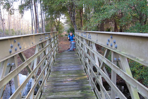
The trail continues north through the oak hammocks and eventually follows the fence line of a private property to the west and to the east begin marshes that lead to the Kissimmee River. Along this section are a lot of wading and migratory birds to which we saw eagles, hawks and sandhill cranes. Then we come to a high bridge that goes over a side tributary of the river and then a section of boardwalks that lead to Bluff Hammock. We encountered a few fisherman here.
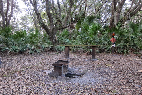
Once we were north of the Bluff Hammock trailhead the maintenance conditions deteriorated. Thick over grown brush, some wet areas in need of a bog board or two and then a seriously overgrown Mosquito Hammock campsite. After our break at the campsite we headed north to another boardwalk, which could also use repair, and here we saw our first otter of the trail! Exciting! It was leisurely sunning itself on the boardwalk and even stayed for awhile as we inched closer. I am sad that the photos and video did not work because I am pretty sure the photos would have been awesome.
The trail then goes in and out of some wet areas as it follows an oak hammock north. Lots of overgrown brush on many of the small boardwalks. Whoever maintains this section needs to get out there and do it. I remember it being semi-overgrown last year when we were there, but this was bordering ridiculous.
In the sand we saw LOL and the date of the day before written in the sand. Love it or Leave it had just been there. Sweet! Finally off to the west I saw the long row of eucalyptus trees that I knew signified the boundary of the bombing range. Soon enough we saw the tall fencing and stile to get into the range. There is an information board and a usually forms to fill out, but we used the same piece of note paper that LOL had written on to write our names down since the official papers were empty. For the most part in this section we walked under the oak hammocks and out of the sun, but one section brings out around a hammock and I think a small wetland and into the sun.
For lunch we stopped at an area of citrus trees we’d remembered from the last time. Chris managed to find, oh, at least a dozen or more oranges and squeezed the juice into his Gatorade bottle. Fresh squeezed o.j. on the trail? Yep! Finally it was time to move on and once we passed the campsite we’d had lunch at the previous year, everything was new territory to us. We were looking forward to the Fort Kissimmee campground as the book stated there was a privy and solar shower! It was pushing on well over a week at this point and we’d started sweating heavily in recent days so things were getting smelly. Well, we found a campsite and were disappointed to find neither privy nor solar shower.
As we kept walking down the dirt road we discovered that this was a much larger campground that thought, so our hopes were not dashed yet. And then, finally, we saw it! A port-o-potty and then—what?? There it was, the solar shower! Separated into men and womens sections in a concrete structure, the solar shower provided showers for the hunters on the weekend. Not a soul was in sight so Chris went in and tested the shower. Cool, but refreshing!
It was nice to rinse the dirt off and try to rinse our socks and shirts of dirt and salt. A well tap also provides fresh water to refill on here. The dirt road continued north through more campsites and then passed an old cemetery. Eventually we got back onto trail again and a few points it got a little confusing to following as some sections were over grown and blazing wasn’t clear. We found the north exit only to see the stile in pieces on the north side of the barbed wire. Gah!!! We looked at each other for a minute and then I spotted a metal gate about 500′ east so we followed the newly tilled fire buffer (sand. ick.) slowly to the gate, jumped the gate and walked back. A minor annoyance, but still frustrating. We walked to where another designated campsite was listed about a quarter mile north of the boundary to be a safe distance from the range.
There were loose cattle in the area so we shooed them and set up camp. In the night we ‘enjoyed’ listening to a family of squirrels shrieking through the night and cattle running by the tent.
The next morning we meandered through the Kicco Wildlife Management Area (Kiss-o). This was a similar terrain as we’d been walking through, oak hammocks, pine trees, some scrub areas. Very peaceful and seemingly remote out here.
At Tick Island Slough we saw our second otter swimming carefree in the water remaining near the bridge. Again, another video and photo was had, but that didn’t transfer.
A very nice bridge has been built over this slough, thankfully, so no one had to get wet. We really enjoyed this section as it follows the outer borders of hammocks and eventually we ended up at the old Kissimmee ghost town along the river. We’d just sat down for a small privy and snack break when another hiker comes out of the trees. It was a section hiker who was in the military and was out for a few weeks before having to go back to work. We chatted with him for awhile about hikers he’d seen and told us he thought that LOL had gotten off in Avon Park, or so was told to him by a trail angel. Our section hiker friend was taking a zero in the woods that day due to his feet hurting him a bit so we bid him goodbye as we left the camping area.
We walked in the woods again for awhile until we followed a road east to a road that parallels the river. Now we were in open, blazing sun and it started getting quite hot. A stop for water was mostly futile as pumping was difficult and the intake valve kept wanting to get mud and silt in it. Chris got enough to get him to River Ranch and I had enough water but was in saving mode since it was so hot. The trail followed the road back in towards hammocks again but at one point we got very confused at some old blazing and ended up inside a cattle fence and then on the wrong side of the fence when we saw more blazes. Luckily we saw a South Florida Water Management District employee working on his truck and he informed us of where we needed to go. Once back and following the blazes we were on yet another dirt road until it ditched the road and threw us in an open, scrubby palmetto thicket. Ugh.
Hot palmetto thickets aren’t fun. They are hot.
We were making good time and were planning on hitting up River Ranch for a late lunch but we needed a food break anyway. Chris and I argued about time, he was peeved we’d turned a 15 minute break into 30 minutes, but I didn’t think it was that big of a deal. Then he jokingly said that he thought there should be ice cream at Ice Cream Slough which wasn’t terribly far from our break point. We crossed a bridge over Ice Cream Slough and found only murky water and no cookies and cream or rocky road.
Again, we were really enjoying this section of trail in the hammocks and finally we made it to the front entrance of the WMA where there was a port-o-potty and a wildlife check station. The inside of the privy was miserably hot and I made an effort to hurry and upon exit I saw that Chris had been talking to a wildlife officer who was kind enough to give us each a bottle of very cold water! Mmmmmmm! He then provided a copy of his menu for the general store restaurant at River Ranch to which we were happy to see a good selection.
Leaving the check station we followed another dirt road north to River Ranch. Now, River Ranch is this very strange retirement/vacation resort place in the middle of nowhere. It’s very strange. But, there was food so we didn’t care. We found the general store and was delighted to see so many things to eat, a deli, sodas, and a nice set of sofas to relax on while watching some tv. We ordered sandwiches and sat inside for several hours cooling off and relaxing. You could resupply here, or at least supplement your food supply if needed, but I am fairly certain that you could do a mail drop here.
Finally we decided we needed to leave as we had four miles to go to our stopping point for the day.
But that adventure will have to wait until next time!
One Comment
bart
This is a nice site, Have you been to Barley Barber Swamp yet? Barley Barber claims to have the oldest and largest cypress as well, it would be nice to see which is actually older, bot are spectacular. here is a link to Barley Barber from my website:http://openspacerestoration.com/barley-barber-swamp-visited/
Thanks Bart,
I’m going to link your site its a great addition, I will also forward to some great friends who are passionate about the Florida Trail.
Thanks,
Bart
http://www.openspacerestoration
http://www.stringsandlead.com