Florida Trail Tales 1: Loop Road to John Stretch Park
So, the Florida Trail….before we started we spent four days in crowded civilization called South Florida. Having exited the state of Florida a year ago to hike the AT it was going to be fun to see some old sights and see friends. Our first stop was to Bass Pro Shop to purchase backpacker meals, fuel and some other essentials as well as to eat at the really yummy Islamorada Fish House for lunch.
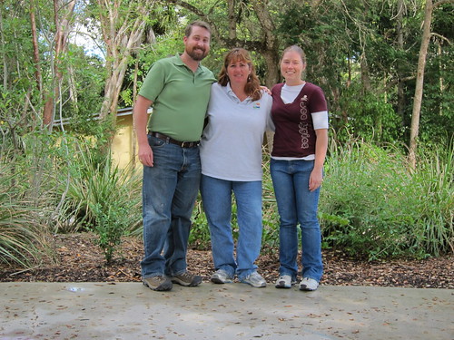
After lunch we drove an hour south to see our friend Christine who was leisurely working that afternoon. We chatted for a good while about all sorts of things from hiking to local geocaching gossip before we left to try to see Marc and Eliana. We dropped by their place but only heard the cacophony of dogs from behind the door and left a note. It was sad that we did not get to see these two but our schedules just did not mesh this time around.
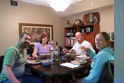
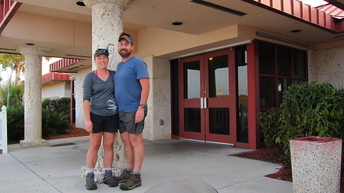
Finally, before heading back to Fort Lauderdale, we stopped by our old Publix in Miami to get our food to start the trip. Ah, I forgot how expensive Publix is—-but I love that store! Randy and Kathy were kind enough to host us during our stay, letting us take over their living room with our proposed boxes from our friend Chris (FootTRAX in the geocaching world) and feeding us delicious food and taking us to meet their friends. You should really check our Randy’s website as he has some awesome food to cook and Kathy has some nice photography, too!
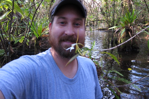
Chris had to get a swamp walk in at Fakahatchee Strand.
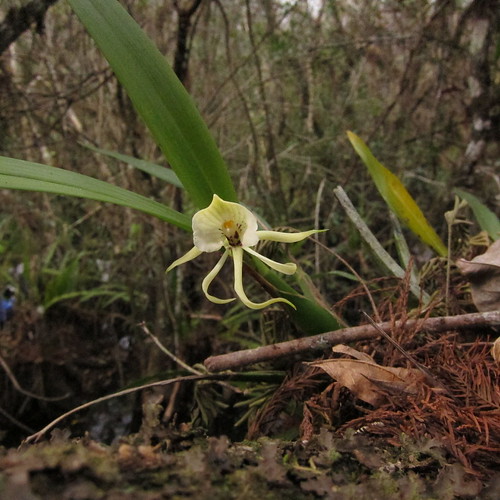
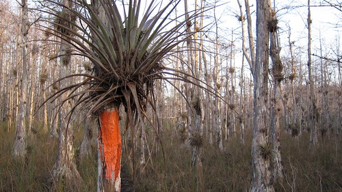
Alba clamshell orchids were on the sightseeing agenda.
Finally it was the day we set off for the trail, January 8th. We knew that at least Chuck Norris and crew were ahead of us by a week and that Love it or Leave It was somewhere in a closer range than the other crew. Our friend Speaker, well, we didn’t know if he was ahead or behind us at all. We wouldn’t know that for a few hundred miles.
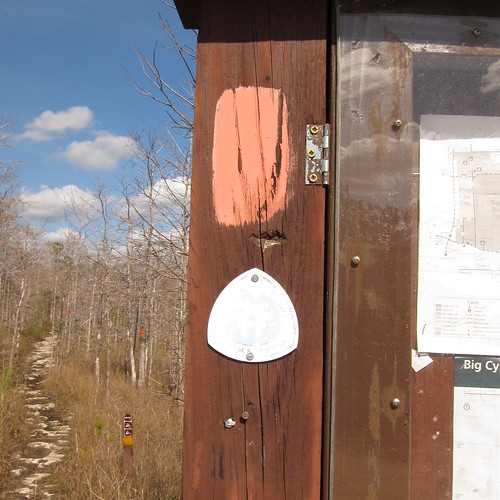
Loop Road has seriously degraded since I was last on it. The Park Service blames the hurricanes several years ago but that’s a farce. I was on that road after the hurricanes and the damage was not that great from it. Sure, maybe a little, but the real reason is the constant flooding every summer from holding too much water in the north and letting it go and eventually it runs over the road and causes massive potholes. Alas, the road looks like crap and unfortunately we’d taken Kathy’s small car down the road and it does not have much clearance. Needless to say it was slow going.
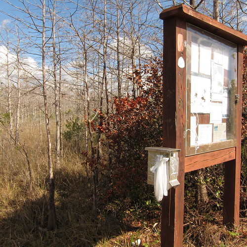
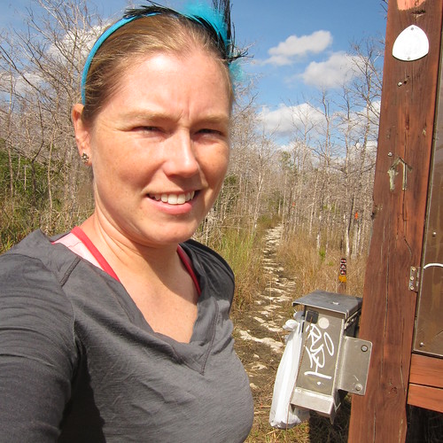
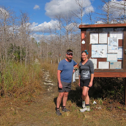
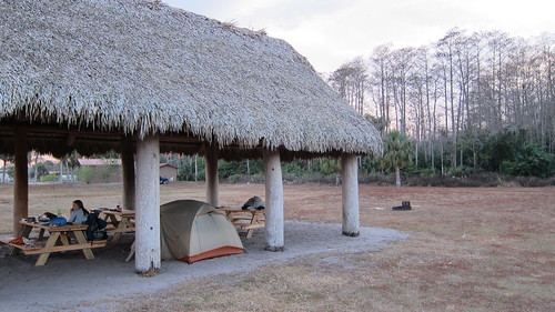
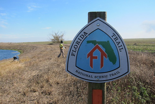
But, finally we arrived at the southern terminus of the Florida Trail. I can’t imagine ending here. At least at Fort Pickens it is an easier ride out; here you might have to have the mosquitoes carry you home. Or a panther.
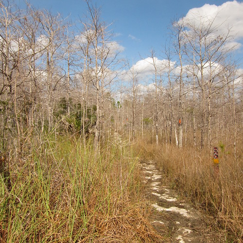
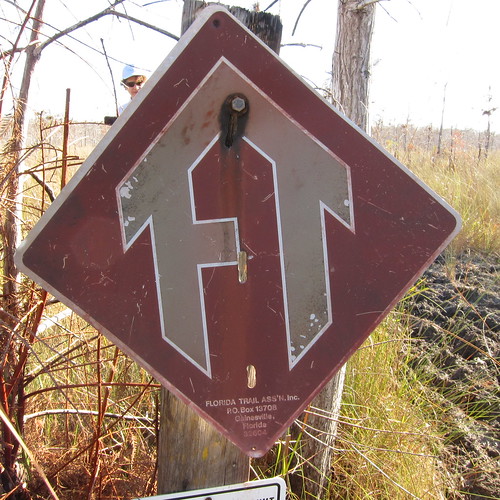
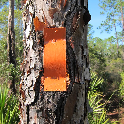
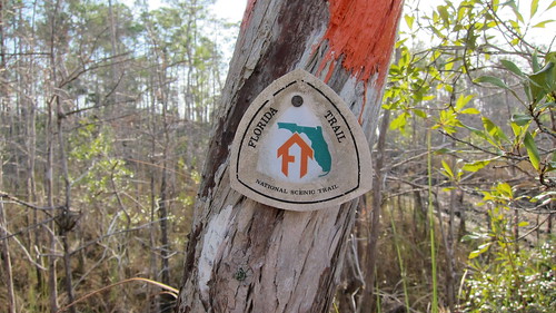
The first orange blazes and a fairly dry appearing trail…
We’d done this section before and it was bone dry, but we knew we’d encounter some water in Roberts Lake Strand.
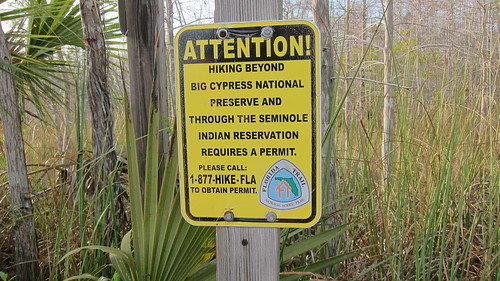
This is a very quiet section. You will most likely encounter people on the northern half of the 8 miles as they come from the Oasis Visitor Center, but if you want to be remote, this is a great section to be remote in.
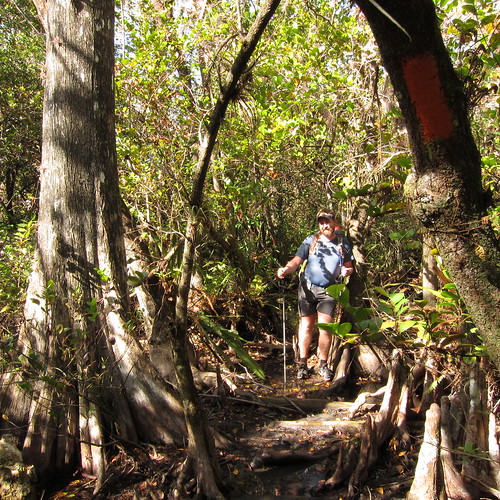
Chris in Roberts Lake Strand
Through Big Cypress there are mile posts so you can get a fairly decent idea of where you are. When you are coming out of Roberts Lake Strand the mile posts are vastly off and I remembered it being off from the last time. We met a park ranger who’d been leading a group of day hikers to the strand for the day as we came out, everyone sloshing through the mud.
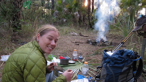
We were excited to see this as we came out at Tamiami Trail—-potential food! Alas, it was our first night out and our hiker hunger had not set in, but it would be nice to talk to some FTA folks and eat some food other than trail food.
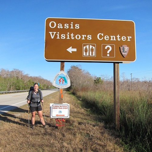
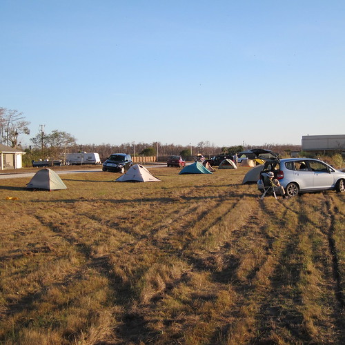
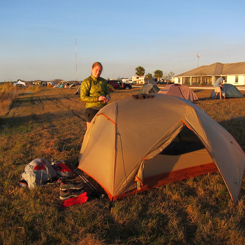
Luckily there is a water hose at Oasis that they let everyone use to wash their shoes off, so we sat on the picnic table for awhile and cleaned everything off, putting our boots and fresh socks on. Two FTA volunteers came over to ask if we were thru-hiking to which we affirmed and they invited us to camp inside the gated area with the whole group for the night. It was their first night to start a week of trail maintenance in the area.
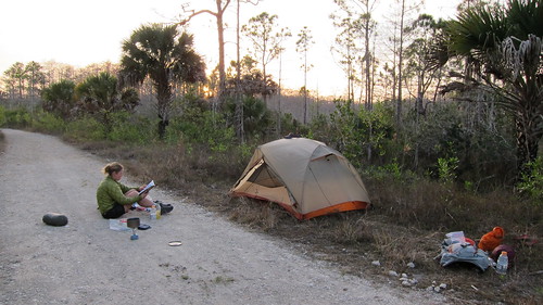
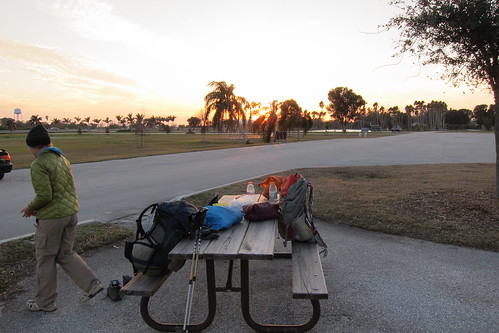
The following morning after breakfast we said goodbye to the last bit of civilization for the next two days. It is about 28 miles to I-75 from there and we were planning on going to 13 mile camp that evening, which is 13 miles from I-75. We were concerned about more mud and water but were pleasantly surprised to see that the trail was mostly dry. We walked through pine forests mixed with cabbage palms and some open prairie type scrub areas. The last time we’d walked through here there was no water, not even in the cypress domes. Such an extreme type situation this area can have—tons of water or none at all. This time it appeared it was just the right amount as we found some in the domes but none covering the trail—-at least in this section!
We actually found this section to be in great maintenance and were curious why they were even doing this section. Well, this dry section to 13 mile camp. The maintenance the following day was a bit worse, blaze wise.
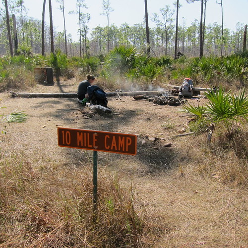
Lunch at 10 mile camp was leisurely as someones fire from the night before was left smoldering. At 7 mile camp we’d just passed the site where the campfire was still burning and a few hundred yards down the trail we met the folks who were leaving their camp for a day hike and were miffed they’d left their fire burning. DO NOT LEAVE YOUR FIRES BURNING!!! Gahhhhhh!
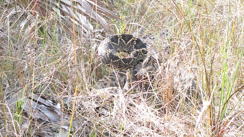
It was getting a bit warm in the afternoon, hotter than I was expecting and suddenly I was spooked by this large eastern diamondback rattlesnake! Ahhh! This is only the second one I’ve seen and it was even larger than the first one I’d seen in another area of Big Cypress. It rattled and battled for a bit but we moved around and let it simmer down in the sun again.
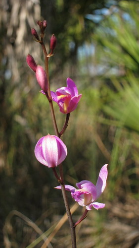
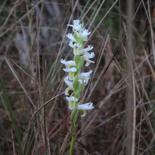
Another orchid. We were getting closer to camp when we pulled into a cypress dome to fill up on water. We had brought a filter and Aqua Mira this time around but we needed a pump for the water in the dome. While a lot of the water in Florida can be clear, even in cypress domes, it is usually tannin stained. Not dirty, just looks a bit like tea. Sometimes it can be silty which is why we brought the filter, plus we knew we’d be filtering out of canals, too.
There are some pumps at a few of these sites, but they do not work. We were quite disappointed by this our first go-round out here!
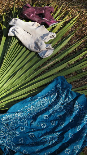
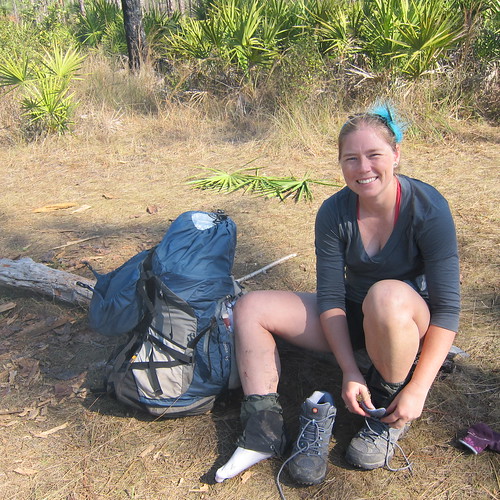
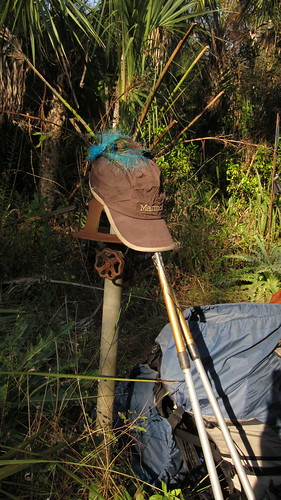
Taking socks off to dry is a must when I get to camp!
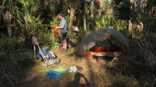
We set up and made dinner. The log book here is in rotten shape.
Chris had gotten in the tent and I was wrapping up my bedtime routine when I heard some very loud noises from the cabbage palms to the north of the campsite. We got nervous it might be a bear trying to rip open a cabbage palm to get the heart, but finally after closer inspection we found a very raucous vulture making the racket. Gah!
The next morning we knew we were probably in for mud and water but we weren’t sure at what point. Chuck Norris and his crew had reported on this nastiness and we anticipated it. The first three miles were good and then it got to the point that avoiding water by going around puddles and side stepping bushes was not going to work. Goodbye boots, hello water shoes. Right where we put on our shoes we found a pair of Rayban sunglasses….ahhh, perfect! We kept these until Orlando when we met the rest of the hikers and turned out it was one of theirs!
The water was cool but not too cold to walk in and ranged from ankle to calf deep for the most part. We sloshed around in the mud, walked by a cottonmouth that was patiently blending in on top of a cypress stump. We poked in at the Oak Hill campsite before going into a deeper slough on the northwest side of the hammock. Again, this was bone dry when we walked the last time. It was probably as deep as just above my knee and didn’t last but a few hundred yards. I kept an eye out for alligators as we walked around the deeper section that contains the alligator flag (a plant, associated with deeper water).
The trail returned to mud and shallower water when we encountered two guys resting on the side of the trail. If you aren’t used to slogging through mud or know what this section can hold, it can really tire you out. We kept going knowing that another campsite was ahead, stopped in the wrong hammock (potential campsite on the map) for a quick break and then stopped at the real campsite to rest a bit. The trail started drying out as we got further north and returned to more of a pine trail. Eventually the trail dried up well and we entered a forested part of the trail and noticed sap running from a pine tree. It appeared to be evidence of red cockaded woodpeckers but we didn’t find a hole or the bird itself, but we wondered if there were colonies in the area.
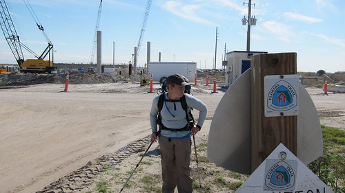
At about two miles out you can see the cell tower on I-75 signifying the rest stop. We stopped here to clean up from the last 8 miles of mud, drank a few sodas and ate some candy and got a few weird glances and a few people we knew what we were doing. We didn’t hang out too long because we needed to walk about mile north to get back into the woods.
We made camp in a flat area on the side of Nobles Grade. We’d done the blue blaze around this orange blazed route a few years ago. It’s a nice section on that blue blaze! The trail follows Nobles Grade, an old road, along a canal for a few miles before turning into another grassed road that leads into the Big Cypress Reservation. We’d gone down to a pond to get water when we heard an ATV pass by during our morning break but other than that we saw no one on the trail.
Once through the forested area we began our first true road walk on the trail on West Boundary Road. At this point it is just a hard packed road of limestone and passes a property that I got to know very well during my job in Florida. Soon after passing this property I saw a white truck coming our direction and I knew it looked like a Miccosukee wildlife officer truck. They passed by and I gave a wave, but due to the tint on the truck I couldn’t tell who drove. Not much later they turned around and rolled down the windows and it was two officers I knew from my job! It was nice to chat with them for a bit, see how they were doing and what was going on at the Tribe. Not too much after though we saw someone else walking our way. A thru-hiker???
Sure enough, it was Plugger who’d started the first of November at Fort Pickens. He told us he’d gone 900 miles without seeing another hiker, well, except one or two day hikers in Ocala National Forest, but he seemed like it’d been a quiet trail. He was relishing the thought of finishing up in a few days but we warned him of the upcoming mud and water. It was exciting to see someone else out there on the trail!
It was noon when we arrived at Billie Swamp Safari for lunch. We’d done 13 miles and had been very excited to accomplish so many miles before lunch. We’d blow that out of the water by the end of the trail. I’d eaten at BSS once before and so we walked into the very bustling place full of workers on the reservation, tribal members and tourists all eating lunch. The fare is standard greasy and fried fare but has other options like Indian tacos. You can even go for a swamp buggy or airboat ride from here. Oh, it should also be noted that we saw showers in the restrooms, so if you are hiking and are in need of a shower you can stop in here. We were going to stay at the chickee huts that you can rent but opted to continue on to the RV park on Snake Road and have a longer day instead.
Eventually the dirt road becomes paved and as we walked someone was riding their bike up and down the road and passed us several times. I felt slow. The sun started coming out and it got quite hot and we were glad to reach Snake Road and see a small restaurant open .1 off the trail. I ordered as smoothie and Chris grabbed soda. It was a nice perspective to be watching the traffic go by on Snake Road rather than how I normally viewed it, as a passenger or driver on it. The RV park is right on the trail at the junction of the two roads and since it was so hot we were very happy to hear it had a pool. Plugger had stayed there the night before and gave us a two thumbs up. The ladies who checked us in were very nice and gave us a chickee all to ourselves in the back. The RV park is obviously full of RVs but it was nice and really quiet.
We set up the tent and then took showers. Chris jumped in the pool before his shower; laundry was done. We had dinner under the chickee and dashed in the tent before the mosquitoes got bad. The tv in the common room was on so we got to check the weather and were delighted to see a cold front coming through. We weren’t interested in walking on the roads and levees in the blazing sun. Some colder air would be nice!
The next morning we got up and packed up quickly to make it to the common room so we could meet our Chris/FootTRAX who was bringing our first food drop to us. Turns out we could have mailed a drop to the RV resort had we known this was a possibility. It worked out though and Chris brought our resupply before he headed off to canoe at Fisheating Creek for the day.
The start of the roadwalk was ok as there was a decent ATV path alongside but eventually that ran out. Snake Road is quite busy with trucks in this section from the local farms and ranches so we made an effort to try to walk along the side of the road as there was no shoulder. The wind was howling from the north but the sky was clear and bright. Finally we turned off the main road and to the east along another road heading for the water conservation areas. We were able to walk along a levee to the south of the road, though a bit sandy, to avoid the road traffic. For lunch we found a shady area of Australian pines to sit by.

This is where we’d gotten our green bean trail magic! Mmmmm!
We continued down another road that turned to dirt and eventually it led to a construction area in the vicinity of the Holeyland and Rotenberger Wildlife Management Areas. Lots of Everglades Restoration here. A small gate house keeps traffic out but the woman manning the booth waved us through. Then we made our turn north on the levee. We had no idea how far we were going to go for the day or wouldn’t know exactly where we were so we had to estimate based on a 3mph pace. We passed a few water control structures before dropping down to a road that paralleled the levee. We were surprised to see houses out here! Normally we viewed this entire area from U.S. 27 and it consists of sugar cane fields for the most part, so here we were tucked several miles from 27 and a couple of houses were there. We eventually saw a tent and two packs set up at 3pm. We couldn’t figure out if they were other through hikers or what, but didn’t bother going up to the tent and asking and never did find out who they were.
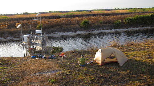
We made camp for the night in a flat spot on the west side of the levee away from sight of the road. We ate our green beans but got in the tent pretty early as the wind was cold.
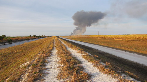
A sugar cane field burning at sunset. The levee and the road we walked on.
The next morning it was pretty dad-gum cold! The wind was blowing steadily from the north and we decided to drop down on the road again to see if the wind would be blocked at all from the levee. We had to watch for the numerous sugarcane trucks that were breezing down the road, but eventually we crossed another road and the levee became just a levee. It’s a little silly here because the trail follows the levee north, then east and then back south to the same road not that much further from where we’d passed it, but the book warns that using the road as a cut off is dangerous because of the lack of shoulder and high speed traffic. We took lunch at this road junction after just passing another sugar cane burn. It’s quite interesting to watch how efficient they are at burning, only burning particular blocks at a time. Birds circle looking for charred mice or other nibbles for lunch.
My hips started hurting pretty badly in this section, bad enough to wonder if I could keep going. We had to continue along some more levees going east and a few times we had to lift up and over some gates or rocks and I could barely lift them up without it hurting pretty bad. We took several breaks to help the soreness.
Finally we reached Lake Okeechobee at John Stretch Park. We had to dash across U.S. 27 on the divided highway, but made it safely. We weren’t quite sure where we were going to camp but we knew that tap water and a bathroom could be had at the park. It was our longest day thus far, 21 miles.
We made dinner on the picnic table by the bathroom as passerby’s came to use the restroom or a few people walked up to the levee to see the lake. No one asked what we were doing, I’m guessing they probably thought we were just homeless or just weird. It is a strange area in this area by the lake, full of immigrant workers, so we could have been up to anything. That night we chose to sleep behind a gated area near the water control structure. No one bothered us.
Next up we’ll head around the Lake and through the Kissimmee River region.
3 Comments
Toni
I was so excited to see your post, finally..I really enjoyed following you both (vicariously) last year and am looking forward to reading about your FT hike. Gator Man and I spoke from time to time wondering how or where you both might be while you were hiking…and even sympathized with you on those cold mornings!
Cheers!
Patrice
You guys are amazing! I love these detailed posts again going through the ups and downs of trail life. I didn’t realize how much you endured just during the first 100 miles. And even though I doubt we’ll ever do the FT, it is nice to read about. It seems like it is quite the versatile trail in terms of scenery from roads to cypress groves. I can’t wait to read more.
Chris
Well, after the shock wore off of seeing that first scarey picture, I loved reading about your adventures on the FT. Some good and some bad places, for sure…and John Stretch Park. Wow, if I had a penny for everytime I’ve stopped there I would be rich! It is the halfway point between my house in Miami and my house in Lake Placid. Anyway, looking forward to reading more. You guys should write a book!