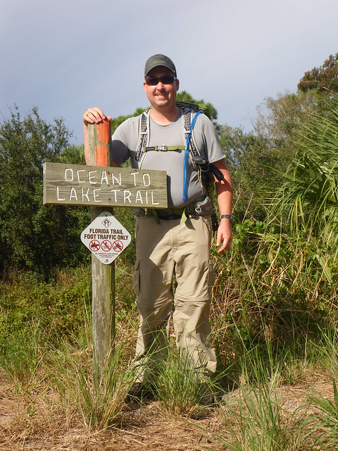
10 Years Ago – Ocean to Lake Trail Hike
It suddenly hit me about a month ago that we’re wrapping up a decade here in a few weeks. To be honest, and I’ll elaborate more on it in my end-of-decade post later in December, my brain is still stuck somewhere in 2014-2016. It hasn’t caught up to 2019 yet. And then I realized that this Thanksgiving week is our 10th anniversary of our hike of the Ocean to Lake Trail, a side trail of the Florida Trail. Typically most people start on the eastern shore of Lake Okeechobee and then walk to the Atlantic Ocean on Jupiter Island at Hobe Sound Beach. We did this as a prep for our 2010 AT Hike (don’t get me started on that being nearly a decade since we hiked that!) and it was the first and only time I’ve hiked in a hiking skirt. Lesson learned—hiking skirts are not for me.
So, I’ll ‘walk’ you through some of what we saw. I’m doing this mostly because I came across the photos last month when looking for some photos for my friend Eliana and I didn’t realize we had a ton more photos than the handful I’d uploaded onto Flickr. There’s also a ton of videos because we were going to produce videos for YouTube—at that time very few people thru-hiked the O2L section. It is increasingly popular to hike now. I may put together the videos eventually but they are with our older point and shoot and the quality isn’t great. We’ll see.
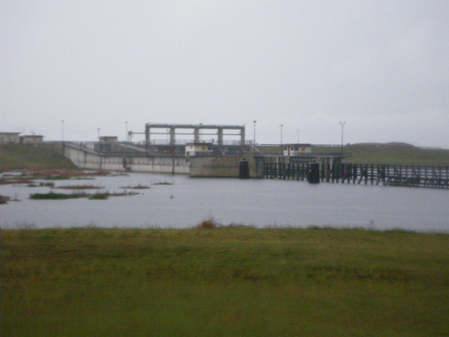
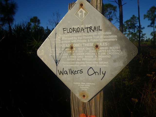
Our friend Tom, aka: Gator Man from our geocaching days, met as at the parking lot at Hobe Sound Beach where we left Chris’ car for the Thanksgiving weekend. He drove us to Port Mayaca and dropped us off on top of the Lake Okeechobee levee where we walked down to the water and officially started our hike. It was a drizzly Thanksgiving morning and a smidge chilly as we hoofed it back up the levee and down the other side to started our road walk along SR 76. I think the trail has been re-located since then to start a bit further south but at that time we had to roadwalk before we could get into the main trail at DuPuis WEA

After our roadwalk we turned at the Port Mayaca cemetery and stopped to read about the mass grave there from the 1928 hurricane which killed several thousand people across south Florida. It is the reason there is now the Herbert Hoover dike around Lake Okeechobee.
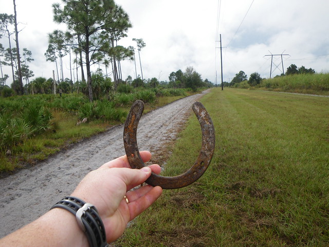
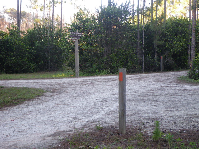
Through the cemetery we took a powerline easement south down the western boundary of DuPuis to find where the trail began in the woods. We still have this horseshoe somewhere around the house!

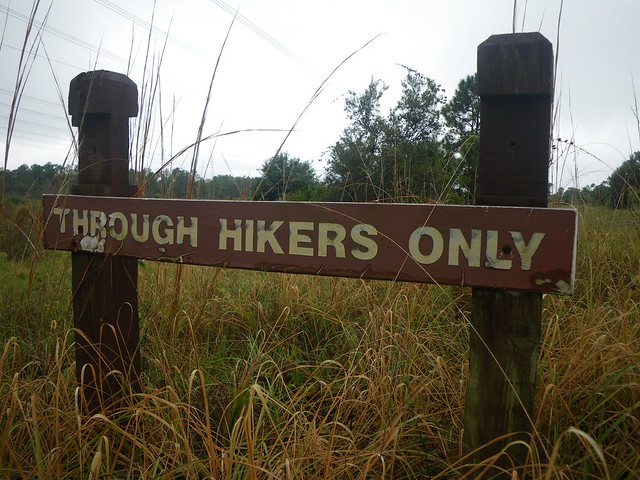
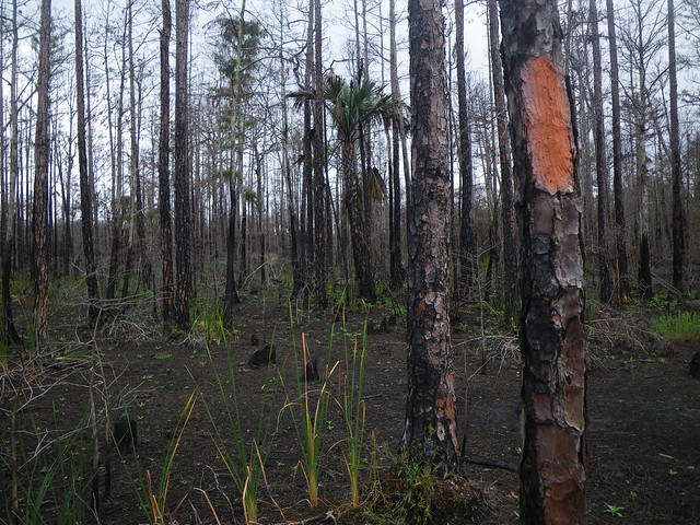
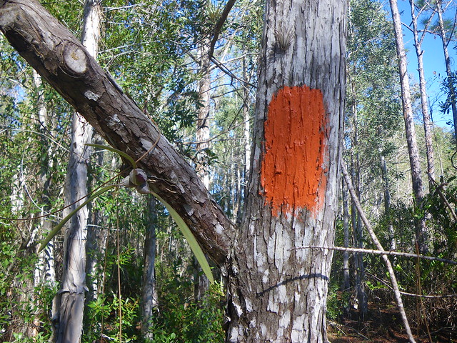
Orange blazes—time to start the ‘real’ hiking!


I’d completely forgotten about seeing this raccoon until I saw the photo!

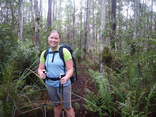
By the time we started off down the trail the rain had let up somewhat. If I recall it might have drizzled a bit more throughout the day but the rest of our hike was smooth sailing on the weather front.

Climbing Maidenhair, Lygodium microphyllum, aka: Old World Climbing Fern, one of the invasive scourges of Florida.

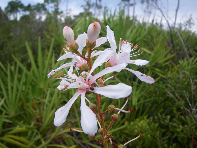
Toothpetal False Reinorchid, Habenaria floribunda
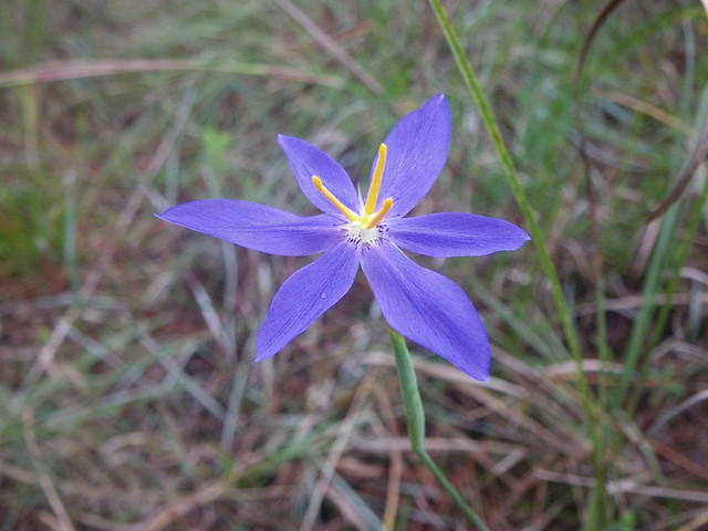
Fall-flowering Pleatleaf, Nemastylis floridana
There aren’t a lot of sightings of this on iNaturalist so I was glad to add another entry. My locations are estimates based on where we were hiking each day. And we did take quite a bit of wildflower photos as you will see in the post.
Over the three nights we camped we stayed on the eastern edge of DuPuis the first night, towards the eastern edge of JW Corbett WMA the second night, and just west of Jonathan Dickinson State Park on our final night. I have visions of where we camped for the last two nights but I couldn’t tell you were we stayed that first night. Oh wait—I’m getting vague memories now! But I couldn’t describe them but I see it a bit. Hrmmmmmm.
Traveling through Corbett the following day we had similar habitats as the day before, a mix of pine flatwood prairies, cypress domes and prairies, and oak hammocks that we hike in and out of. Despite being the tail-end of the wet season there wasn’t a ton of water on the trail and I don’t remember having wet shoes.
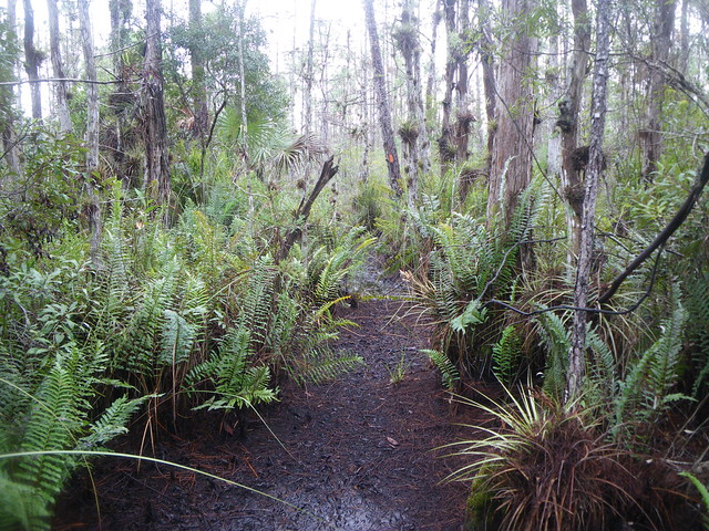
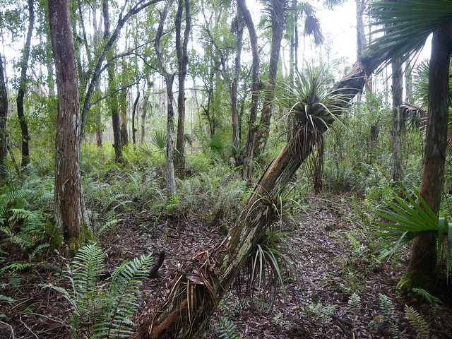
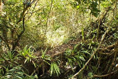
Of course the habitats are jungle-like in areas, with large ferns growing along the ground and bromeliads lining the trees. Ah, good stuff!
Ah, babies!

Some great early middle-aged saw palmettos thriving after a fire.
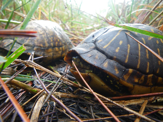
Common Box Turtle, Terrapene carolina
Can you smell the mustiness in this photos? Ahhh! The swamp!
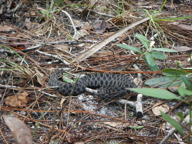
Pygmy Rattlesnake, Sistrurus miliarius —-late edit because iNaturalist (read: people who know better than me) tells me this is actually Dusky Pigmy Rattlesnake, Sistrurus miliarius ssp. barbouri and I am not a herper so I’ll trust them.

Musky Mint, Hyptis alata
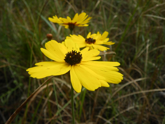
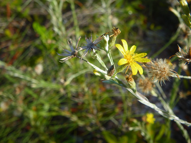
Leavenworth’s Tickseed, Coreopsis leavenworthii
White Bog Violet, Viola lanceolata

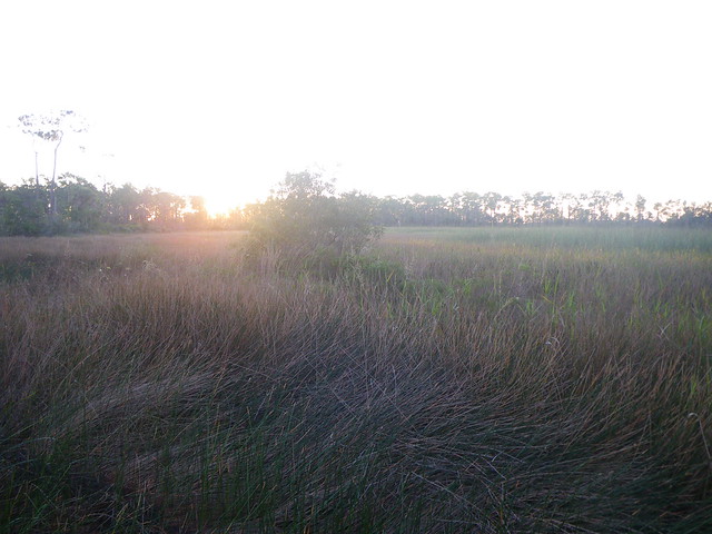
Typical Florida! Love those pipeworts in the bottom foreground!
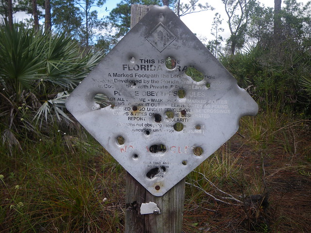
Also, typical Florida. Or typical ‘rural areas’.

We wound down our second day on the trail by camping about a mile from the eastern Corbett boundary. Our friend Chris aka: FootTrax from geocaching days was planning to visit us the following morning and we didn’t want to have to walk terribly far before we had to meet up with him.
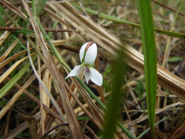
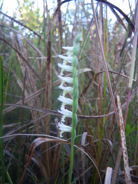
Panther Ladies’ Tresses, Spiranthes triloba

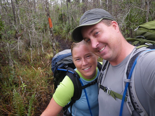
Chris met us at the end of Seminole Pratt Whitney Road and the C-18 Canal, bringing us Egg McMuffins from McDonalds and refilling us up on water. It was the first time he would trail angel for us and definitely not his last. He helped us out twice on the main FT in 2011, too.
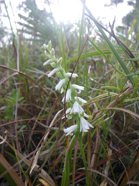
Giantspiral Ladies’ Tresses, Spiranthes longilabris
We said goodbye to Chris and meandered our way through Hungryland Slough Natural Area, weaving in and out of what you can see on aerial imagery was once an area slated for development. This is certainly not the only example of this in Florida. Drain and build, drain and build.


Next, after crossing SR 710, we walked through Loxahatchee Slough Natural Area, which in some areas had some of that evidence of developers wanting to drain the land and of course you don’t have to zoom out far to see where actual development abuts the LSNA. Loxahatchee Slough is part of the headwaters of the Loxahatchee River.


Once we popped closer to civilization it was time to levee walk along the C-18 Canal until we arrived at Riverbend Park. (We paddled on the river in the park in 2014) Riverbend Park is popular for launching to paddle on the Loxahatchee River but also has several miles of improved trails, which the O2L follows some of those paths. We couldn’t hike fast enough through the park because we were itching to get to Indiantown Road so we could hike a bit down the road to a gas station and small strip-mall where a couple of restaurants were located. It was hiker re-feed time! After dinner we walked across the street to continue on down the trail and stealth camped for the night.
Narrowleaf Silkgrass, Pityopsis graminifolia
Our final day was going to be spent mostly through the expansive Jonathan Dickinson State Park, one of my favorite state parks in Florida. We had hiked a lot of the trails in the park including this section of the O2L before we so knew what to expect for most of this section.
Florida Pennyroyal, Piloblephis rigida
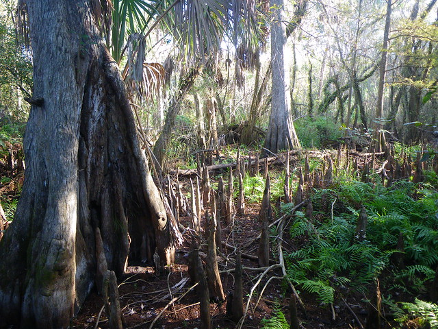
In the river floodplain there are some outstanding cypress knees—this is right after crossing under I-95.
Tarflower, Bejaria racemosa

Largeflower Rose Gentian, Sabatia grandiflora

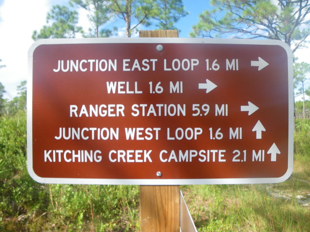
And then you enter the wonderland that is JDSP! Mostly sandy uplands with just wonderful native plant species throughout the area. I think this outhouse is at the Kitching Creek campsite—a great campsite if this is your stop for the night.
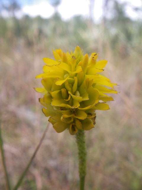
Yellow Milkwort, Polygala rugelii

Hairy Chaffhead, Carphephorus paniculatus

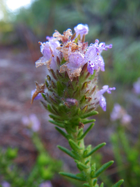
Largeflower False Rosemary, Conradina grandiflora

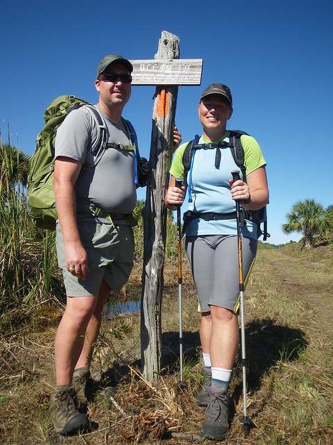
And then sometime around early evening we finally arrived at the beach!
It certainly felt like a great feat to have walked 63 miles over four days, our longest hike to date at that time. Only four months later we’d be embarking on a 2,179 mile journey from Georgia to Maine that was significantly more difficult than this hike. It was a great trial run, though and it certainly really helped sparked the interest in long distance backpacking.
And as I mentioned earlier, the O2L is now quite popular with the local trail clubs organizing group hikes, trail runners heading out to tackle the trail, and it makes the rounds on social media. This little known side trail is now pretty well known in Florida hiking circles. I’ll end with some updated links about the trail from other folks:
+Ocean to Lake Trail via Florida Hikes! — Sandra and John’s website is where all the Florida hiking knowledge is located. Definitely hit up their website if you are planning on hiking in FL.
+Ocean to Lake Trail via the Loxahatchee Chapter of the FTA
+So you’re interested in hiking the Ocean to Lake Trail & Everything you need to know about hiking the Ocean to Lake Trail via Jupiter Hikes. Jupiter is well-known in the hiking world. He set an FKT record on the main Florida Trail a few years ago (it has since been broken) and the O2L is in his backyard in south Florida so he hikes it often.
+Ocean To Lake Trail via FreeFreaksHike
You May Also Like
One Comment
Stretch
Sounds like a fun hike! I hope we get back over to FL soon. I sure do miss the plants & animals. I’d never heard of inaturalist before. How cool! Thanks for sharing your adventure, Ripley!