Charon’s Garden Wilderness | Wichita Mountains NWR

Getting up to DFW for Christmas break was one of those is it going to happen? ordeals since Omicron broke out. Skipping out on a trip up there last December meant that I really wanted to get up there this year. Plus, my nephew was going to be my parent’s house for a week while his sister and parents went to New Mexico for a scouting ski trip. Which meant a lot of uninterrupted cousin play time for Forest and Grayson and in turn meant that Chris and I could likely slip away for a couple of days and let the grandparents wrangle the two boys for a few days. So, that’s what we did!
I suggested to Chris that, weather permitting, we try to go backpacking for a night or two and thought the Wichita Mountains sounded lovely as I had heard about them for years but had never been. Chris turned it into one night in the Wichitas and then a bed and breakfast the following day, which turned out to be a perfect plan!
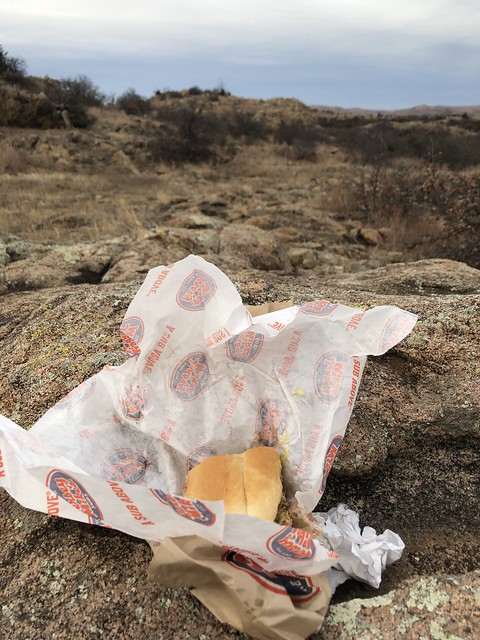
Texas, being the huge state it is, has a lot of nooks and crannies that I haven’t visited. Only an hour and 45 minutes from my parent’s house and where I grew up, is Wichita Falls, a town that I hadn’t been to before, oddly enough. Chris I briefly stopped in there to get something at Academy (zip off hiking pants for me which are apparently impossible to find at the moment for women–and I’m not paying the $75 that REI wanted for their brand–I left Academy with non-zip off hiking pants but at least I had hiking pants. I had recently hiked a hole into the crotch of one of my pairs and a snap button had busted off the other pair. Le sigh.) and to get lunch and dinner for the day. We opted to go stoveless for this hike but not in the way that most backpackers think of stoveless, which is cold soaking ramen or the like and eating it for dinner. Nope, we packed out a sandwich (me) and some chicken tenders (Chris) for dinner. Ah, so delicious!
And then we zipped off for the Red River and crossed into Oklahoma!

Chris took some back roads into Cache, OK which were mostly farm fields and very flat. I spotted a coyote running alongside an interior fence and that was an exciting sight as we sped down the two lane roads. It didn’t take long before we could see the mountains off in the distance, rising from the flat farm lands around. We finally arrived at the southern entrance and being that it was a holiday week after Christmas, even though it was a Monday, there were plenty of cars out for scenic drives or heading to trailheads. We found the visitor center closed, presumably for covid, but I found a bathroom outside of the also closed education center and was ready to go for the trail.
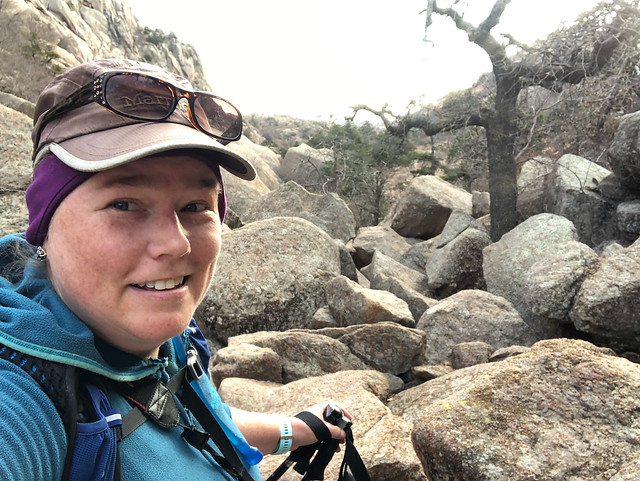
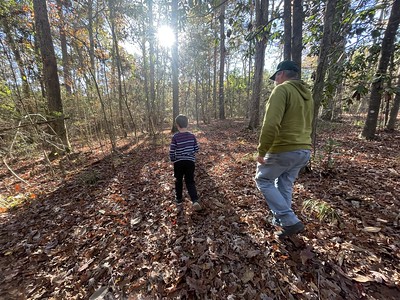
The Charon’s Garden trailhead (pronounced Karen) was very busy, so busy that I worried we wouldn’t even have a parking spot or would have to wait until someone left. We ended up finding one tucked up near the front, thankfully, and spent a few minutes eating lunch, gathering our gear, and watching day hikers trek up either Elk Mountain or head out to the Charon’s Garden area.
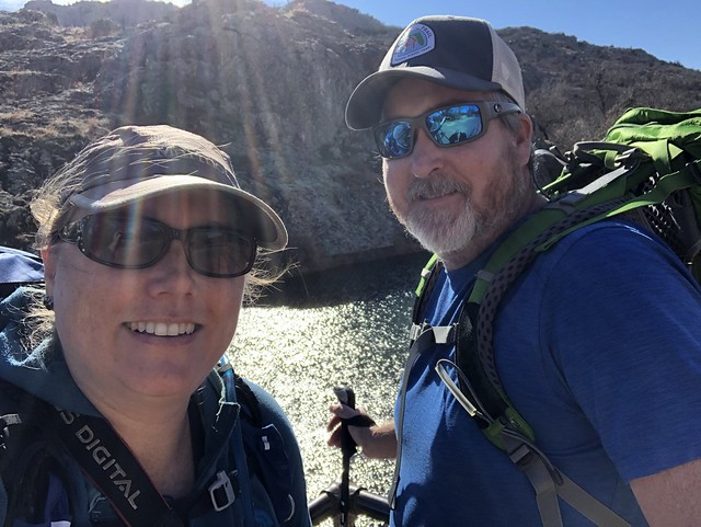


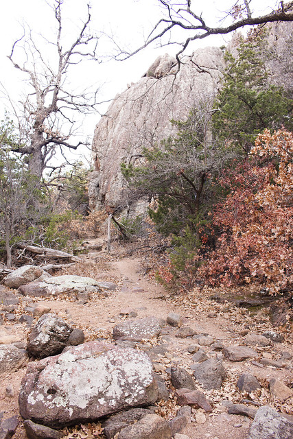
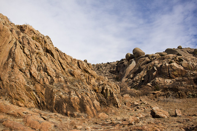
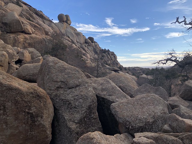
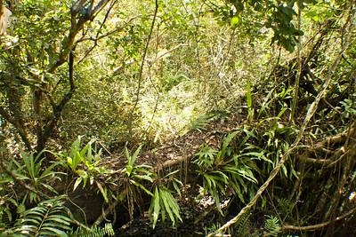
Once we got going I was immediately enamored. The terrain was wonderful and reminded me a lot of the Enchanted Rock area in central Texas with limestone boulders and interesting formations. Considering it was winter there wasn’t a lot of flora to take in, but there was quite a bit of cacti and plenty of interesting grasses. We quickly found that the trails here are not labeled well at all and the maps you can find online vary in detail. The trails on the ground meander with various paths wandering to different rock formations. Chris’ goal was for us to hike from the north trail head down to the south trail head and see Treasure Lake or Post Oak Lake and then head back north to the designated camping area which we only found labeled on one map and it was certainly not labeled anywhere on the ground in the refuge. It was a big blob on the map that had a generalized dispersed camping zone, which made sense because that was really the only flat area to set up a tent that wasn’t in the middle of the trail.

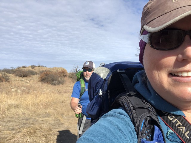
Because I hadn’t studied any of the maps I was mostly relying on Chris’ use of a map on Avenza and we had poor cell reception so it wasn’t like we could look up anything online while we were out there. Eventually I figured out we’d come down a western trail loop when we saw Apple and Pear, two large boulders perched atop one of the low granite mountains. Yay, a marker of some sort to acknowledge our location! We passed and were passed by several various groups of people, some with kids in broad age ranges. It was a busy trail!


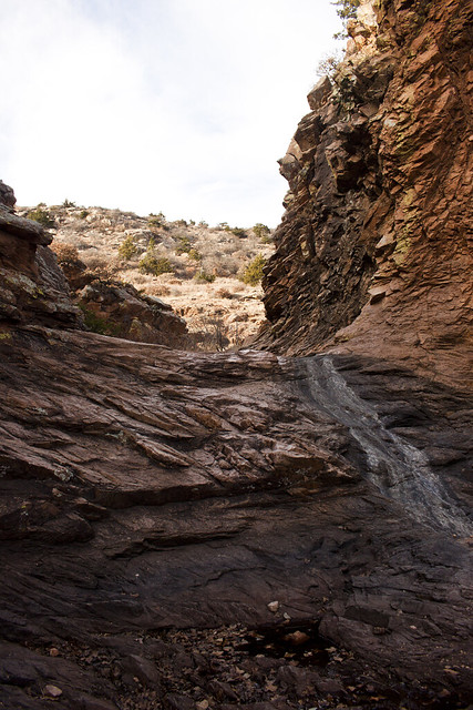
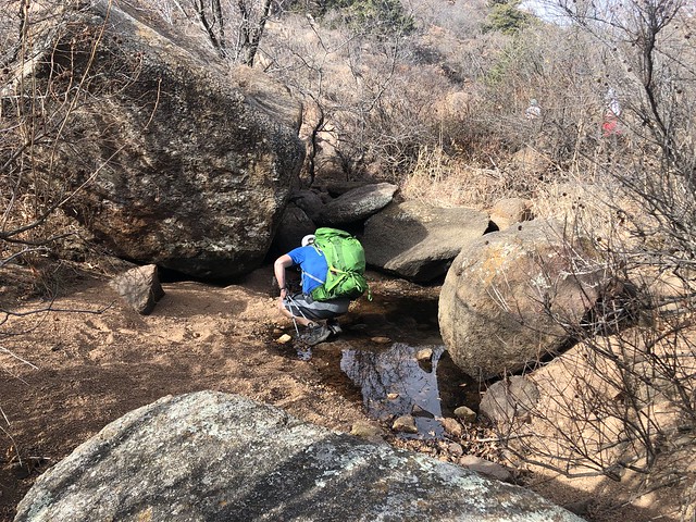
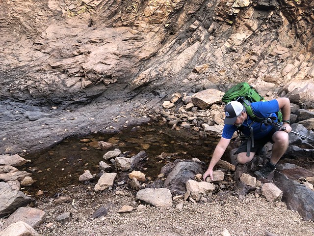
Eventually we made our way to the Post Oak waterfall which was not running at all and was a trickle. A few minutes respite and we continued down towards the lakes, which again, there were multiple trails that led up to the ridge here and we were never sure we were going in the right direction. I finally noticed Treasure Lake out the corner of my eye and then noticed we’d made it to the southern trail head. I headed over to check the trailhead out and amazingly they had a decent map on their board so I took a few photos. I was glad it included other trails in the park because we had plans to check a few others out the following day. There was no signage showing the trails at the north trail head.


With plenty of light left in the afternoon, we paused for a break above Treasure Lake and I took a few minutes to check in with my mom since I had cell service. After, we headed north again and it certainly seemed like a lot of a shorter distance than I had thought we had covered initially.


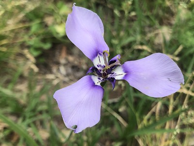
Amorpha canescens, leadplant, I believe! It’s an amorpha, just not totally certain which!

We headed onto the east trail this time which took us through the boulder field below Apple and Pear, with large chunks of granite creating interesting cave-like features ripe for exploration. Forest would have had a lot of fun exploring them! Then the trail skirted the boulder field and took us up and above to the top of the boulders! Chris had mentioned that there was a mini Mahoosuc Notch (a mile long boulder field on the Appalachian Trail in Maine that takes about three hours for the average person to get through) along this trail and we had finally found it! On the AT at least there’s a blaze every so often marking a best way through but there was nothing marked along the trail here, which wasn’t any different than what we’d already experienced with this trail. I took a few photos with my phone, careful not to drop it down into a crevasse and we carefully inched our way along the boulders until we could find solid ground once again. We passed two 20-something women at this point who had no clue where they were and asked which way they were going and if they were heading to the trailhead. It took a few minutes to suss out where they had even began so we could help them get to their car safely. Again, I’m not impressed with the maps and signage in this area, especially in a highly trafficked trail with a lot of day hikers unused to the terrain or hiking.
By this time I was very much in the mood to stop for the evening and we still had to find our way back to the camping area on the one vague map Chris had found. We lost the trail junction and ended up walking down a dry creek bed in the general direction we knew the trail would be heading back to the west and eventually we found the trail again. Eventually we stopped at a grassy area and walked a bit off trail and found a flat area behind some boulders amongst elk and buffalo scat and set up our tent for the evening. We saw no one else that evening.
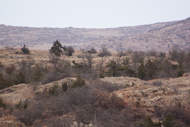
Dinner was eaten on top of some of the rocks and we watched the sky, which had clouded up, turn into pinks and oranges as the sun started to set. Chris had brought binoculars and spotted elk and buffalo in the distance, which I took a few photos of with my 75-300mm lens. It was extremely peaceful! But the downside to backpacking in winter is the early nights in the tent and we were in the tent before 6pm. I read my Kindle for a few minutes before dozing and Chris tossed and turned for a few hours before realizing his NeoAir had a hole somewhere and he was laying on the ground. Needless to say he did not sleep well. I woke up several times because I had nightmares, something I don’t typically have but I had like three of them that night. Sometime far into the night it started to lightly rain and I heard thunder in the distance. Chris had enough service to check the radar and it appeared it was going to pass to the north of us but we fixed up the packs under the rainfly a bit more and tidied it all up in case it did rain.

Elk in the middle ridge here.
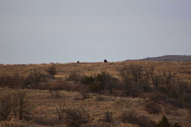
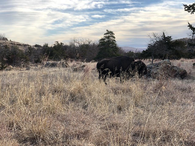
A couple of buffalo.

Dainty Sulphur, Nathalis iole

Echinocereus reichenbachii ssp. baileyi – This was the predominant cactus throughout the refuge.


Bleary eyed and leaving the Wilderness Area!
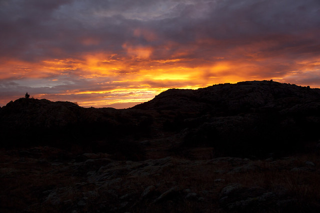
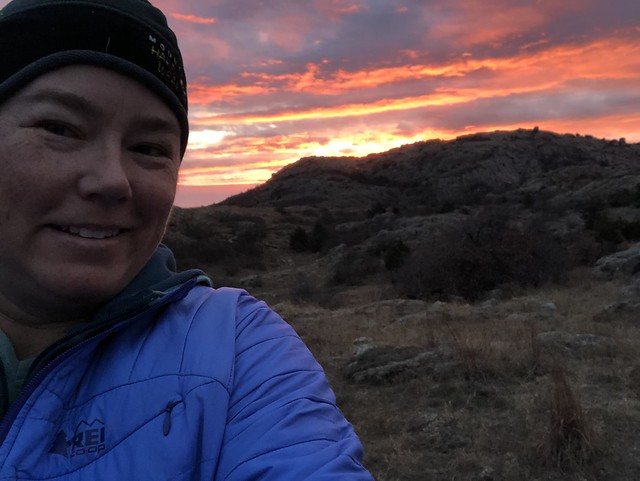
We were quite tired the following morning but after 12 hours in the tent there wasn’t any sleeping in. Chris got out before I did but I was too chilly to want to get out. I emerged at the perfect moment as the sun was coloring the sky behind the mountains to the east. It really was a spectacular sunrise, one of the best I’ve experienced! We ate breakfast quickly and then had a fairly short hike back to the truck.
We weren’t far from the trailhead when Chris stopped me. I had one mind and it was getting to the truck and I didn’t see the giant beast next to the trail! A buffalo! We eased by quickly after snapping a few photos. After we got back to the truck, with plenty of parking spaces at the early hour it was, we dropped back by the bathrooms at the education center to refresh ourselves and plan out where to go next. I’ll share a few separate posts from the other places we visited in the refuge before we left for Lawton to get lunch and to return to Texas later that afternoon. But otherwise, I highly recommend the Charon’s Garden Wilderness Trail and securing a permit for an overnight there. It really was a great hike and the solitude was wonderful!
2 Comments
Donner
Who knew!? This looks amazing, like almost desert? – I’ve never been to OK so I just googled this drive from Nashville, and didn’t realize this was West OK, not close to AR ha. If I ever end up out that way though – it’s on my list. Maybe I can get a copy of that map kiosk photo you took 😀 Nice write up, Happy New Year!
Patrice La Vigne
This reminds me of the black mesa area (Oklahoma’s high point). We only day hiked the high point, but I was highly impressed with the area! Not what you think of when you think of Oklahoma!!!