Outdoors
-
Puttering Around the Confederate Reunion Grounds State Historic Site
Jack’s Creek, which feeds into the Navasota River around the bend to the left of the photo. Virginia Springbeauty, Claytonia virginica A very chilly plain-bellied Watersnake, Nerodia erythrogaster. The Navasota River Hemisphaeric Liverwort, Reboulia hemisphaerica, with both male and female reproductive parts visible. I don’t usually see this species like this, usually it is in its non-reproductive phase. Close up of the female archegonium, the globular structures, and the darker, male antheridiums above. Leather Lichen, Dermatocarpon miniatum Effervescent Tarpaper Lichen, Collema furfuraceum A remnant fireplace, there were a couple of these around the grounds, if I recall correctly. Pennsylvania Pellitory, Parietaria pensylvanica, growing out of the fireplace. Rabdotus sp. I’m…
-
Late Winter at Fort Parker State Park
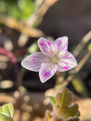
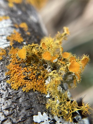
An interesting limestone creek wall with black maidenhair ferns, Adiantum capillus-veneris. Sound on for lovely creek sounds. Golden-eye Lichen, Teloschistes chrysophthalmus with a sunburst lichen, Xanthomendoza weberi. Winter Grapefern, Holubiella lunarioides White Avens, Geum canadense Common Script Lichen, Graphis scripta, with an unidentified liverwort. Orthotrichum pusillum moss with a rosette lichen, Physcia sp. Bare-bottom Sunburst Lichen, Xanthomendoza weberi Roundleaf Scurfpea, Pediomelum rhombifolium Alabama Lipfern, Myriopteris alabamensis Overlook of the Navasota River Bulbous Adder’s-Tongue, Ophioglossum crotalophoroides Cutgrass (Zizaniopsis miliacea) & creek A stately bur oak, Quercus macrocarpa Blunt Woodsia, Woodsia obtusa Small spring at the east end of the lake/Navasota River Ranunculus sp. at the spring In mid-January I went up…
-
Liminal Moments on Film
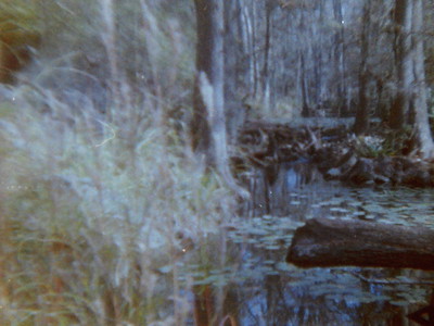
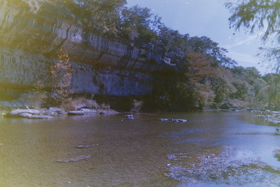
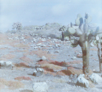
One of the two 110 film cameras I have (the Diana Baby being the other one) is a Concord 110 EF, much like the Neon Lites one in this link. It’s the first camera I had as a kid and was a Christmas present from my grandmother, I believe. Someday I will flip through my photo albums to see what kind of photos I took with it back in the day, though I have an inkling of what some of them look like based on memory. While this camera does not shoot great photos, as evidenced above, at least my technique has improved over the years! Shooting on film, and…
-
Guadalupe River State Park on Film – November 2024
All photos above were shot on a Minolta XG-1 on expired Kodak Gold 200 35mm film. All photos above were shot on a Minolta XG-1 on expired Kodak GC 400-8 35mm film. To continue from my last post, here are photos from other rolls of film I recently had developed. These two are from expired 35mm film and I really love the outcome for both. It’s giving “looks like 1975” but in reality it was 2024. The Montezuma cypress along the river as well as the rock wall on the river provide excellent backdrops for photography, whether on film or digital. Since we have typically gone to this state park…
-
The Galapagos on 110 Film
I recently had some film developed that I’d had sitting around for the last year and a half. I had forgotten I had shot an entire roll of 110 film on my Diana Baby toy camera when we were in the Galapagos in July 2024 so these were a fun treat to see when I scanned the negatives. The film was Color Tiger 110 ISO 200 from Lomography. Getting the film developed has renewed my interest to shoot more film so I’ll be trying to do more of that this year. I also need to see if I can find a local developer to develop my film instead of shipping…
-
Texas Prairie Dawn (Hymenoxys texana) | Wildflower Wednesday
Ozark Milkvetch, Astragalus distortus Aquatic Pygmyweed, Crassula aquatica Rose Bluet, Houstonia rosea After more than a decade of wanting to see Texas prairie dawn (Hymenoxys texana), Chris and I were finally able to see a population of the plants in western Harris County last spring. They’ve been on our survey lists for years when we work in certain areas of the state, primarily the Houston region, but no one in our office had seen them yet. I’d been looking during my cemetery botanizing the last few years in SW Montgomery county and NW Harris county but never came up with anything. Thankfully, someone pointed us in the right direction to…
-
Country Dirt Road Botanical Finds
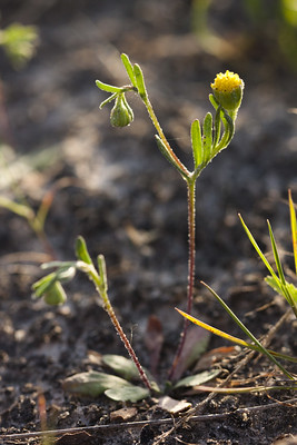
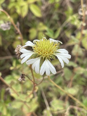
Gaillardia aestivalis winkleri, white firewheel White firewheel with a nectaring little yellow, Eurema lisa This is a locally uncommon to rare grass, Gymnopogon ambiguus, bearded skeletongrass. I’ve only ever seen it over on the Big Sandy Creek Unit of the Big Thicket. I suspect it may be more common in some of these areas but people generally ignore grasses. Oenothera rhombipetala, fourpoint evening primrose A few weekends ago, Chris took a random dirt road that his GPS said to take to get to the Beaver Slide Trail in the Big Thicket. It was a pleasant drive, lots of interesting plants to look at outside the window. Then we entered a…
-
Late July at Watson Rare Native Plant Preserve
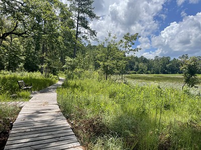
Geraldine’s cabin, steady through the seasons. Hibiscus aceuleatus, pineland hibiscus Marshallia graminifolia, Grass-leaved Barbara’s buttons A few of some of the Platanthera chapmanii, Chapman’s fringed orchids along the boardwalk Two of the Chapman’s in bloom. Ascelpias rubra The boardwalk down near the pond. When it cools off I’d like to sit down here and read or paint at some point. The beginning of liatris season. Some scenes from a quick trip to the Watson Rare Native Plant Preserve back in July. It was a quick trip but there was quite a bit blooming as you can see. I wrote a different post over on Substack with about similar things that…
-
Finding All the Plants
It’s spring and so I am in my happy space–there are PLANTS BLOOMING AND MORE TO COME! I’ve been out hiking a lot recently, trying to wrap up what remains of trails for my Big Thicket region hiking guidebook, and so I have been seeing a lot of interesting plants and sights recently. I’ve essentially given up on trying to keep this blog to the detail I used to be able to and so this is what you are going to get from me now (this is a note for future me when I get mad at past me for not writing about such and such thing.). My favorite place…
-
Snow Day
After a week of forecasts for snow, late Monday evening finally arrived and the first inklings of the proposed 2-5″ of snow in our region arrived. The forecast went up and down for days, but mostly stayed in the 2-4″ range for us, though some areas closer to the coast said they would have 6″+. That never really materialized in Texas but it sure did in parts of Louisiana! There were some veritable snow drifts from an internet acquaintance in New Orleans and her kids even managed to have a decent sledding experience on the side of an overpass hill near their house! For us, Forest finally got to use…