Trail Tales 16: New Hampshire
Relevant posts: The Whites: A Definition
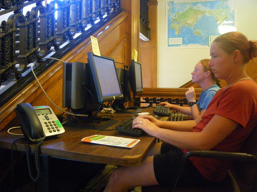
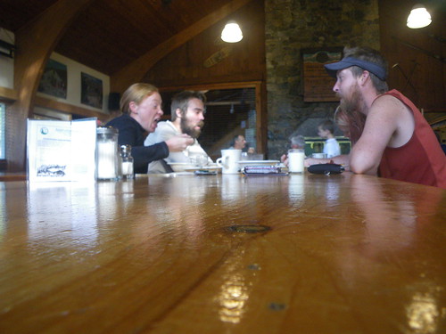
After crossing into New Hampshire we followed the trail along the road that leads to Dartmouth College and it opened up into what I’d imagined an Ivy League university to look like. It was sprawling, had many old buildings and a large, open field was situated in the middle of it all. College kids, clean college kids, were riding their bikes, walking by and smelling so clean! We found the DOC headquarters and sat down to use the computers.
After getting our share of the internet we emerged back outside and while Merf and Little Brown had gone to a few other places, we said we’d meet them later on to figure out our schedule for leaving town. It was enticing to look at all the shops lining the road. We went in an outfitter to pick up a map of the Whites. So far we hadn’t carried a map at all but we had found out from southbounders that the Whites weren’t well marked in some places and the AT followed other trails and that was the primarily labeling and since we didn’t want to get off trail we thought a map might come in handy.
And I’m sure much to MC’s dismay, we did not go to Ramunto’s for lunch like Merf and Little Brown, instead we found a Thai restaurant where I feasted on pad Thai for my belated birthday lunch! Mmmmmm!
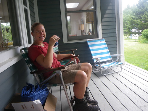
Before leaving town we stopped at the local rec center that had recently been allowing thru-hikers to take a shower there for a small fee. We hadn’t had a shower since Manchester Center, Vermont so it was about time to get the dirt off. For our resupply we stopped at the Food Co-Op, a conglomeration of a Whole Foods and a regular grocery store. It was nice to have a different variety of foods to choose from than we normally would have had.
We left town late, nearly 4pm, with the intent on doing 10 miles to the Moose Mountain Shelter. We left without Merf and Little Brown, but they were to leave an hour later. On our way out of town we met someone who was stealthing near the soccer fields and kept on going past the first shelter at Velvet Rocks. We’d heard that the water source was unreliable for the next two shelters so we carried enough water out for the next morning as well.
The walk to Moose Mountain was fairly easy, a bit of a climb up Moose Mountain itself but not too bad otherwise. It would be one of the last easy days on the trail for a long time. We got to the shelter at nearly 8pm, set up the tent and made dinner. Little Brown and Merf came in a little later.
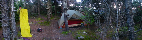
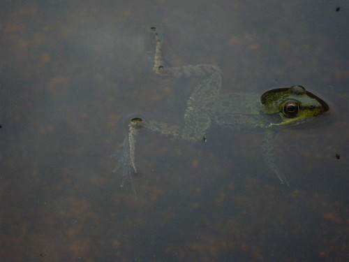
This is the Moose Mountain privy. Merf, and I suppose I did too, made the mistake of hitting the privy the next morning in full few of some other hikers who were camped just up the hill from the privy. Just poor planning on the trail maintainer’s part! Air circulation is nice, but not that nice!!
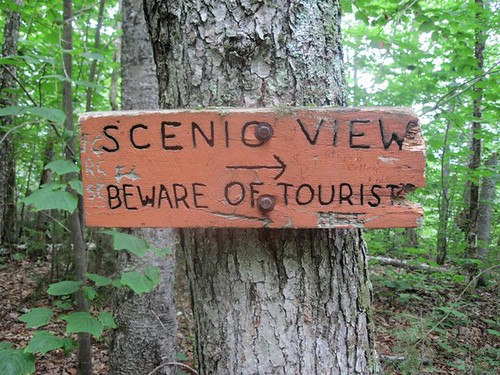
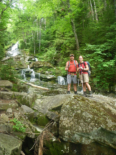
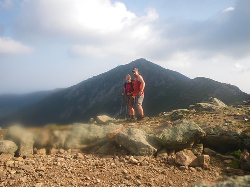
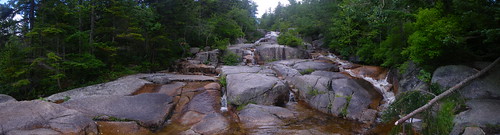
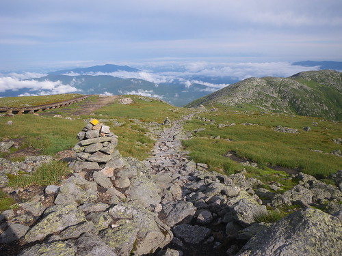
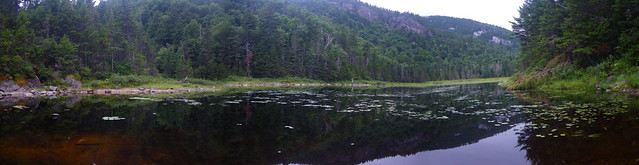
The following morning was overcast but the trail was enjoyable for the most part. A nice downhill to a brook and road preceded a 1,000 foot climb to Holts Ledge where we took a mid-morning break to see if we could see the beginnings of the Whites. It was cloudy and sight distance was not very far. We made the descent to the next road where we knew we might have a chance at some trail magic.
The guidebook says that at the Lyme-Dorchester Road we’d find “water and ice cream at the blue house just west of the trail; sign on Trail after road intersection”. After a bit of negotiating some white blazes and where they went, we eventually found the sign and the house. No one was home, but we found sodas and a log book to fill out. It was fun to find out who’d stopped in for a treat and in the journal it listed everyones ages; many people were either vastly older or younger than I’d expected! Like Nuthatch, I thought you were a year or two older than me, not younger! Not that it matters, but the trail is deceiving on peoples ages.
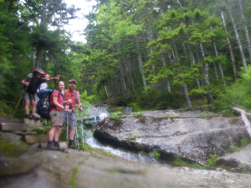
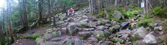
From there we knew we were going to have a 2200′ climb up to Smarts Mountain. We began making our initial ascent when lunch time came. Chris and I found an open area of rocks to lay out on but were quickly ran off by some spotty rain. The rest of the hike up the mountain was foreboding of the next several hundred miles; we walked on large rocks slabs, careful not to slip. When we got to the final ascent of Smarts we found rebar fastened to the rock face in order for us to climb up. Someone was descending the mountain and we had to find a smidge of room to the side to let them slip by. That’s how tight the trail got. Merf and Little Brown had passed us while we were eating lunch and we found them on top at the Smarts Mountain Fire Tower. We also met a French Canadian couple who were thru-hiking together, or doing a flip-flop or something like that. After a brief break we started our 1500′ descent down to the Hexacuba Shelter.
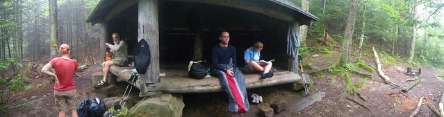
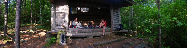
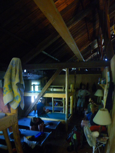
The Hexacuba Shelter is a multi-sided shelter that can fit a lot of hikers. We found the shelter packed and tried to find a spot to set up our tent.
We cooked dinner and the skies that were spitting rain earlier in the day finally decided to let it all go and we all ran into our tents for an early evening.
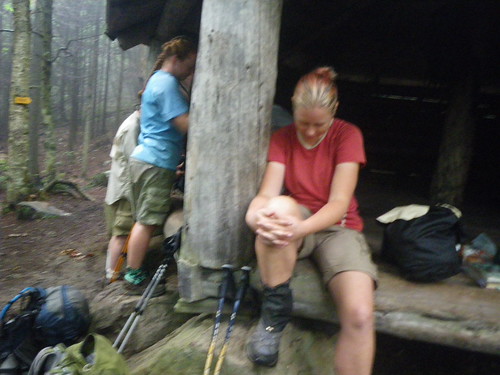
The next morning the trail was still wet and we were beginning to find more of the rock slabs to walk on as we climbed up Mt. Cube. We didn’t even stop for a break that morning, just kept pressing on when we finally arrived at N.H. 25A where I downed a small pack of gummy snacks to tide me over until lunch. Lunch happened finally at the Ore Hill shelter, a measley 9 miles from the Hexacuba shelter. We had gone really slow down the rocks from Mt. Cube and didn’t realize how bad it had gotten. The Ore Hill shelter characterizes their privy as being of a medieval style. Merf was really curious on what a medieval style privy looked like and when she returned from her scouting she told us that it really meant something along the lines of run down and broken. I went to check it out and thought it was hilarious and definitely broken. We’d found that this section maintained by the Dartmouth Outing Club was really lacking in trail maintenance. We didn’t stop long for lunch since we were intent on making it to Glencliff to pick up our mail drop at the post office. It was still another seven miles and we had to make it before they closed. We didn’t know how bad the rest of the trail was going to be after the first seven.
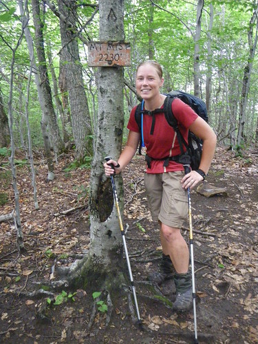
Luckily the next seven were much more smooth and we went up and over Mt. Mist, a summit of no big means, pretty quickly. I remember on the way that Merf and I chatted a lot about Jane Austen, hobbies and other chick things, I’m sure much to the boring dismay of Chris and Little Brown.
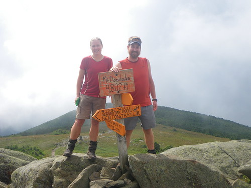
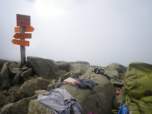
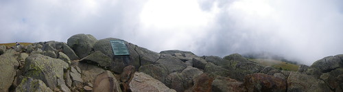
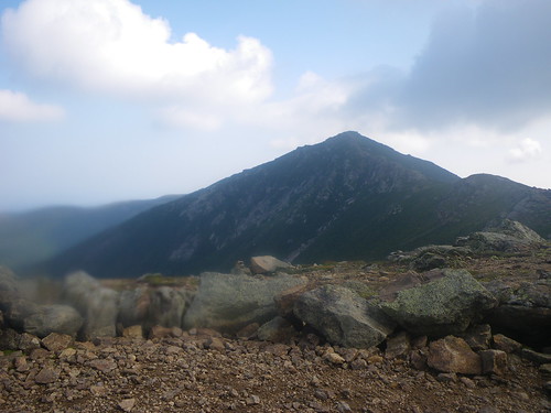
After Mt. Mist we came to a viewpoint where we tried to make out Mt. Moosilauke but it was wrapped in clouds. We peered over to the north and found a rock pile of a mountain much closer and thought that it would be our luck that the AT went over it. Thankfully it did not.
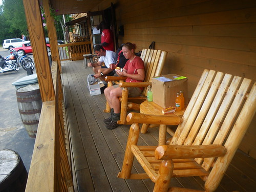
We arrived at the Hikers Welcome Hostel which was just across the street from the post office in Glencliff. Snack Attack was going to stay the night, but we stopped in and filled up on sodas and ice cream and ate some of the chocolate chip cookies my mom had sent us in our mail drop.
I’d wanted to position ourselves at the shelter right before the climb up Mt. Moosilauke so we could conquer it early in the day before rain might have a chance to move in, so we left the hostel for the Jeffers Brooke shelter a mile up the trail. We heard thunder coming so we hiked one of the fastest miles we’d hiked in awhile but luckily did not get caught in any downpour.
We were joined by one other person that night, someone I don’t recall, so it was a quiet night for us at the shelter.
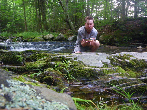
The brook wasn’t far from the shelter so Chris took advantage of that and tried to fish.
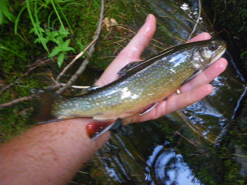
He managed to catch one!
The next morning dawned nice. My whole intent on getting over Moosilauke early was to avoid rain and to avoid making the northern descent worse than it already was. During the year we were planning I followed the journal of Wags on Trailjournals.com. I had remembered reading an entry by her about the harrowing descent of a mountain that had a waterfall running next to it. When were in Manchester Center I thumbed through her journal again and realize that it was Moosilauke she had been talking about. I was not thrilled.
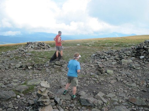
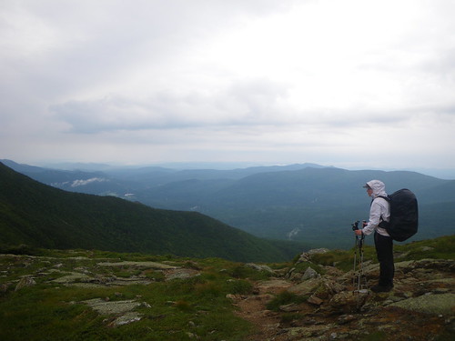
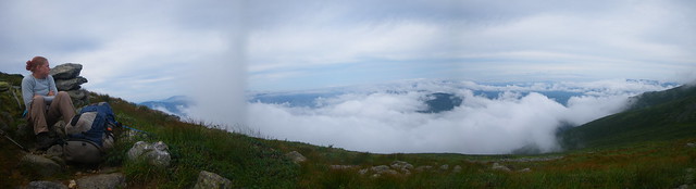
We left the shelter and figured that Snack Attack, who rose super early, would have already passed us. Chris and I left Merf and Little Brown at the shelter that morning as they were gathering their stuff up. The ascent was not too terrible, and turned out to be very lovely. We slowly left the deciduous trees behind and started seeing confiers and moss covered stones. There were some water areas, but nothing too bad on that side. Slowly we rose above treeline and the trees became stunted. We found an old carriage path that the trail followed and took that and finally we were able to make out the very top of the mountain about a quarter or half mile away. We saw Snacky with this white shirt and tiny pack dotting the side of the mountain. It was AWESOME up there! Our first time above tree line and it was beautiful! It was cloudy so we moved in and out of the fog, but it was just spectacular!
Chris and Merf thought they would attempt to make a kite.
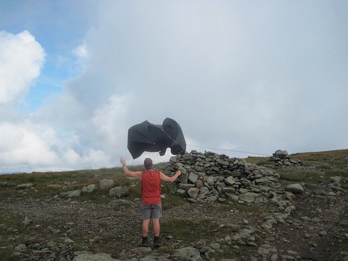
It kinda worked!
We descended below tree line and walked some beautiful trail along the ridge before starting our descent. It didn’t get too nasty until after we passed the Beaver Brook shelter.
And then we found the bad stuff. There sure was a waterfall chasing the trail, sometimes spitting onto the trail making it wet and slick. Rebar was built into the rocks along with wood blocks to make steps where there were none, only a rock face.
I was glad we were able to enjoy the waterfall and that it wasn’t raining and we weren’t being even more cautious than we already were.
What a ham, Little Brown! 😉
When we finally descended into Kinsman Notch we made a short roadwalk to the Lost River Gorge and Boulder Caves where it was rumoured to have a cafeteria. Lunch!! We filled up on microwaveable burgers, chips and soda before filling our water up and heading for the Eliza Brook Shelter.
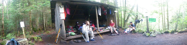
We worked pretty steadily all afternoon thinking we were doing decent miles not realizing we were walking on a very slow treadmill instead. We jumped over mud puddles, slick rocks and wound our way up and and over Mt. Wolf before coming to a sign that we thought was for the shelter. Nope! One more mile! One more mile! What? Everyone sighed and was resolved to make that last mile fast. We found the shelter full of southbounders who’d just left the Whites and were excited to start putting some miles on their boots.
The next morning we were planning to meet Patrice 9 miles away at Franconia Notch. We knew we’d started the hard stuff so we got up extra early in order to make it by lunch time. But first we had to go over the Kinsman’s. We left Little Brown here for the last time; he’d broken a tent pole and was planning to try to get it fixed in town and we never saw him again!
The Kinsman’s were rough. Some areas involved pulling yourself up to get further up the trail, handing poles to each other and carefully negotiating the trail. I got very nervous we wouldn’t make it to Franconia Notch in time. We just kept going and enjoyed the bogs on top of South Kinsman, took a short break on North Kinsman and tried to speed up as we went down the trail but it was mostly futile as there were just more rocks to negotiate. Finally we made it to the Lonesome Lake Hut, our first hut run by the AMC in the Whites. We stepped in for a few minutes to see what the hut was all about and the smells from breakfast made me even hungrier than I already was. I felt bad because I had to hit the restroom, which is actually flushing and has running water, but some of the hut workers were cleaning it. One of them let me in even though they’d just mopped and they gave me dirty looks as I tracked my muddy boots in. Merf tried to go later on but she was turned away because I’d set such a bad precedent. I wanted to tell them that it was the outdoors and to get over themselves!
The next three miles to Franconia Notch were easy and we flew down the trail. That was the only thing that got us there on time. We encountered a big problem when we got there because Patrice said she’d meet us at the trail head at the notch and she wasn’t there. I gave her a call and she said she was there but we walked up and down the bike path but couldn’t find her. Turns out that bike path lead a long way down to a parking lot. Eventually we met her and her husband, Trail Angels and future 2011 thru-hikers!

They’d set us up with a bunch of candy and sodas to tide us over until we made it to North Woodstock for lunch. It was fun to sit around the table and talk of the trail and listen to what they thought of the Whites. They’d trekked all over the Whites so we listened with intent on what was coming up for us. It rained a bit while we were eating and we debated going to the hostel in town if it kept up, but luckily the rain stopped for the most part by the time we hit up a grocery store for a resupply for Merf and Snacky. We said goodbye to our new Trail Angels and made our way 2.5 miles up to the Liberty Springs Tentsite.
The AMC-CT ridgerunner we’d met earlier in the hike had told us the name of the maintainer at this campsite so when we arrived we chatted for a bit and then casually mentioned we’d run into his friend and he said “hi”. We got to escape paying for a tentsite that night! Merf and Snacky were carrying tarps, and in the case of Snack Attack he had an over-sized rain poncho for a tarp so they combined efforts and out came Super Tarp!
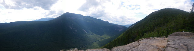
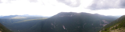
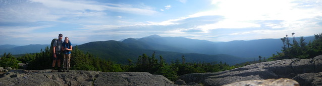
The next morning was overcast with smidges of sun poking through and after a quick weather check from the maintainer he told us we’d be up above treeline in no time. We started the steady climb up Little Haystack, did some more tricky rock maneuvering and before we knew it we were above tree line! It was just so awesome! I remembered coming down into Franconia Notch and looking at the gigantic mountains, grey, imposing monoliths. And here we were, finally on top of them!
The walk across the Franconia Ridge was pretty easy going despite the rock strewn path. We stopped for awhile on Mt. Lincoln at the Greenleaf Hut trail junction to take a break and I had to try to find a way to shield myself from the biting wind. It was there that Merf and Snacky decided they were going to walk a bit slower and stop at the Galehead Hut for the night to attempt to do work for stay, while we were planning on going past that to stealth somewhere. Once we descended from Lincoln it seemed to take forever to get up and over Mt. Garfield where we had lunch at the trail junction to the Garfield Ridge Shelter.
Shortly after lunch we started down the mountain but when we noticed water on the trail we thought we’d missed a blaze and gotten off the path. We started looking around but then realized people were coming up so it must be the trail. Yes, the trail went down the middle of a stream. Greeeeat! The trail was teeming with day hikers and we tried to get past them so we wouldn’t be hiking behind slow people all day. We noted a few stealth sites before we made it to the Galehead Hut.
We stopped in Galehead for just a little while, enough time to fill up our water and read the registers. The area was full of day hikers as well and many were coming down from South Twin Mtn, where we were headed. It was another rock climbing venture of 1000′ in a mile. Once on top we turned towards Mt. Guyot in hopes of finding a stealth site either before or after the side trail to the Guyot Shelter which was located nearly a mile off the trail, downhill. We weren’t interested in making that trek and after passing up a stealth site just south on the trail from the turnoff we decided to keep going and see what we could find north. We eventually found a little spot that may or may not have been a real stealth site. It looked like it might form a puddle of water if it rained, but it was situated quietly behind some conifers.
That night it stormed violently. Thunderstorms passed through with lightning and thunder and I begun to worry we’d wake up in a nice puddle of water. Luckily that did not happen. We found out later from Snack Attack and Merf that Snacky had watched the lightning from the large windows at Galehead and had worried about us out in the storm. *awww*. 🙂 It’s nice to be thought of!
The morning was cloudy and it looked like there was potential for more rain so we booked it for Zeacliff and then the Zealand Falls Hut where we arrived mid-morning in time for eating some left over pancakes at the hut. We later heard many negative comments about the people running this hut; turning people away in storms and being in general very nasty to thru-hikers. I’m glad we didn’t try to stay!
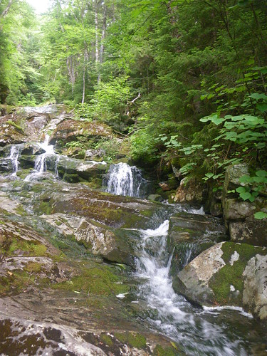
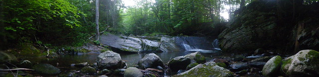
Zealand Falls. The next 8 miles to Crawford Notch has to be the easiest section in the Whites. We flew down the path much faster than we’d done the last few days, enjoying the smooth-ish path that lined the way to Ethan Pond and eventually Crawford Notch. We crossed paths with a few southbounders, stopped in Ethan Pond Shelter for a quick privy and snack break where we met a pretty nice maintainer running the place with an interest in thru-hikers. We had a mail drop waiting at Crawford Notch and wanted to get in and out as quick as possible.
At Crawford Notch we met many day hikers who were taking a short side trail to a waterfall. Some stopped to ask us questions and we even talked for awhile with a woman all about thru-hiking and how we needed to get our mail drop. She was doing nothing but waiting for her husband, yet she had her car keys. I kept hoping she’d ask if we needed a ride, but no such luck. We stopped at the road where we tried to hitch. It took a few try’s but we managed to find a fellow hiker who gave us a ride down the road to the Crawford Notch General Store.
The store was packed with visitors filling up on supplies for their camping excursions around the Whites. We bought ice cream and hot dogs while we sifted through our mail drop next to another southbounder. He ended up giving us a few items to use, some dehydrated refried beans that we later ate on Mt. Washington and found them to be delicious. The hitch out of the notch proved to be one of our most difficult yet, taking nearly an hour before a friendly couple let us jump in their pickup. The southbounder had already started walking the road back so we grabbed him on our way out.
The climb up to Mt. Webster was not overly terrible. Before our long hitch out we thought we’d try to make it to the Mizpah Hut but the lost hour left us back at our original plan of stealthing near Mt. Webster.
We found a pretty good place about a tenth or quarter mile from the summit of Webster, tucked into the pines with enough room for a few tents. There was a wonderful viewpoint right next to it.
The wind was whipping up from the notch creating a chilly atmosphere.
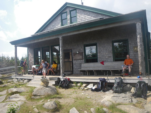
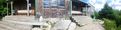
The next morning we made our goal for the day to be the Lake of the Clouds Hut, a mile and a third from the summit of Mt. Washington. We looked at it from a distance and saw it poking in and out of the clouds. The morning started bright with a few clouds and we met several day hikers from the Mizpah Hut on our way to Mizpah. We poked in the hut for a few minutes, enough time to see what breakfast leftovers were available, sign the register and take off. We found out that the Madison Hut past the Lake of the Clouds Hut was going to be closed for the day due to a party so it was good that we were only doing a measly 8 miles that day.

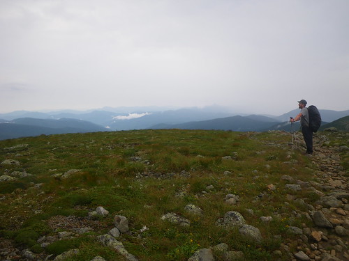
About a mile up from Mizpah we arrived on top of Mt. Pierce where we realized the weather was turning quickly. Storm clouds were coming and we saw lightning and thunder, not good things when above treeline. The storm rapidly approached and we threw up the tent in order to avoid being drenched and to stay out of the lightning. The storm passed quickly and we continued walking above treeline as we approached Mt. Washington.
The area was teeming with day hikers from the various huts nearby and we fielded several questions about thru-hiking, but mostly we were in a hurry to get to the hut before the weather turned bad again.
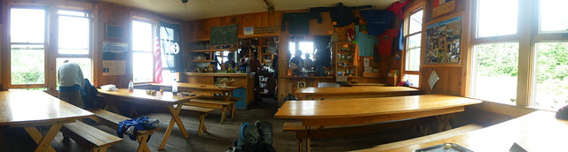
We found the hut to be pretty busy when we arrived; everyone was staying indoors for lunch, reading books and playing games in the common area. We’d decided since we were so early, noon-time, that we’d wait a few hours before we asked about work for stay so we wouldn’t get told to keep going despite bad weather and because Madison Hut was closed and it would be another ten miles of hiking above treeline before getting anywhere safe to stay for the night.
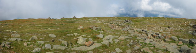
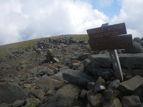
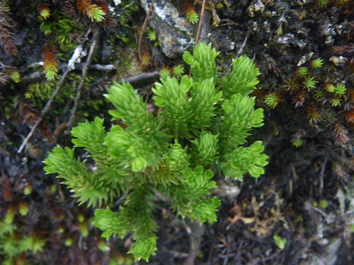
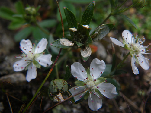
Between rainstorms Chris went out to take photos of the alpine vegetation.
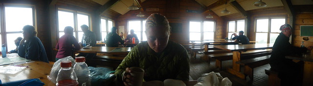
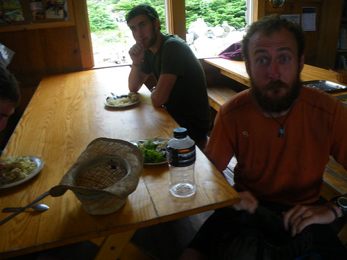
I spent the afternoon inside reading a book, writing and catching up on some relaxation. It was so nice to look outside the window at the valley below and then to get glimpses of the summit as it passed in and out of the clouds. Some people ventured out in the rain, most stayed inside. Finally we got the nerve up to ask the crew about work for stay. We were in luck, the normal crew had gone to Madison for the party so we got some middle to later aged guys from the Mount Madison Volunteer Ski Patrol who’d been crew members of the hut system back in the 60s. They were friendly and had no problems with us staying for the night and doing some work. I had a few bowls of soup for $2 initially, $1 refills. Mmmmm!
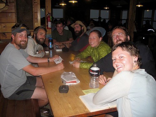
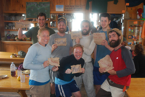
At nearly five pm the door opened and a bunch of thru-hikers walked in the door, including Cubbie and Dilly Dally, Merf, Snack Attack, Snickers and his friend, plus several southbounders. It was going to be a full house and thankfully the crew accomodated all of them. Seriously….I do NOT get how they would turn people away that late in the day to go over the Presidential’s in bad weather. This happens all the time and you can read it over and over again in books and trail journals about hut crews turning people out. If they really do not want a lot of people doing work for stay, the AMC needs to provide tent sites near the huts for thru-hiker use. It is really ridiculous the kind of treatment some people run into. I honestly do not think they fully understand what thru-hikers go through. And the ‘dungeon’ that doubles as a shelter underneath the LOTC hut is not sanitary. It has to be one of the grossest places we’d seen other than the Blood Mountain shelter in Georgia. Even the MMVSP told us we wouldn’t want to stay in it. We all ended up staying up later than our normal hiker bed time because people were using the common room. Eventually we were able to sleep under the picnic tables and I found a place on a long bench against the wall, but sleep was not superb because of the creaking of the wood when folks got up to pee at night and the annoying slamming of the bathroom door every half hour.
Thankfully the next morning for our climb to Mt. Washington was awesome! It was clear, it was sunny, it was beautiful!
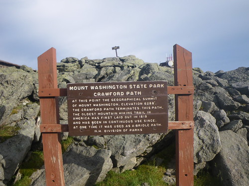

We didn’t stay on top too terribly long, just enough to check out an old restaurant at the top, look at the current visitors center that was closed and grab a few photos.
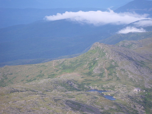
Looking back down at the LOTC hut.
The cog railroad
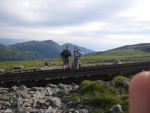
On the cog, with a bit of Snack Attack’s finger.
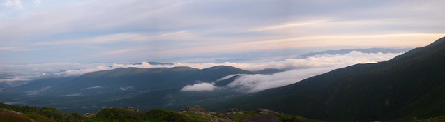
We took a snack break somewhere down the trail and watched the clouds rise from the valley and envelope us in fog.
We saw a few crew workers coming from Madison wearing these gigantic pack holders, they remind me a bit of a rescue gurney, but they are designed to carry up lots of gear to the huts. They looked uncomfortable.
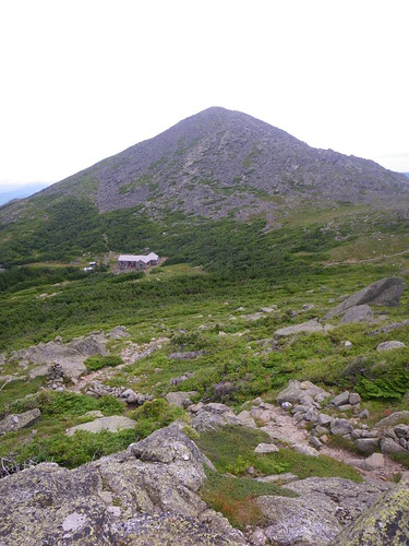
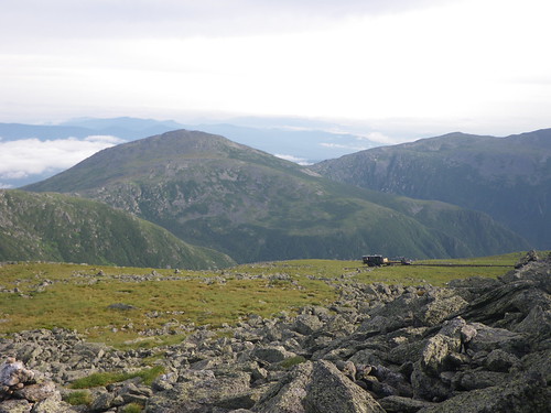
Just in time for lunch we arrived at the Madison Hut. This hut is scheduled to be torn down and rebuilt as it is one of the smaller huts in the system.
Inside Madison
Dilly Dally and one of his silly faces!
At Madison they had a lot of food left over from the party and the crew members offered us work-for-food. Of course we said yes, but I felt a little skeevy doing work for food. Like, really? You are just going to throw it away but you know you can toy with thru-hikers’ stomaches and get them to do your bidding. In the end we ate lots of food, cleaned out the very disgustingly dirty bunks and changed the pillow cases. It worked quickly with a few of us dividing and conquering. Snack Attack left out of the hut first, followed by me and Chris and we went up and over Mt. Madison. It was still fairly nice outside but you could tell the clouds were building. Just after descending treeline and before the Osgood tentsite we met Flora and her friend Fauna. A few other southbounders were aiming for Madison, too.
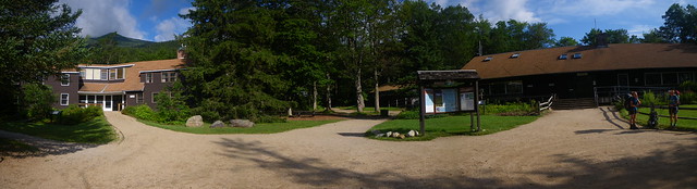
The stretch from Osgood to Pinkham Notch were a bit rough. We were wanting to hit the notch, a 15 mile day, to stay at the Joe Dodge Lodge since it’d been well over a week since we’d had a shower. Around Low’s Bald Spot we started hearing thunder. Not long after it started raining and we had about a mile to go to get to the notch. It ended up downpouring on us before we got to the notch. Merf was still behind us as was Cubbie and Dilly Dally. Snack Attack was already at the notch deciding what to do for the night. We all wanted to get dry from the rain, get clean and get some rest in a bed, but it turned out that the lodge was a bit of a rip-off. Rip-off or not, we decided to stay anyway, plus we got meal tickets for dinner and breakfast. Chris and I got one of the last rooms available and Snack Attack got a bunk in the ‘hostel’. We showered in the community showers and went down to the visitor center for dinner.
Before dinner we saw Cubbie and Dilly Dally had shown up and were going to attempt to find a stealth site somewhere nearby. They’d been caught in the rain, too. Stealthing in that area was pretty difficult as it had a high day hiker traffic. We’d sat down to eat when Merf showed up looking pretty upset. Around Low’s Bald Spot the trail isn’t very apparent. It looks like you go to the Bald Spot but you don’t really. She’d gotten stuck in the rain up there and sat down and was very frustrated about being lost. Now she was at the lodge and was hungry and when we told her how much the hostel stay cost she balked. We ended up sharing some of our bread with her even though she hadn’t paid for dinner. I mean, you can’t turn a hungry hiker away! The next morning I ran into her in the bathroom and was happy to see she’d ended up staying. A good night sleep and food in your belly can do wonders to your spirit.
Breakfast the next morning.
Merf played us a tune before we left the lodge that morning.
Climbing up the Wildcat’s ended up being a near repeat of the Kinsman’s only a bit worse. Merf with her rock climbing skills showed us how to get up a few places that seemed impossible. There were many WTF moments as we ascended Wildcat Peak D. You know what the pissing point of all that climbing was? A ski lift at the top. *Some* people were known to blue blaze down or up the ski lift. Hrmph. I’ll bust my butt, thank you. After the main climb it was not too bad walking along the Wildcats, but we had a pretty steep descent down to Carter Notch and the Carter Notch Hut.
We stopped for lunch at the hut and found that some bad weather was on the way. We got some warnings about climbing up Carter Dome but at that point we brushed it off as we’d gone up enough bad stuff, what was more bad stuff? We also got doubtful look of our intent to make it to the Imp Shelter another 8 miles away.
Carter Dome was not too terribly difficult and once at the top we started hearing thunder. It stayed safely away for a long time and were able to walk along South and Middle Carter Mountains before it started getting closer. It was a nice walk along those two mountains; stunted conifers lined the rock path and alpine plants were all around. On north Carter the bottom fell out. The rain came down in a deluge and as we were descending the mountain we found it to be more of a river. It was not safe to really walk down some of the rocks so we scooted as much as we could while attempting to keep everything in our packs dry. We passed a green tent set up in the middle of the best clearing possible and knew it was Cubbie and Dilly Dally so we shouted out to them as we hurried past and they mumbled a hi and said they’d see us later. We really wanted to make it to Imp.
The shelter was packed when we arrived but we managed to find room with the help of the maintainer. Snack Attack was already wrapped up in his sleeping bag. We alternated going to the privy to try to change out of our wet clothes, made a quick dinner and then turned in like everyone else. It was here that we met Traipsing Platypus again. When we saw her we realized the first and last time we’d seen her was at the Wayah Bald shelter way back in North Carolina! I’d been seeing her entries for hundreds of miles but couldn’t place who the name went with.
Even though we’d just stayed at the lodge at Pinkham Notch we had already planned to probably stay at a hostel in Gorham where we had to resupply. Now that our boots were soaked through from the rain it was a definite. We finally were leaving the Whites and had a fairly easy eight miles to get to U.S. 2, the road to Gorham. Snack Attack met us at the road where we found our first trail magic cooler in quite a long time. We picked up some extra food left from a hiker, downed sodas and called a ride from the White Birches hostel.
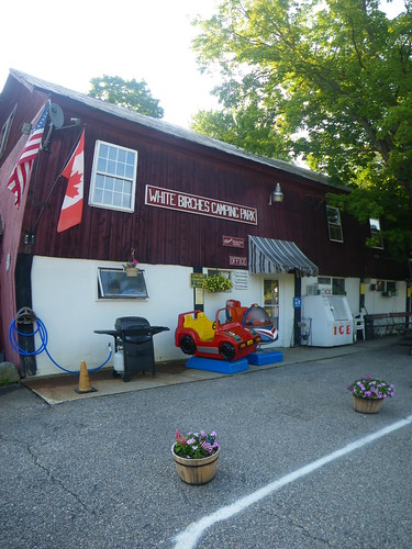
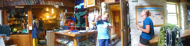
The hostel and camping park.
Inside the hostel. We went to town where we feasted on a Chinese buffet, walked to a couple of outfitters, the post office and attempted to go to the library. We had to catch the town bus to our very first Walmart on the trail. We’d been avoiding Walmart the entire time but there was not another grocery store in town. We saw Dilly Dally at Walmart, too. He and Cubbie were staying at a different hostel in Gorham. We stopped in at the library where we ran into Sly Jangle for the first time since Connecticut. He was still ahead of us, somewhere around the Mahoosuc Notch area, but had gotten off the trail due to some very bad back pain. He was going to rest up at the hostel for a few days. He later got off the trail and was diagnosed with a later stage of Lyme disease. He did end up getting back on and finishing in September!
At the hostel we ordered pizza for dinner, watched a Harry Potter movie and relaxed.
Snack Attack having too much fun! Oh, I forgot, we found rub-on tattoos at Walmart and plastered Snacky’s face with them!
On our final full day in New Hampshire we were planning an easier 12 miles to the Gentian Pond shelter. The first part of the day was very easy going to the Trident Col Tentsite, a nice change of pace from the last stretch through the Whites. We’d contemplated going further to stealth on Mt. Success or somewhere near there but decided against it after awhile since the terrain became more difficult after lunch.
We weren’t but a mile or two from the shelter when we passed a few southbounders who told us that a guy was waiting at the shelter and for us not to go farther. That was Snacky; he always hiked faster and in front of us and he didn’t want to get separated from us. In Gorham we’d convinced him that he needed to eat some real food. He didn’t cook food and instead sucked tuna or chicken from the packets. We told him if he bought some Mountain House meals that we’d cook his water for his dinners as we had extra fuel in this stretch. He did not want us to pass him up for dinner!
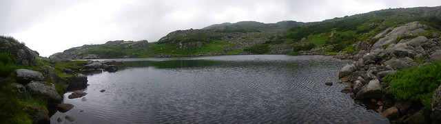
We did stop at the shelter and it was worth it. A beautiful view of the Whites were before us.

In our heads we were already in Maine, but the next morning we had only 5 miles to get to the NH/ME border. The going got really rough and we slowed to what seemed like a crawl compared to the day before. Where we ever going to get to Maine?
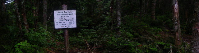
Well, sometime before lunch that day we arrived at the border. We’d made it from Georgia all the way to Maine. We did not see the “Welcome to Maine, the way life should be” sign that many people got photos of.
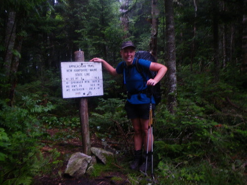
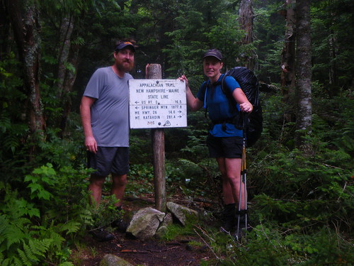
Only 281.4 miles to Katahdin!
You May Also Like
2 Comments
Chris
I miss the trail….let’s go hike!
Patrice
I love reading all this about my home state. I know it has its downfalls, but I do love hiking in it!