Trail Tales 4: U.S. 192 to Lake Mary
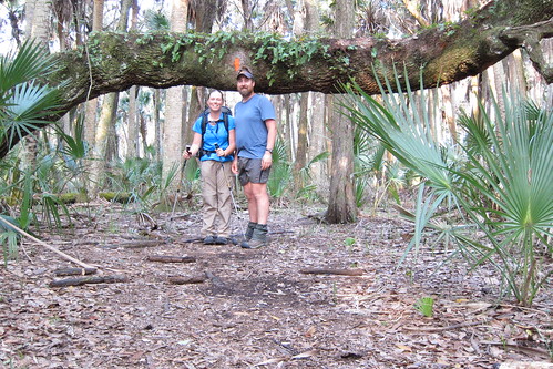
Once we hit U.S. 192 we planned to do another 12 miles, or walk until about 4:30 and see where that got us. We stayed on the grass shoulder on 192 for the most part until we turned onto C.R. 419. Luckily 419 is a quiet two-lane country road that is frequented by mostly locals. Steve told us he’d drive up the road a bit and then walk towards us and then walk back to his car with us. Originally we planned to stealth camp near one of the creeks that was listed as a water source in the book and when we passed by it we realized it might have been tough, do-able but tough. As there was mostly open pasture in this area there would have been little cover to duck in anywhere. I was glad that we were going to be going to Steve’s house for the night.
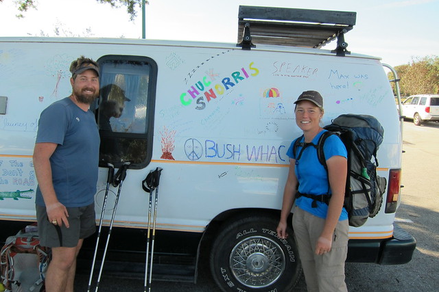
When we met Steve at Bull Creek he’d said that Chuck Norris’ group was within a day to a day and a half ahead of us. Their group was spread out with some of the hikers maybe five to seven miles ahead and the furthest ones up 20+ miles ahead. When we met Steve that evening we decided we’d just drop by David ‘AWOL’ Miller’s house where they were all staying that night. We’d found out Speaker was with the group as well.
AWOL’s book was one of the first AT non-fiction books I read once we decided to do the AT. I bought it at an REI in D.C. to get a bit of excitement going for the AT. We’d met him in person at the opening of the of the AT Museum last June when we were in PA but didn’t know if he’d even remember us at all. I mean, he’s met lots of hikers over the years and I think we all might run together at some point!
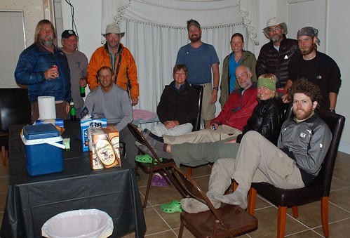
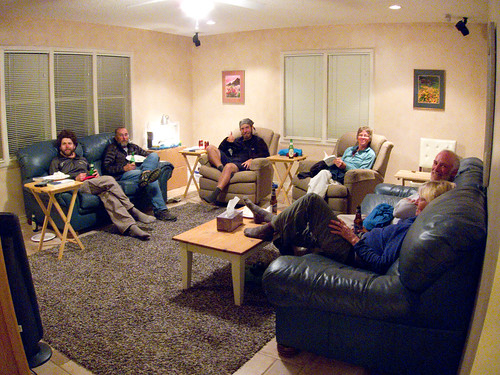
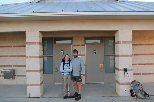
Photo take by AWOL, nabbed from Facebook. We hung out in the rental house that AWOL is renovating for awhile before heading over to his house for pizza and chatting. It was nice to try to get to know a few of the other hikers out there and to get some scoop of Florida Trail knowledge from Chuck Norris.
We decided to stay with Steve since he’d already been kind enough to invite us over so we headed there for our first good shower in a long time. That shower at Avon Park bombing range hadn’t been quite so satisfying since it was cold and we would get to check our email and relax a bit.
The next morning we decided we’d slack the rest of the road walk up 419 and S.R. 520 so Steve made us an egg breakfast and set off for where we left off the night before. On the way we saw two of the hikers from the other group slacking and finishing up their road walk.
It was mostly an un-eventful roadwalk but at one point we did have a scary experience when some idiot decided to pass on the left from behind us as we were walking on the white line!! There was no shoulder at this point only down on the grass which was hard to walk on. Despite not having heavy traffic, when there was someone coming our way we’d ditch off the road until they passed. I didn’t expect someone to actually try to pass on the left! Unfortunately I think this happened at least three more times throughout the rest of the hike. Having done so much road walking I’ve realized how bad people drive and do not pay attention. And how much they text and drive.
We ended up making better time than expected and met Steve at the end of Yates Rd before heading into the Tosohatchee Preserve.
We were pleasantly surprised with some more trail magic from Steve when he gave us oranges and home made chocolate chip cookies! Yum!! We said goodbye thinking we probably wouldn’t see Steve again.
That night at Tiger Branch campsite in Tosohatchee I called my mom like I called her just about every night. I know some people aren’t very into using their phone or calling home while hiking but I enjoyed calling for a minute or two to check on things. We double checked the weather with Chris’ dad because upon leaving that morning from Steve’s house we saw that there were severe thunderstorms expected for the following day. If anyone knows me it’s that I despise hiking in rain. Ok, so a drizzle isn’t bad and a rain that lasts 30 minutes and stops isn’t bad, it’s the all day rain and nasty weather that I can’t handle. Plus, wet boots? Blech.
The night was quiet except that sometime prior to my urge to get up and pee there was a loud animal that ran right by the tent. I suspect it was a pig because it ran heavy and gregariously. So, when the urge to pee came along I was wary about running into said animal, or made up monster in my groggy mind.
It was overcast that morning and we’d decided to get up early in order to make at least 13 miles to a campsite in Seminole Ranch WMA before it started raining. We’d heard that it was supposed to start getting bad after lunch so if we could put some miles in we’d be ok.
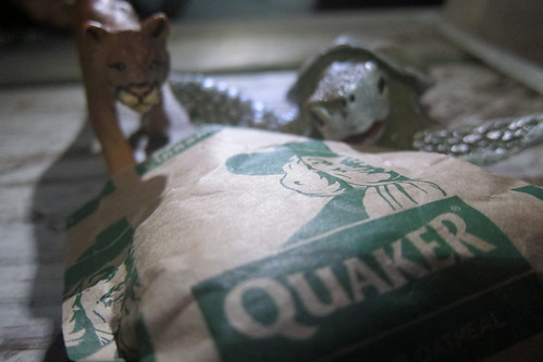
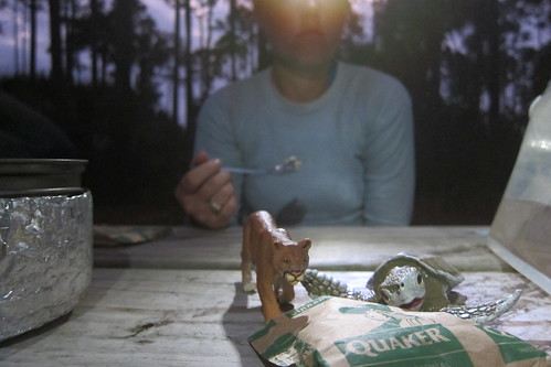
Oatmeal….not on my list of edible items anymore. It really stinks too because there are all these ‘gourmet’ oatmeals out there now and I pick them up, turn the boxes over and then crinkle my nose and want to barf thinking about oatmeal.
As we walked through Tosohatchee the sky cleared a bit and though there were clouds our minds were in more ease as we felt like we could make the miles by lunch easily.

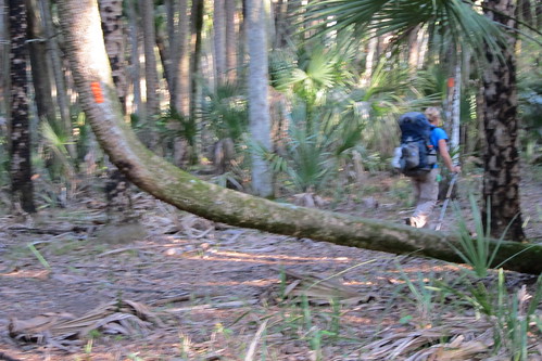
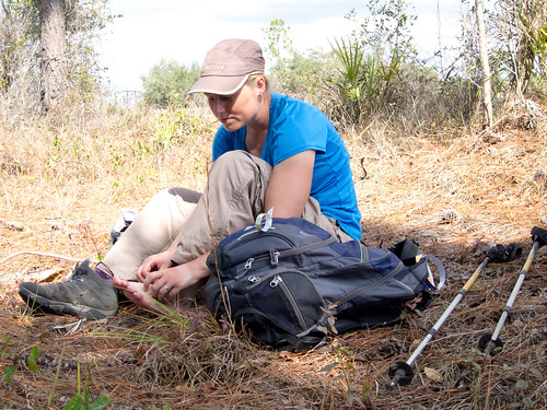
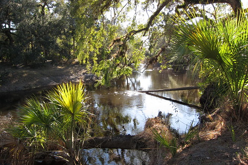
There are a few wetlands in Tosohatchee but most of them we were able to avoid. However, one of them made us change our shoes despite our attempt to look for ways of hopping across on logs or patches of dry ground.
At S.R. 50, the road to Christmas we needed to refill our water and saw an RV campground. There we were able to get water and chatted with the receptionists up front about the weather. They let us peak over their computer to check the radar out and saw that it now appeared the bulk was going to hit around 3pm. After downing a Pepsi so kindly given to us by the ladies after we expressed our dismay of their lack of a soda machine, we headed down the trail. A few more miles and we were at a wildlife cleaning station for hunters. The book said for hikers not to stay inside the covered picnic shelter, but it would have made a nice place to stay that’s for sure. We walked down a levee road that lead to another levee road, thankful we were on a roadway as it appeared to be water in a marsh all around us. We had to detour off to the southeast to the designated campsite.
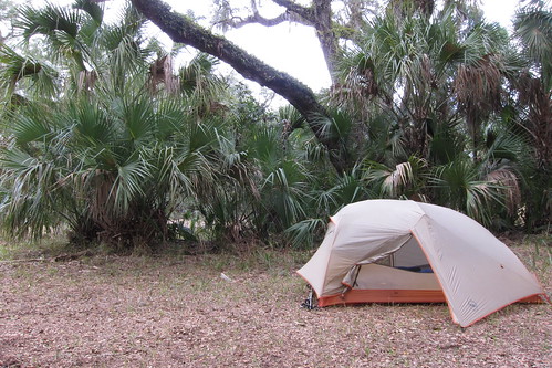
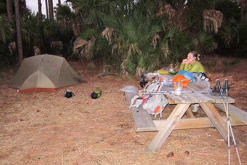
We got to the campsite at about 1pm and set up the tent and got everything ready in case the bottom fell out. Flipping through the book we’d decided that we’d stay in a hotel in Lake Mary since there were no good camping spots in the middle of Orlando. Chris called a hotel and got reservations for two nights hence and we spent the rest of the afternoon waiting for the rain.
We each did some exploring in the hammock to the south of the campsite. A bald eagle cried out from a nest nearby every so often.

After lounging more in the tent, flipping through Persuasion a bit, I pulled out the maps and looked a them. We’d been looking forward to going through Chuluota like the book mentioned but the map showed otherwise. It took us off into a detour back to the east and through the Little-Big Econ State Forest. And added more miles. Grreeeeat.. Chris and I debated for a few minutes before I called Chuck Norris since he’d hiked the trail several times and would know what was accurate. The map turned out to be accurate…drat! No deli sandwiches for us! And instead of having a 20 or 22 mile day it appeared we’d have to do 27 miles to get where we’d planned in order to get to our hotel on time. GAH!!!! Somehow Chris worked it over in his head that we really could do it and so I mentally got myself prepared.
At 3pm the rain still hadn’t come and at 4pm it started spitting a bit but finally, finally at bed time (5:30 or so) the rain finally came. We ended up moving the tent before bed after deciding it was too depressional in the spot we’d set it up and we weren’t sure how much rain was going to fall and the last thing we wanted to be was floating in the middle of the night. I found a talk radio station I’d listened to when we lived in Melbourne, Real Radio and they chronicled the storm as it moved through the Orlando area. Rain, hail, tornado warnings—gah! A leaking tent to boot! The storm came and went and the next morning we woke up to more overcast.
We made our way north to the Orlando Wetlands Park dodging pools of water from the rain the night before. We weren’t sure how wet the park was going to be, I mean it said wetlands, so we were going to be slogging? Turns out we walked along a levee on the north side of the park. Now, at this section there is trail that apparently opened up a few days after we went through, at least that is what we heard. Now the trail will go through other natural lands from the NE corner of Orlando Wetlands Park instead of going through the park and onto Ft. Christmas Rd like we had to walk.
We’d made it to the west side of the wetland park when it started with a hard drizzle resulting in us putting on our rain gear. Grrr! The roadwalk was quiet along a two lane road through mostly country homes and farms. We passed one trailer that had a yard full of junk and a yard full of animals (chickens, goats, cows, sheep) and not an inch of vegetation left. I’m not sure what the animals ate. Slowly the clouds broke and the sun came out.
Since we were hitting a 27 mile day we took shorter breaks more often. We were close to the Seminole county line when a car pulled up and it was Steve. He was checking on us from the night before. When I’d called Chuck Norris the verify the map issue he’d offered to come get us since the storm was coming, but we were too far out to be easily accessed. Since we were hitting lots of miles and were on a time crunch he didn’t walk with us so we said goodbye and thanked him again for his hospitality and the trail magic.
A few more turns on some other roads and we ended up back in the forest. This time we started seeing a few hills and some clear running creeks. Cool!
We stopped for a short lunch at the first campsite we saw and it appeared to be relatively new. I wish we’d taken more photos in this area but since we had tunnel vision for miles that day we didn’t stop nearly as much. Some new trail work had been done, bog boards in some areas, but we found on wet area that was a hundred yards or so in length that was bog board deficient. And the water was cold! We’d met a hiker lounging in the scrub before that who’d warned us of the wet area. He was doing a southbound section but said he was going to get off early because of a bad attitude!
Finally we came to the rails-to-trails trail that joined up where we thought we’d initially be going through at Chuluota. We took that north to the Econlockhatchee River.
It was late afternoon when we arrived at the river and we still had several miles to go.
Our goal was to get as close to Lockwood Blvd at possible, the start of civilization. We followed the winding river through beautiful terrain. I wish I’d known about this area while living in Melbourne because it would be great kayaking and exploring. We walked and walk and started hearing roads and kept thinking we were getting close but weren’t quite there yet. Finally we passed a trail runner and figured that we were getting close. The map labeled a possible campsite, not designated, on the map about a quarter mile from the road. We’d passed it and ended up at the road and had to backtrack, setting up in a sandy area in the oaks.
The next morning we wanted to get our 19 miles in as soon as possible in order to do our resupply and enjoy the hotel room.
We first stopped at the Oveido Sports Complex to use the restroom and refill our water and then stopped by a gas station to get snacks and sodas. Inside the station we got a few weird looks. Now on the AT and in some neighborhoods on the FT I might consider leaving my pack outside, but this was not the neighborhood to do such a thing. Chris left his near the front door but I kept mine on the entire time. We talked to a few guys from the neighborhood about the hike and what we were doing. It seemed that everyone we passed on the city walk thought we were practicing for something or hiking with ski poles. Seriously people?
We started our urban hiking by walking through Round Lake park and entering a subdivision where we found blazes painted on the back of fences. We were walking through at the time kids were heading to school and I felt a little odd walking by kids heading to a bus stop. After crossing a few roads we found our way on the Cross Seminole Trail, a paved bike path. We’d been on a few minutes when we started getting confused as we did not see many blazes. We’d turn around to make sure we didn’t miss one and still worried we’d missed a turn, kept going.
As we were about to cross a road a car stopped and honked. At first I thought the driver was angry at us and then I spotted the Florida Trail Association license plate on the front. Ah, someone who was hiker friendly. Turned out it was Joan a local trail angel and someone familiar with the trail in the area. We chatted with her for a bit and found out we were on the correct trail and that we followed it for a long way until we got out of Orlando. We told her that there should be more blazes, at least every quarter mile, as a reassurance. She told us she wished she had something to give us but had only Kleenex—something I didn’t need at the moment but always seemed to otherwise; my nose runs a lot while hiking. Thanks for stopping Joan!
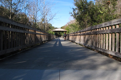
Crossing an old railroad bridge.
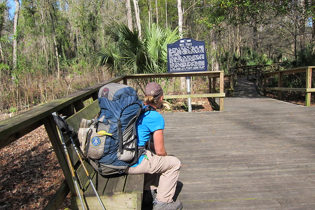
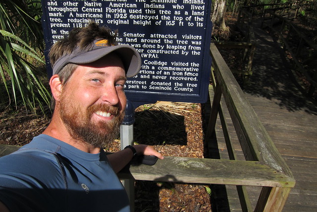
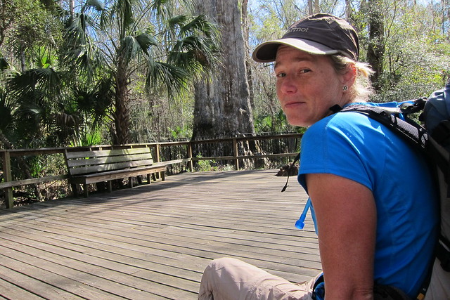
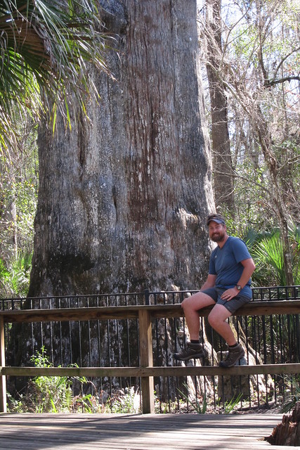
Most of the walk from Oveido to Winter Springs was between home developments, through a sports complex and past a few schools. Then the trail ducks off into an industrial area and at first we thought we’d lost the trail again only to find it went through a construction site where it appeared they were shredding trees and then onto another sidewalk under a powerline. After turning at Soldier Creek park and crossing S.R. 419 we ran into Amanda, one of the hikers we’d met at AWOL’s house. We’d caught up to the end of the group. She was having some foot issues and was taking a break and so we left her to rest and not much later we were following within a few hundred feet of Max. We ended up losing him because the highlight of the day was coming up, Big Tree Park. This was where we’d find The Senator!
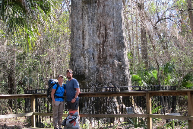
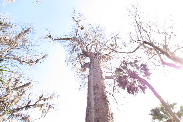
The Senator is the oldest pond cypress in the world! It’s gigantic! Nothing I’ve seen in our swamp tromps compares!
The park has a restroom but the sign says not to drink the water. That’s ok because it is only a quarter mile or so to gas stations on Ronald Reagan Blvd.
We hit up 7-11 for a very junky lunch—delicious, but junky! I think it consisted of taquitos and hot dogs, something that I’d normally pass up but instead devoured.
More neighborhood walking continued as we headed north and eventually we ended up on another sidewalk under a power line. The entire time we walked through Orlando I kept looking for stealth spots. There were some, very few, but I suppose it would be possible. Then again, you could get a cop hounding you to move or dealing with neighborhood kids. It just seems dicey.
The walk along the sidewalk dumped us on Reinhart Rd through shopping strips on all corners. Along the way we met a guy in his 20s asking us if we were preparing for the AT and of course we told him we were on the FT and that this was indeed the trail. He continued walking with us as we discussed the financial and gear aspects of hiking the AT. He seemed genuinely interested and hope he gets to hike someday.
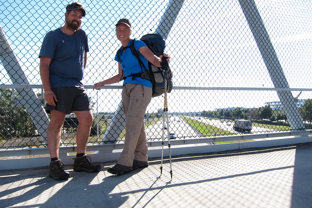
Finally we came to the pedestrian bridge over I-4 signaling we were close to our destination for the night.
Once we reached the corner of International Parkway and H.E. Thomas Parkway we spotted the Chuck Norris crew. They were hanging out in the Publix parking lot, eating food and a few were continuing their walk north for another hour or so. It was 3pm and we’d blazed through 19 miles.
We chatted with the group for awhile before walking across the parking lot to the Hampton Inn. I was looking forward to a good bed, doing laundry and getting a shower in. The plethora of restaurants nearby made us even hungrier! The Publix was a great resupply and we had dinner at Moe’s, a burrito place, a decent substitute for real Mexican. Mexican is our go-to food choice when getting into a town but we only had it once the entire trail!
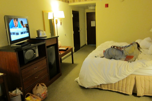
This was definitely a nice hotel to stay at, beating the heck out of the two motels we stayed at later on!
Next up we’ll get back into the woods!
One Comment
Patrice
Really pretty section, especially the video. With the exception of the urban areas of course! Cool bug picture too!
You didn’t carry tissues with you on the AT? My nose always runs when I’m hiking and I never have tissues. I figured it would be a must-have on the AT.
We LOVE Mexican food too! Guess it makes sense that there were not a lot of places to stop for Mexican along the AT though.