Florida Trail Tales 8: Suwanee River to U.S. 221
I forgot to mention in the last post that Shamrock Steve had shown up at our motel the evening before after spotting our boots out drying. He’d been doing some hiking around the Osceola National Forest area and had left us a message on our phone but we had been further than where he was planning to hike. He’d seen our note in the journal at the Madison shelter that we were planning on taking a zero in White Springs so he knew he’d catch up with us.
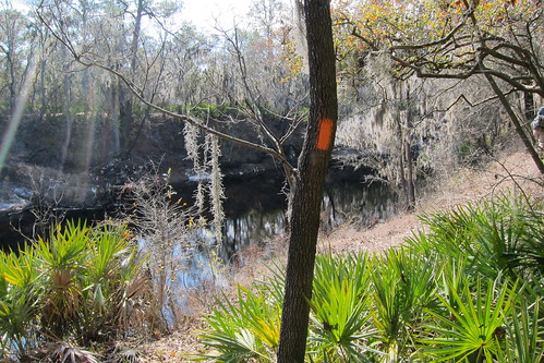
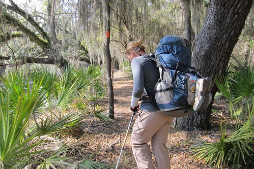
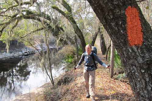
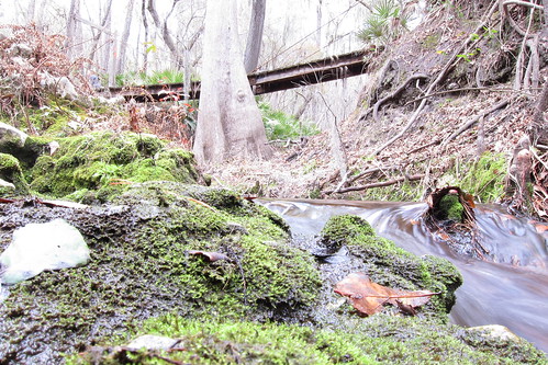
After breakfast at the bbq joint that morning with Shamrock Steve we left White Springs. It was a sunny, beautiful morning as we entered Stephen Foster State Park. We lost the blazes for a few minutes but wound up where we were supposed to be, down by the river. Steve had left ahead of us and said we’d catch him, which we did. We walked along the bluffs and we started having more terrain that we’d been used to. Up and down the rolling bluffs, next to thickets of palmettos.
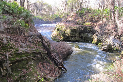
The water was moving from the rain several day’s before but was still not what it should be for that time of year. Since we’d left south Florida we’d moved into a different climate and rain season. It’s usually pretty dry in south Florida during the winter but north Florida seemed to get more rain than we were used to.
We crossed a few small creeks that lead into the river and were glad they weren’t flooded and knew they had been a few days earlier. It reinforced our good decision to skip the river section on our way into White Springs. We’d of done some wading.
We crossed I-75 for the second and last time. The first was right after we’d left Big Cypress on our third day out on the trail.
I really enjoyed this section, particularly because it was sunny this day. It’d been so grey for the last week that the sun drenched its warm gold on the vegetation and warmed the pine needles.
Somewhere, I think it was before lunch, we came to a bluff that had a long wire coming from the top of it to help you climb up the bluff. While it was a bit tricky with the slippery dirt, it wasn’t nearly that complicated. It was something you’d see on the AT but wasn’t necessarily needed for the FT. The book had listed there being a ‘mountain’ or a big hill that was supposed to be one of the hardest jaunts uphill on the FT. We wondered whether this was it or not, but once up to the top we didn’t get the view that was supposed to be seen. We guessed this wasn’t it.
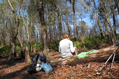
We found a small, dry cypress pond with a few logs to sit down for lunch.
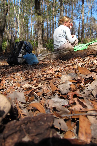
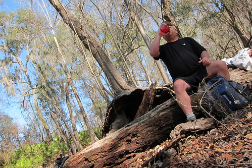
We were about halfway done with lunch when Steve showed up. He sat with us for awhile to chat and rest. He wasn’t going as far as we were and was planning to get off at another trail head and hitch back to the b&b he’d stayed at in White Springs.
This time it seemed he was really saying goodbye to us because he planned to do the rest of the trail in order as he sectioned it westward. Doing our 20+ miles a day he wasn’t going to catch up with us. We said goodbye and mosied on down the trail.

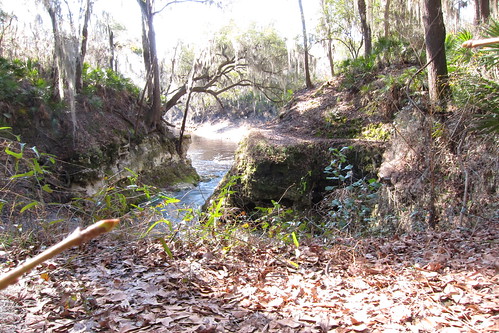
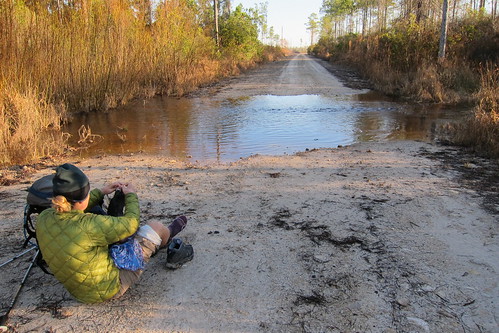
Stopped here to fill up water, nice bridge!
The rest of the afternoon was pleasant as we followed the river. We heard CR 51 for awhile as we weaved around the bends and turns of the river before we finally crossed it. It was getting near time to look for a campsite but we ended up finding an area that was full of homes and it was difficult to try to find a stealth spot. The sky was clouding over, preparing for the next days round of bad weather. We ended up stealthing just past an old rail road bridge in the flattest spot we could find. It didn’t take long for us to finish dinner before the first raindrops came our way.
Not keen on hiking in the rain again, the next morning we slept in an extra hour to let the rain pass. We turned on our radios to listen and found that the worst had passed so we packed up and headed down the trail.
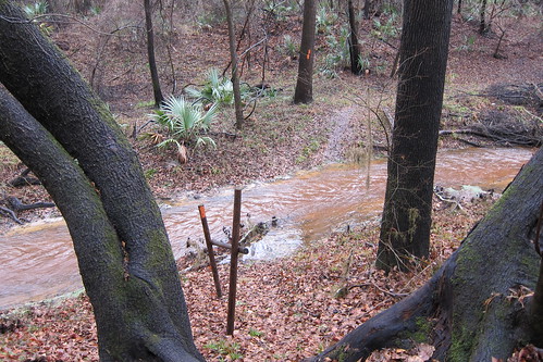
What we found was this: flooded creeks that involved taking our boots off, for what it seemed, every 10 minutes. Ugh! This was going to be a long day! We did end up crossing a handful of streams that involved wading up to at least knee deep, sometimes we’d just cross barefoot to skip putting on our other shoes, other times Chris tried to find a way to jump across or walk across a log, mostly ended up wet in the process. I just gave in and took my boots off anyway. Usually we’d walk up and down the bank to see if it narrowed enough to cross but we’d waste as much time doing that we would with the on-off boots thing. At least in this area the trail maintainers were nice enough to try to label the names of the streams! If they’d been in the guidebook it would’ve been a good way to tell where we were.
Our walk along the river eventually ended as we turned north through a wildlife management area and into a dry swamp area and then into an oak scrub area where we stopped and had lunch on a log. We refilled our water at a check station before ended up on a dirt road for the beginning of a road walk around private property.
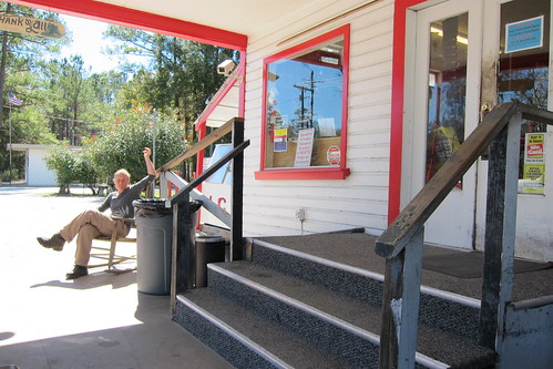
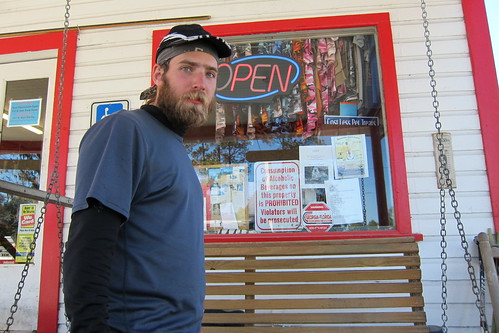
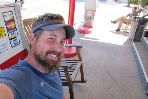
On CR 249, where we emerged from the woods, we saw a sign for a general store. We approached the log building and saw inside two women baking and decorating cakes. We opened the door and told them we thought they were still a general store and were looking for sodas or something to snack on. They’d seen a hiker or two so we weren’t too strange to them, and luckily they scrounged up some sodas for us. We sat on their front porch swing while a friendly dog came over for pets. The Cake Ladies, as we soon started calling them, came out with scraps of cake they kept in the freezer and asked if we wanted some. Of course! I lamented after they went in that some icing would be really good not thinking that I’d actually get some, and soon enough they came out with icing! Oh, sugary goodness!
We wrapped up our sugar high and said goodbye to the Cake Ladies and informed them of the group behind us a few days and told them to be on the lookout. The sun had come through a bit during this time and warmed us as we walked down the road. We’d gone too far for to turn around when I realized my snot rag, my green bandanna, was gone! I must’ve left it at the store. Oh well, at least I had another. I know, I know, seems silly to be sad over a bandanna, but it’d gotten soft out of so much use in the last year of hiking.
We encountered more trail routing idiocy at the end of that road when it veered off down a short side street only to emerge just south of where it would’ve emerged had we followed the original road to the end. We both shook our heads at the stupidity of the planning of that, why is it like this to begin with?
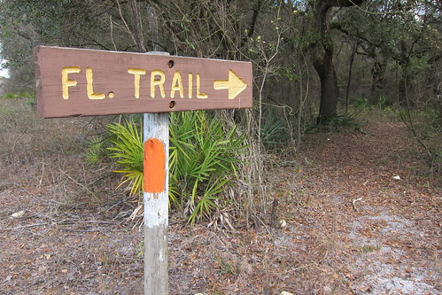
Up another road and then into a short section of the Lower Alapaha Conservation Area before we were back on another dirt back road which led to more dirt roads. It was here we started seeing double blazes with arrows. Like we need arrows when the double blazes should do their job!
We got a bit bored here and started drawing things in the dirt with our hiking poles, leaving message behind for Speaker.
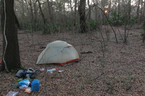
Finally back in the woods at the Suwanee River State Park, where we found our campsite for the night. One of the nicer sites we had on the entire trail.

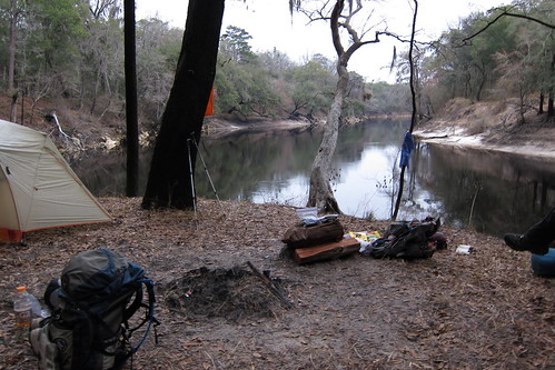
We found a small outcrop along the river to camp for the night.
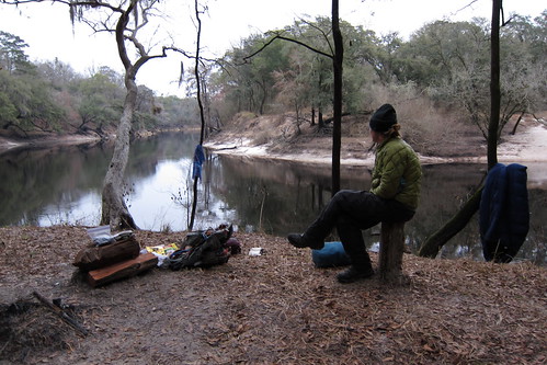
It’d been used several times before as a fire pit was already built and wood had been chopped, making good seats. Sometime in the night we heard some weird noises, not fox noises like we’d heard previously, these were bird-like.
The morning dawned almost as evening had left, grey and dismal and if you didn’t have a watch you might assume it looked like the same time of day. This grey and cloudy stuff was starting to get old!
We continued walking in Suwannee River State Park that morning, passing some of the campgrounds and the terrain was similar to what we’d been in the last several days.
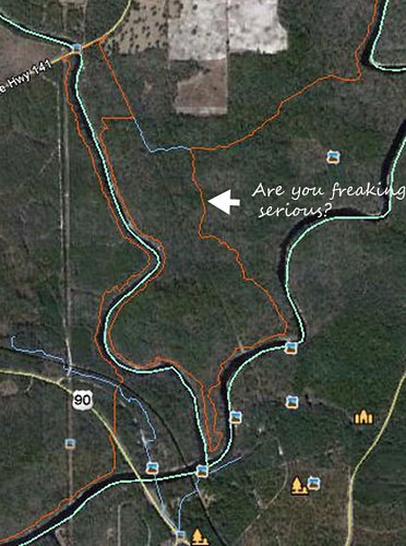
Chris and I had been arguing for a few days over whether we were going to take the absurdly out of the way real trail or a short blue blaze in this section, highlighted above. The real trail apparently went down to a large oak tree, and while we did see several large oaks and none were even labeled so I don’t know which was the ‘big’ oak. I thought it was ridiculous to go out of the way like that when the blue blaze was so short. I lost that argument and down the orange blazed trail we went. Along the way we noticed that this route had been blue blazed at one point and apparently someone got it in their head to make this orange. Bad idea folks! At least label the tree or make it more enticing to go down and see, right now it’s just an additional mileage water haul! It was pretty, but nothing different from the previous days of hiking.
Up onto a road and then over the Withlacoochee River, which dumps into the Suwanee, and then back into the woods, we were taking a short break when Speaker walks up. He’d caught us that morning because he’d taken the blue blaze instead of the real trail. We talked for a few minutes about how he and the rest of the Chuck Norris crew had taken a zero the day it rained, the day we walked through it, and how he’d been doing big miles to catch up to us.
We entered Twin Rivers State Forest, passed the ghost town of Ellaville, mostly remnants of old bamboo from gardens and some bricks and things lying about, small signs of life. The sun was coming out full blast by now and made the day beautiful. We followed a nature trail, meant for day hikers, along the river before we forked away from it and then found ourselves running into I-10. Walking along the fenceline of I-10 and the state forest, we had to parallel it for a mile or so before getting onto a road to take a bridge over the highway.
Our gear was spread out near the junction of I-10 and River Rd while we had lunch. It was here we learned we weren’t going to have to do as many miles as we originally thought, they’d gotten added wrong that morning. Instead it would be a shorter day and the following would be at least 25 miles to get to some sort of area for camping. We were going to be entering private lands the following day and camping was supposedly prohibited.
A woodcock…don’t remember where we saw it that day, but I’ll throw it in here for good measure.
Speaker caught back up to us, he was still on his own hiking schedule at that time, just as we were leaving lunch. We followed River Rd. down to another conservation area which dipped into the woods for a camping opportunity next to the river. We stopped for an extended break since we were full on time with less mileage. The trail left the woods again, followed the road once more before heading back into the woods where another campsite was located.
At the designated campsite, a picnic table and access to the river, we sat for an hour or more. Two locals came down in their golf cart to scope out the river, talked how the water was up from a few days prior and we noticed that the river had come up since we’d been sitting there. We contemplated eating dinner there but decided to walk 10 minutes further to find our camping spot for the night.
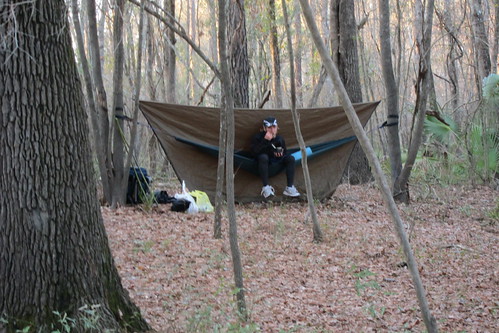
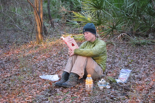
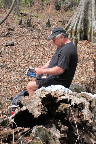
It was still early enough even by the time we got to camp to read and sit around for awhile. Speaker was the smart one and had got water down at the designated site while we ended up scrambling down a steep bluff to get to the water for dinner and the following day.
The next morning we began a long series of road walks, and I think most were primarily dirt or fill material roads. We passed farms and tree lots before entering a forested private property section for the majority of the day. This area was owned by a logging company but it was also leased to hunters and each of the hunters had their own section. So, you’d see particular name and warnings of it being on camera 24/7 and not to trespass and such. One could probably stealth in here fairly easy but I don’t know if I’d want to deal with it.
Most of the trail aka dirt road was decent, though some areas were flooded. We’d try to skirt the sides by walking on the vegetation, but sometimes that just didn’t work. We passed several hunters throughout the day and most just ignored us. When we’d stopped for lunch Speaker had been behind us so when he caught up he told us that he’d talked to a group that had seen us and was wondering what we were doing. I’m sure they don’t have a clue the trail goes through the area.
At lunch we tried again to call a trail angel we’d called the day before about getting a ride into Perry or Shady Grove for a resupply. It seemed this section was difficult to get a ride in, as ever person we called said they were too far away and the one person who was in the area was starting the same section we were doing but was at least half a day behind us. It appeared we’d have to hitch into town, something we wanted to avoid if possible. On the AT it was one thing to hitch, everyone knew about the trail. On the FT it could take awhile!
At this point we were in public lands again, the San Pedro Bay WMA. Despite having to walk on roads the entire day I was very glad to be mostly dry because the entire area was very, very wet. And logged. And looked nasty to walk through. We managed to go most of the day without taking our boots off to cross water until we came upon one section that was impossible to evade. Boots came off and it was cold water! At this time of the year the nights are pretty chilly and it was keeping the water cold during the day even though the air temperature warmed up quite a bit.
Our 25 miles for the day would take us to what appeared to be the start of the Econfina River, at this point it was a small, tannin colored creek among the cypress. We went up to the river to get our water and backtracked a tenth of a mile to a turnoff to a dirt road that was gated off. Speaker came up and figured out a way to hang his hammock from the yellow gate as there was not a suitable area for his tent anywhere around. That night we heard coyotes come by the tent, probably walking down the road.
Speaker arose and left early the next morning. Since we all had to go to town he figured it’d be better if he split from us so we could get a better hitch. Plus he was going to take a cut-off from the trail and exit closer north to Shady Grove than the trail actually does. We’d nixed the idea of trying to hitch to Perry because we thought of the difficulty of getting out of town and that Shady Grove would be a closer walk if we had to go that route.
We hadn’t gone far when we had to get take our boots off to cross a channel that was flowing across the road. And, lemme tell you, it was cold! I tried to walk on my tip toes to avoid getting my legs wetter than they had to be, but it was pretty difficult to avoid.
You could tell that sometimes hunters messed up the blazes as was evidenced when we had noticed that Speaker’s footprints, and moreover the other footprints we’d been following for days, had disappeared. I’d noticed a large oak tree at a road junction about a quarter mile back from where we’d stopped seeing footprints, and when I mentioned it to Chris we looked around for a minute and backtracked. Sure enough on the tree the blaze had been scratched out but the one for the opposite direction was still in tact so we knew we had to turn.
We arrived at SR 221 well before lunch, it was time for our mid-morning snack. Chris and I took turns sticking our thumb out and going for a particular round of cars, usually 5 or 6, before switching over. It was Sunday and we thought that it might be slow since this was the country and everyone might be in church. We’d get excited when we saw a truck, hoping they’d be nice enough to stop. Folks drove by in their Sunday best but didn’t blink an eye.
We debated how long we’d wait before we gave up an walked the 3 miles or so into town and then back out. We didn’t like the idea of an extra six miles for the day. Finally, after an hour and a half, a nice woman in a pickup stopped. She knew about the trail a little and told her we needed to go to the grocery store at Shady Grove if she knew where that was. We were just thankful for the ride! Half of our problem was solved, we’d have to get back to the trail, too.
A few hundred feet from the grocery store (gas station was more like it) we saw Speaker walking down the road with a cardboard sign. We waved and saw that he’d turned around to come back to the store. We thanked our ride who subsequently turned around to try to go get Speaker but he waved her off and said he was coming back to see us. He was wondering what took us so long! We’d done our best, but 1.5 hours was what it took. Still, it wasn’t our longest hitch, that was the 3 hours out of Baxter State Park when we finished the AT.
Speaker had become a hitching connoisseur since his hike on the AT, he’d even hitched from the Ft. Lauderdale airport to the start of the FT on Loop Road. We picked his brain for hitching trivia and suggestions.
Inside the grocery store at Shady Grove we quickly realized we’d be putting together some rough meals. It was also expensive compared to a real store. We littered the counter with tons of loose items for our resupply, I’m sure making the cashier think we were nuts.
We had lunch of pizza and soda before we left the store to try to attempt a hitch back to the trail. This time we had Speaker and his sign, which I should’ve got a photo of. I think it was all of 15 minutes before a man and his wife, in a truck, stopped to give us a ride. He knew where the trail was and since Speaker had wrote something about it being three miles down the road he thought it would give us an extra boost in getting a ride.
Soon enough we were back at the orange blazes and heading west.
One Comment
Patrice
This looked like a pretty section! I’m just a big fan of walking along rivers, etc. I like your first video – cute. What’s Speaker’s secrets on hitching? 3 hours out of Baxter … no surprise there, but yikes.