Pine Top Campsite via the Bush Mountain, Marcus and Tejas Trails
When we left Dog Canyon the next morning the sky was relatively clear. The forecast did not predict any significant problems so we left the campsite with an intent to take it easy along the way to our initial destination, the Tejas campsite. We planned on stopping along the way to enjoy the scenery, take lots of breaks and really soak it all in.
On the Bush Mountain trail we headed in a westerly direction along the crease between two hill tops. We followed on the flat terrain for maybe a mile, perhaps less, before starting our wind up the hill. Initially we’d bundled up but as soon we we entered the sun out of the shade from the nearby mountain we started shedding layers, plus it became warm as soon as we started exerting effort on our climb up the hill.
On top of the first hill we knew we’d have it easy for awhile as we ridge walked and then descended again before going up once more. On the first ridge is where we looked to the north and thought, “Uh oh”. Ominous clouds were in the distance and we both said we hoped that it didn’t involve rain, but we saw a rainbow and, well, you know how rainbows are formed. We trucked along when all of a sudden the temperature dropped and I scurried to put some layers back on. Then Chris pointed out that he thought the precipitation that began coming down was snow flurries! It was then that I suddenly had an image of a freak snow storm and us trying to find our way on a mostly unmarked path, other than the well trod path we followed. No blazing, very few rock cairns….we were going to be stuck in a snow storm. Ok, so I got an overactive imagination at that point, but it does help to start thinking about what you might do in a situation like that.
We started descending down the hill and of course it was cloudy, snowing lightly and getting colder. Now would have been the time to go up hill. Over to the south we could see the Marcus trail where we could be going up another hill in a little while.
Down at the trail junctions we stopped to take a snack break, get some sugar into the system before heading up the hill. Heading down the Marcus trail we were again walking on flat trail between two sets of mountains and we found evidence of previous homesteads or campsites when we walked by an old trash pile with rusted cans and bottles that were quite possibly 100 years old. Right before that we had scared up a decent herd of mule deer, one fawn heading off in the wrong direction at one point but we knew they would all gather back together somewhere out of sight.
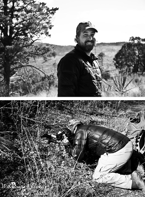
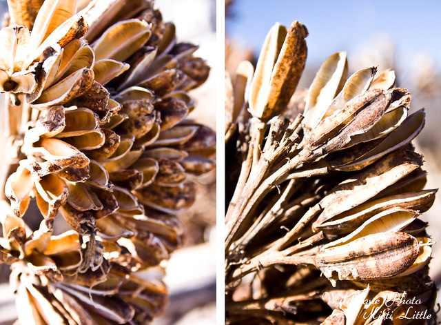
Then it was time to start climbing again, and it wasn’t terrible and of course I took my breaks. We were on top of the next ridge before we knew it and as I was eyeing a downed agave, Chris decided to take a photo of a live agave near it. I took advantage of the moment to rest and eat a snack. The sun was fully out now and it was warming up a bit by this time, enough to shed a layer or two. The ridge was peaceful and quiet and in the distance we thought we spotted a golden eagle but weren’t sure. Chris thought the flight pattern was definitive of an eagle but the bird never flew close enough for a positive identification.
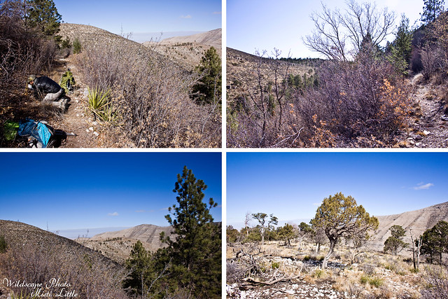
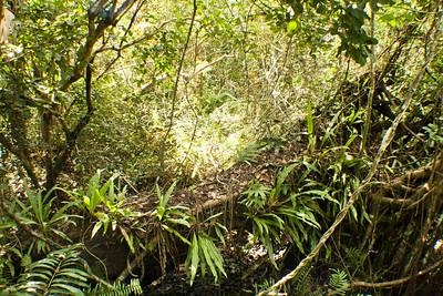
From the top we wound around the edge of the ridge, slowly descending and flattening out.
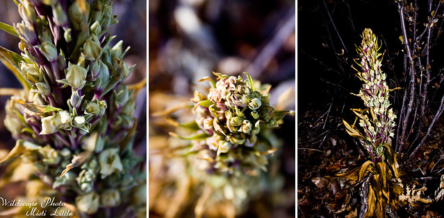
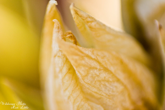
Along the flat part we stopped to check out this flower, initially thinking it might be an orchid but then deciding it wasn’t upon closer inspection. No matter, we had plenty of time to stop and take photos so we both dug our cameras out and took some shots.

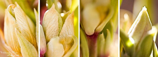
Chris left me to take these macros, slowly walking down the trail to see what he could find. When I finally started heading his direction I walked slowly, taking my time and enjoying the quietness of walking alone. I rarely walk by myself in the woods and the feeling is very different.
When we intersected the Blue Mountain Trail we knew we were about a third of a mile from the Tejas Trail junction. We were descending into a small valley where the topo made made it appear we would walk along a creek. Sure enough, after the Tejas trail junction we did find the creek and walked for about a mile after to the entrance of the Tejas campsite. It was only 1pm; we’d talked about moving on to the Pine Top campsite which would allow us to have less miles in the morning and to be completely downhill for our exit of the park. With a ten hour drive back to Houston, less hiking was probably ideal. We sat for thirty minutes or so at the Tejas campsite entrance to snack and rest before summoning up the energy for the final ‘up’ to the Pine Top campsite. The topo signaled it wouldn’t be very difficult, a few switchbacks and then mostly straight up on the ridge with a small up at the end to the campsite.
When we got up the first set of switchbacks and to the the top of the first hill Chris declared that he thought it was PUD, “pointless up and down”, because we shortly descended a bit to rise back up to another small hill. From there it was easy walking and I kept trying to determine which bigger mountain we were aiming for, which one the Pine Top campsite was located at.
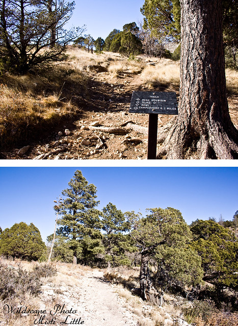
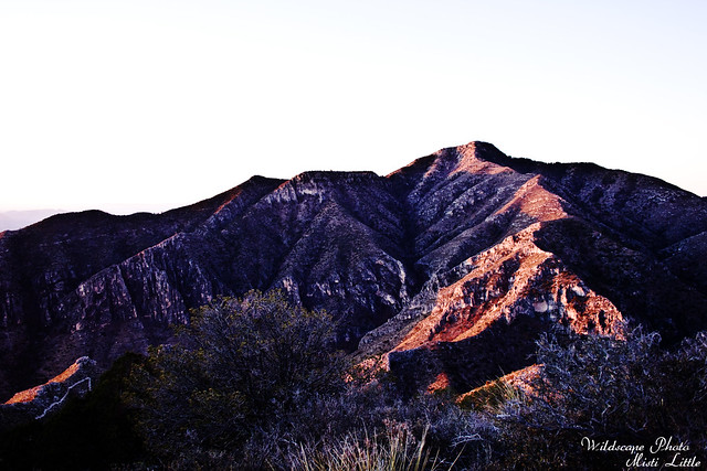
In front of us the mountains grew larger and I finally determined that we were getting closer, thinking that the mountain in front had to be Guadalupe Peak. Finally, we saw the metal sign marking the trail junctions.
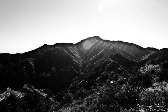
And there it was, Guadalupe Peak, where we’d been only days before.

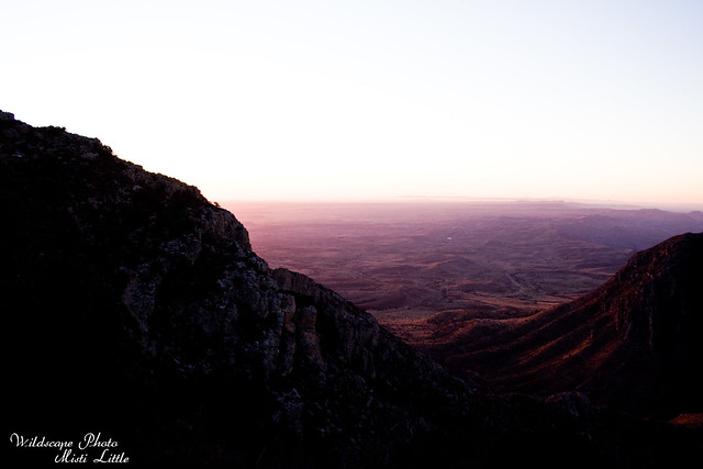
Looking southeast towards the visitors center.
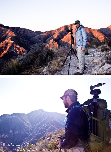
Chris scoped out a place for sunset photos and we walked the .2 miles up to the campsite. Several of the tent pads were not very level, we bypassed those for one further back and more sheltered from the wind up top. Quickly we set up the tent to dry out from the previous night’s rain; it had frozen to the tent and still had not melted. We shook the fly off, ice flying everywhere. Later we looked down at the ground and saw a pile of what appeared to be snow and wondered if that was what had come off of the tent or if we had somehow overlooked the little pile of snow/ice when we set the tent up.
We ate dinner early, partly because we were hungry and partly because we were cold and wanted something to do. I attempted to walk around further down the other end of the Bush Mountain Trail but was too cold to want to bother with much.
I did manage to take this before heading back to camp to get into the tent for the night. I snuggled in the sleeping bags, doubling Chris’ over on top of me until he got back from taking photos. Despite zipping our sleeping bags together for the night we were still shivering for awhile before sleep, tossing and turning throughout the night when one of us got too cold.
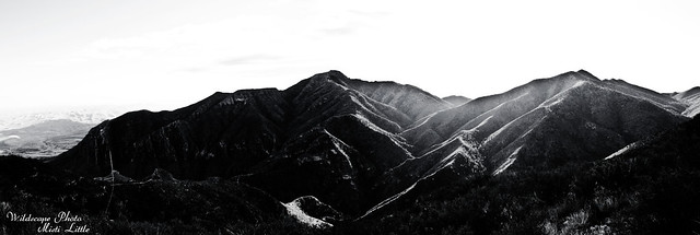
The next morning we quickly took the tent down and scurried over to the edge of the ridge where Chris attempted to take sunrise pictures.
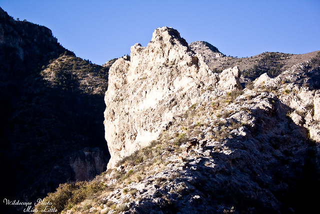
We weren’t exactly in the best position, so we packed things up and headed downhill. Along the way we stopped a few times for Chris to take a few shots but then we stopped for longer to watch a small herd of Barbary sheep.
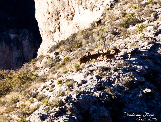
Neither of us had a zoom lens on us and instead we made do with our landscape lenses. I cropped this one so you could see the sheep. One of them, maybe the leader, was ahead of the pack and already topped the small crag and went over the other side.
Only a few miles more and we were at the Pine Springs campground once again. I was partly glad to be done but sad to not be out in the backcountry still. There are still other trails we didn’t see that I hope to eventually hike one day.
So much to see and not enough time!
5 Comments
Chris
Great trip with my wife!
Chris
Great shots…that place looks amazing! You guys are so lucky you’re able to take the adventures that you take 🙂
Patrice
You ARE living adventurously for sure! Great pictures! I am jealous you did end up spotting the barclay sheep …
Pingback:
Pingback: