Thanksgiving Morning From The Top of Texas
We arrived at the Pine Springs Visitors Center at Guadalupe Mountains National Park somewhere around 11am MST. Patrice and Justin were going to be meeting us in a few hours and I was surprised that we’d arrived at the visitors center so quickly. That and we didn’t anticipate a time change though I should have figured that we were going far enough west to have one. The extra hour was definitely a bonus.
Inside the center we filled out our backcountry slips and took a look around the exhibits, watching the video in the small room behind the main desk. Killing time, we decided to get everything together so we could book it as soon as they arrived. A few texts were exchanged and they were going to arrive around 1:30 MST, which they did pretty much promptly. Chris was anxious to get to the top of Guadalupe Peak, the 8,749′ mountain that reigns as the highest point in Texas, for sunset. The ranger at the visitors center said that three hours would be a fast time for anyone to climb the mountain, but he didn’t know that there were two recent Appalachian Trail thru-hikers that could probably whip that out pretty fast (Deal and Steadee) and though our thru-hike was well over a year ago we figured we could do pretty well. (I think it was somewhere around 2.5 hours to the top for us…Patrice can verify, she had a Garmin Forerunner clocking our time and altitude).
We were the only ones to start up that late and most folks were coming down by that time. I took my time, slowly and steadily, and not feeling so great from the slowly increasing altitude and from not eating a good lunch. Bad choice on my part! A mule deer was scared from its resting place just off the trail about a quarter of the way up and we encountered an obnoxious if informative kid saying that “we had a long way to go” still. Yeah, we know, dude. Then, since we were all A.T. thru-hikers we lamented about the ever persistent question on the trail when descending a mountain “How far to the top?”. The answer in our head would have been “Well, for you or for me?” After one has covered so many miles it is easy to become quickly efficient at hiking up and down a mountain. Of course we didn’t answer so snidely and are nice about it, “Well, it’ll be awhile, sorry!” This time though I definitely felt on the other end of the stick since I was out of mountain shape and my lungs were feeling the pressure.
The peak we thought was the summit turned out to not be the summit, of course. This is the ever annoying curse of “That must be it!” and it really isn’t. The false summit was instead the 1-mile from summit campground. Looked promising.
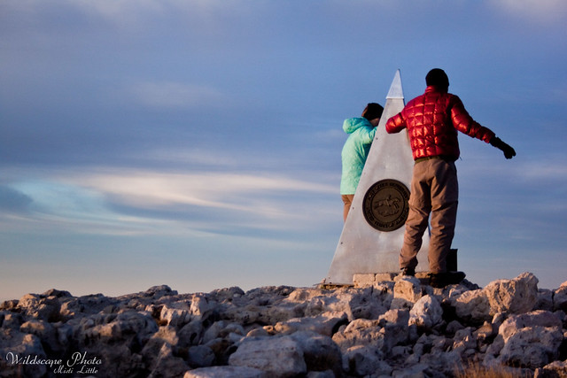
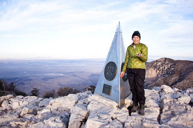
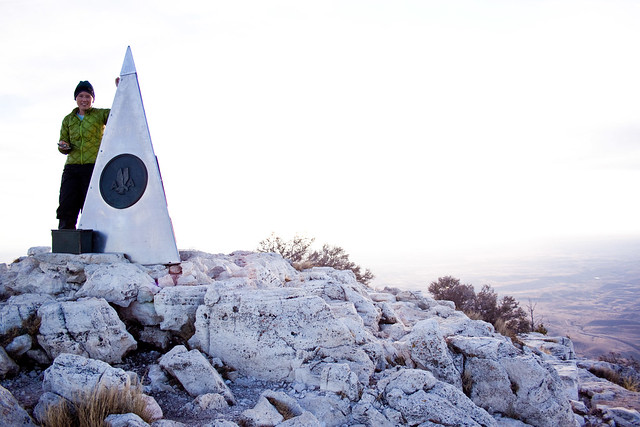
Up, and up, and up. Round, and round, and round. We spotted the horse hitching posts and then Chris noticed the monument on the top of the summit.
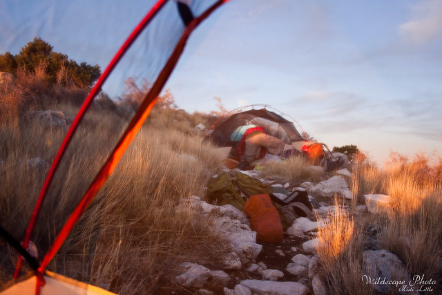
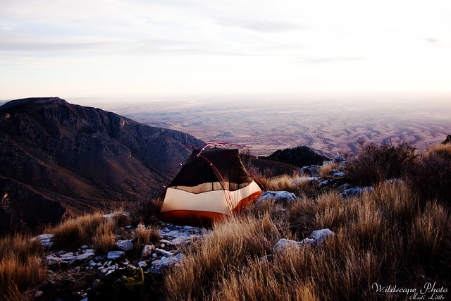
We’d made it! The rotten thing was I was so shaky and had started having leg cramps on the way up (a banana would have made me feel a lot better!) that I immediately started making dinner. That, compounded with the wind chill at the top didn’t allow me to share in the hub-bub of making it to the summit. I just wanted food and to get in the tent. We decided to find a good patch of rock to set the tent up on instead of descending the mile down to the campground and pitched the tent on the summit instead.
It was a great choice, the view was magnificent and the stars—-wow, the stars! We left the fly off the tent that night so every time we woke up to turn over, our view was to the beautiful stars above. Before we went to bed we were stunned by the amount of cars driving down the road to the east of the park. The lights were endless and we only guessed that it was holiday travel coming to the park or going to areas in southeastern New Mexico (Carlsbad is less than an hour away) and west Texas. Chris took some great shots of the lights and when he gets them downloaded and processed I’ll post them here.
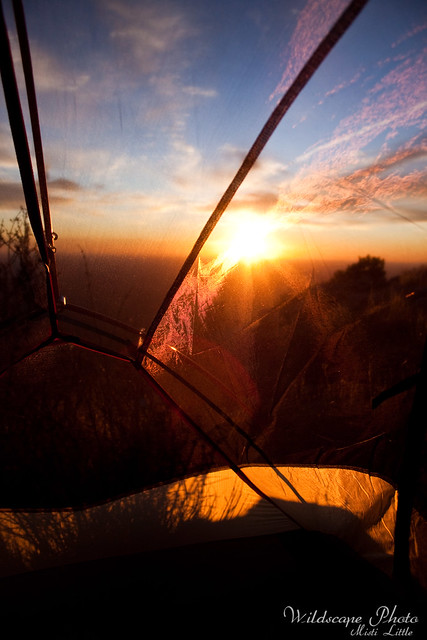
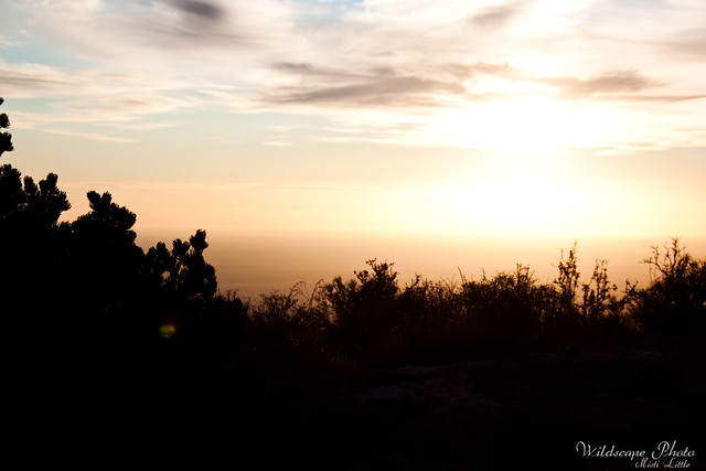
The next morning was awesome! Sunrise was wonderful…perhaps almost as good as Sunrise on Katahdin, I mean, I think the 2,179 miles behind that summit made that one, but it was still pretty awesome.
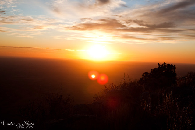
Was not going for composition here. I literally reached out of the tent for my backpack, got my camera (we carried our good dSLRs up) and shot the photo out the door of the tent.
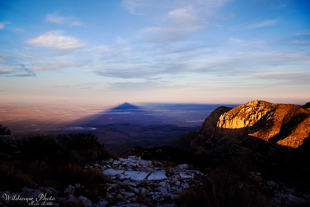
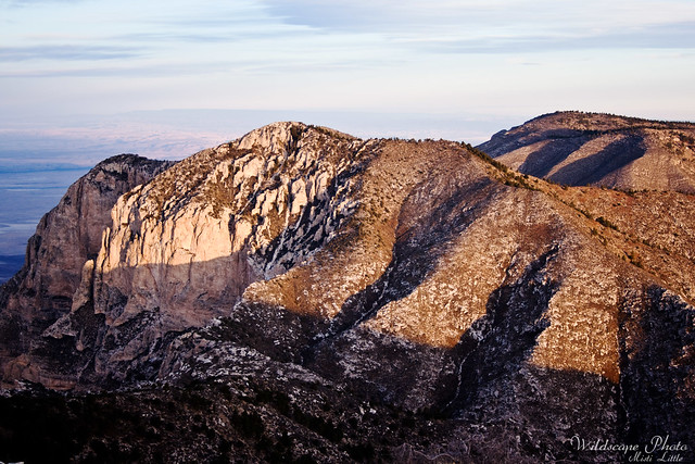
Looking west, the shadow from Guadalupe Peak on the flats below.
Deal and Steadee
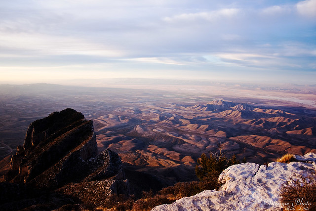
View south to El Capitan and the salt flats
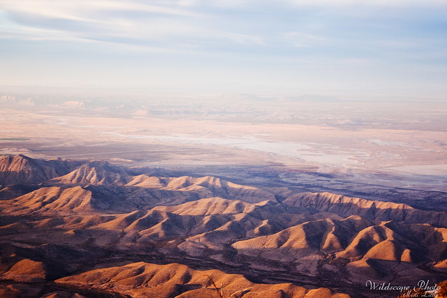
The salt flats again
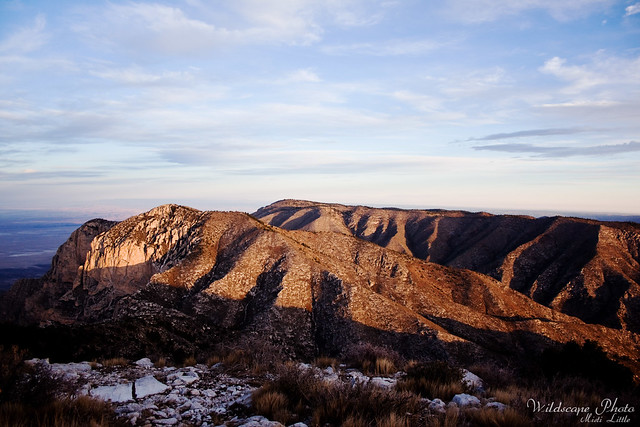
Looking northwest towards the rest of the range
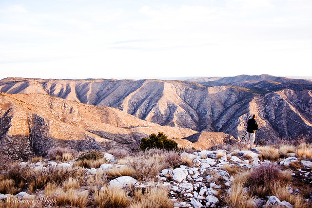
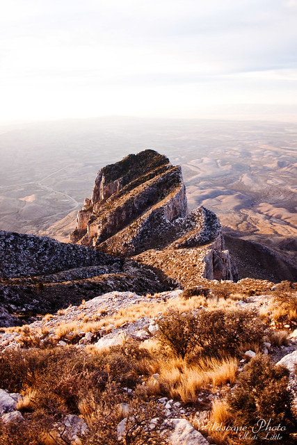
We camped directly on the other side of the canyon, there, our last night. You can see the trail, the Tejas trail, that goes down the mountain on the far right side of the photo.
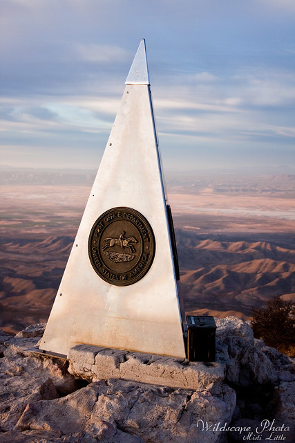
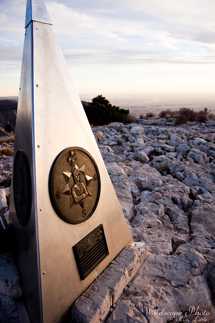
About the monument erected by American Airlines in 1958 honoring the Butterfield Overland mail route that went through the region.
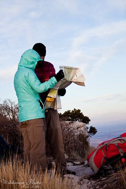
Deal and Steadee studying the map…
I took Ridley, the little sea turtle mascot my niece gave me when we did the Florida Trail, to the top.
Next up, we’ll descend and then hit up McKittrick Canyon for some strenuous, but beautiful, hiking!
6 Comments
Patrice
OMG, for feeling sick, you got some really beautiful shots. I am so bummed I didn’t get any pictures of the 2 of you with my camera (aside from one of you guys hiking, but it’s far away). With no pictures, people are still asking me, who is Misti & Chris???
Can’t wait for the rest of your post!
Moosie
Beautiful pictures! to bad i will never see in person
Pingback:
Pingback:
Pingback:
Pingback: